NOTES FROM THE ROAD


NY: New Years Bonfire…


Ringing in the New Year…


31 December 2023: Made a quick “supply run” to prepare for the New Year’s Eve toast, then set up a small bonfire in the backyard fire pit and popped a bottle of bubbly to ring in the New Year, first at midnight Paris time to celebrate with our friends there, then again at midnight New York time with everyone here in the US. 2023 was a good year, but 2024 will be even better. Happy New Year everyone…


VA to NY: Back up the Coast…


Kiptopeke and Bombay Hook…


30 December 2023: Caught the sunrise over the Chesapeake Bay then jumped on the Bridge-Tunnel and made a quick sprint to Kiptopeke State Park to photograph the “Ghost Fleet” — a set of partially sunk concrete ships that were transformed into a breakwater back when the park location was a Ferry terminal. I needed to get them with the morning sunlight, and it was perfect when I arrived — apart from the wind. Walking out to the end of the pier to get the right angle for the photos I was “against the wind” and despite my two coats, it seemed freezing. My hands were feeling icy as I needed to manipulate the camera, and I didn’t stay very long — just long enough to grab a few shots of the line of wrecked ships. From Kiptopeke I continued north up the Delmarva Peninsula, taking another break in the late afternoon at Bombay Hook National Wildlife Refuge in Delaware. Drove the whole rest of the way to New York and made it home to Long Island before midnight…


NC to VA: Back to the Outer Banks…


Pea Island NWR…


29 December 2023: Made a detour back to the Outer Banks this afternoon to stop at the Pea Island National Wildlife Refuge which has a beautiful landscape of wild sand dunes and wilderness beaches that evoke the barrier island environment perfectly. The afternoon was partly cloudy with the sun breaking through occasionally leading to a gorgeous light that transformed everything it touched. I explored the dune field and then drove to the narrowest point of the island which is just barely wider than the road, with only the sand dunes keeping the water at bay. I could hear the waves on the other side of the dunes, but decided to go exploring out along the marshes of the bay side, where there was a hiking trail through a thicket of brush and out along the edges of the marsh. Caught the sunset there before returning to the mainland and continuing the journey north up to the Chesapeake Bay in Virginia …


SC to NC: Leaving the Sea Islands…


Santee NWR…


28 December 2023: Up early this morning and headed out to the Santee National Wildlife Refuge hoping to catch the sunrise, but the sun had other ideas. Thick cloud cover muted the “rise” and there wasn’t much of a photo to make of it. Still, I took the time to explore the 7.5 mile “Wildlife Drive” that traverses the forested wetlands and “Alligator Alley.” There is a lot more to discover at this refuge, but I didn’t have a lot of time, as I needed to make up a lot of miles on the route north, and I continued driving all the way to Rocky Mount, North Carolina before stopping for the night …


GA to SC: Traces of History…


Harris Neck NWR…


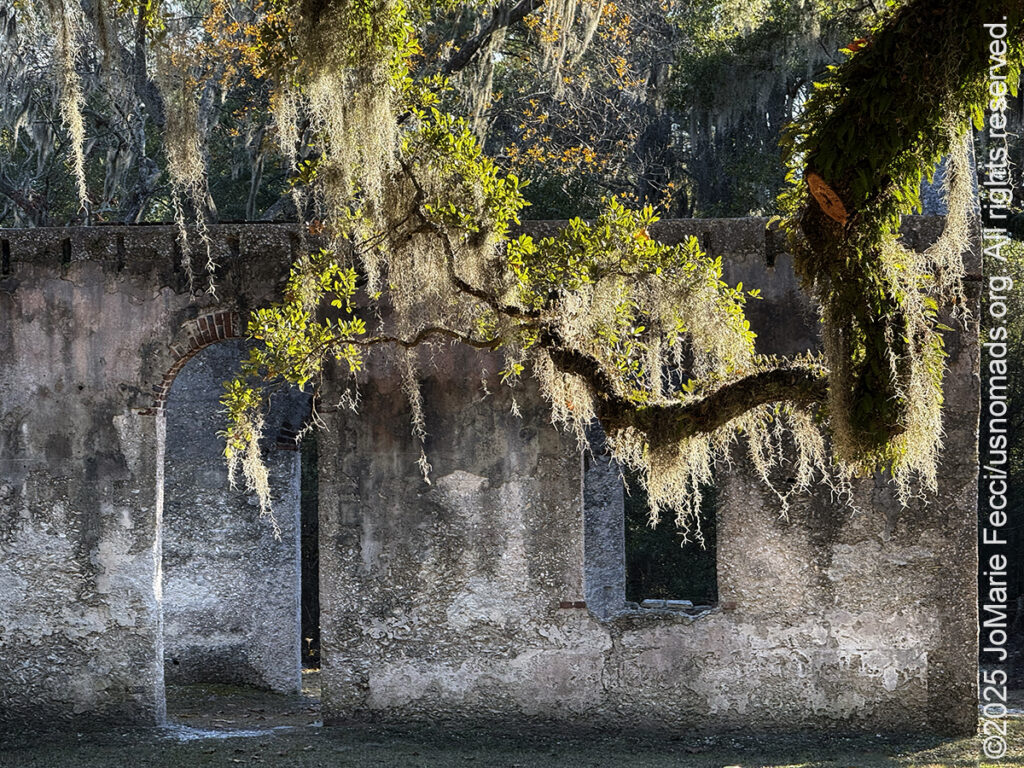
27 December 2023: Today is the real start of the journey back up north, and I planned a route that includes stops at a number of National Wildlife Refuges on the way, continuing the theme of the coastal route and the search for history of the vanished rice plantations. A number of the NWRs incorporate former plantation lands and in some cases there are artifacts beyond simply the traces on the topography of the man-made irrigation grids. I spent some time exploring at Harris Neck NWR not far from Sapelo Island, and got to discover some surprising WWII history, too. The refuge has a 4-mile Wildlife Drive that accesses multiple hiking opportunities and it was fun discovering the remains of the old estate in the form of elaborate fountains, now overgrown with brush. Most surprising was the old WWII-era airfield remnants — mostly just the runways, now cracked with weeds growing in between. From Harris Neck I continued the drive and made it as far as Santee, South Carolina, before stopping for the night…


GA: Okefenokee Swamp…


A day on the swamp…


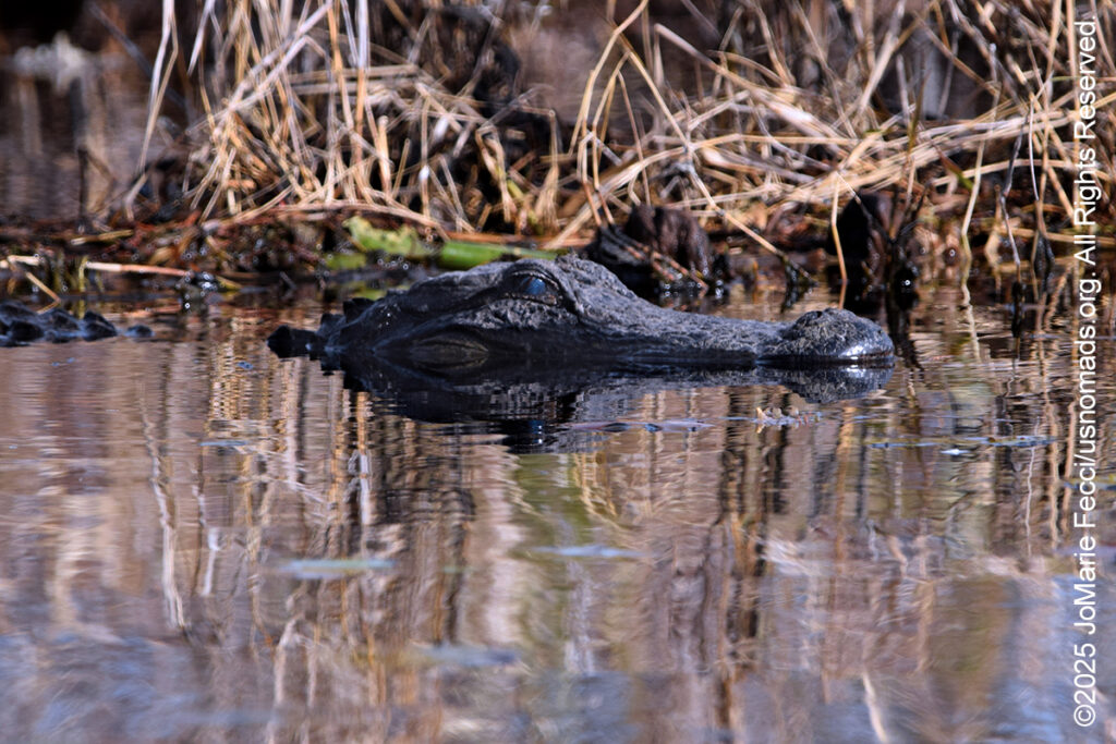
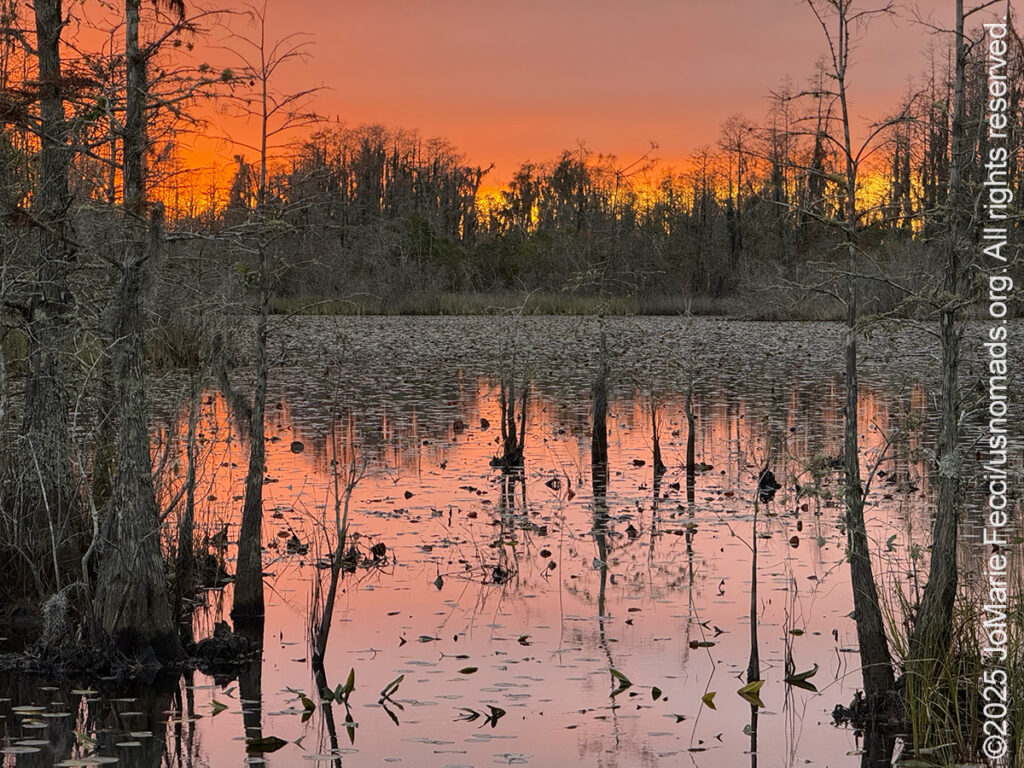
26 December 2023: Started the day early as fog enveloped the whole area, and it was eerily evocative out on the Suwanee Sill. I was “chasing the fog” trying to catch some imagery of it before it disappeared and almost forgot to look for gators. At the end of the paved road, where the water had come up over the boat ramp, two gators were lazing low in the water as several wading birds were grazing the edges. Later in the morning I joined a Ranger talk out on the swamp and we were very lucky with gator sightings as we motored along the water trails on this side of the Okefenokee. When we were done, there was still the whole afternoon left, and I decided to go around to the other side, near Folkston to go on the Swamp Island Drive and out to the observation tower. It was a full day of swamp exploration, and it was really great. Coming here was a good decision. By sunset I was back at the Eco Lodge (though there wasn’t much of an actual sunset due to the overcast skies), and the moon was full and looked beautiful shining through the cloud cover as I relaxed in the rocking chair out on the porch…


FL to GA: Heading to the Swamp…


Starting the journey back north…


25 December 2023: Last night while I was enjoying the fire I made a decision to evacuate camp this morning due to incoming rain that is going to last the entire day. I debated the idea with myself, as I usually like to spend Christmas Day relaxing around camp and maybe going on nice hike nearby, but if it was going to be a rainy day all day there’d be no place to “escape” to and a hike would not be fun, and so I changed the plan and determined to detour for a couple of days at the Okefenokee Swamp in Georgia, where I was able to get a spot in the Eco Lodge for a few nights. I needed to get up early before the rain began, and get the tent and camp packed up while it was still dry. Amazingly I woke without the alarm well before first light and I just started breaking camp and packing it all into the Jeep, and I was on the road just as the first light of dawn began to breach the forest canopy. Took the slow road “north” with some detours to search for the “ghost town” of Ellaville, which isn’t really a ghost town — rather just the site where this old town had been. Only a bridge remains, and it is blocked by the “border” of a state park. I drove around looking for any ruins but only found some houses and trailers that were still inhabited. Here and there was an abandoned structure, but not necessarily part of “Ellaville.” After a bit of searching I turned back to the route for Fargo, GA, and the western side of the Okefenokee Swamp. When I got to the Suwanee Sill, I turned off to go looking for gators. The rain had slowed to a light drizzle, but the “Sill” was full of water and the forest was flooded. I have never seen the Sill so full, with water coming all the way up the bank almost to the road. I did manage to see a few gators lying low in the water near the edge of the swampland, then satisfied with that I headed to the Eco Lodge to make my Christmas dinner and enjoy the evening out on the screened porch where the rain didn’t matter…


FL: Christmas Camp…


Celebrating Christmas…


24 December 2023: Today is Christmas Eve, and in my tradition our family always really celebrated the holiday starting this evening and including a midnight toast to welcome in the day. To keep that tradition out in the forest means having a big bonfire that lasts until twelve. With sunset around 5pm, it takes quite a lot of firewood, so my first stop of the day will be back to gather more wood. The weather was spotty and rain was in the forecast, so I had set up a big “easy up” canopy covering half my table and part of the area near the fire ring in case I had to take shelter at some point. I decorated the easy up with a bunch of sea shells threaded on fishing line, which along with my tiki torches, gave camp a very festive atmosphere. I took the morning to explore a little bit along FR09 (the major “sand highway” south of HWY 40), then went back to the logging site to load up the Jeep. This time I took really big tree trunks (the biggest I could fit in the Jeep) to use for the “yule log” as well as plenty of smaller pieces to keep the fire fed throughout the night. Back at camp I set up everything and started the “celebration” a little before sunset with a nice antipasto and some proseco. It did drizzle from time to time, and I was glad to have the easy up, but there was no heavy rain and I was able to grill lamb rib chops and a complete meal. The fire burned nicely the whole night, and there was even plenty of wood leftover — a very Merry Christmas camp indeed…


FL: Ocala National Forest Trails…


Getting out on the trails…


23 December 2023: The prairie awoke to a golden glow this morning, and one of my fellow campers wanted to get out and hit some trails to test out his new lockers. He was looking to get stuck on purpose. We headed over towards FR46, to a place where a number of trails intersect and people use it as a play area. There is plenty of soft sand there, and that was our best chance for creating a stuck scenario. It had rained a lot recently so the sand was not super soft, but my friend managed to get himself stuck enough to test out the lockers, which worked just as they should. After that we just went out and enjoyed the day on the trails, continuing to my favorite “trench” section and doing a bit more of the Jeep Badge of Honor trail known as “TreadLightly! 4WD Way” — the whole trail is actually 81 miles (it is not actually a single “trail” but rather a route that combines multiple Forest Roads and runs from South to North throughout the entire forest). After the trail run, we went to gather some firewood on a tract that has recently been clearcut. There was plenty of wood to glean and I filled up my Jeep and was glad to have a nice bon fire as darkness falls early at this time of year …


FL: Plantation Ruins …


Exploring plantation history…


22 December 2023: This morning it was raining lightly on the prairie and everything around camp was wet, so I decided to go exploring a little further afield. Went searching for the traces of plantation history at the Bulow Plantation Ruins — a site that contains the remains of a burned down sugar mill as well as the archaeological sites related to the plantation that once was there. The dirt road into the plantation was nicely graded, but long and straight and cut through thick swamp forest, and when I got out of the Jeep to make some photos I was attacked by mosquitos even though it is winter — I could only imagine what it must have been like for the enslaved people working the land in this environment. There are only a few actual “ruins” left — primarily the sugar mill, but it was interesting to walk through where the slave quarters were and down by the “docks” where only the cut out “slips” remain as evidence of what was once there. Saw a red shouldered hawk down by the river and made lots of photos of the ruins before turning back towards Hopkins Prairie. By late afternoon the rain had stopped and the sun had come out back at camp and I was able to enjoy the sunset and the sand hill cranes — they actually “danced” at one point, which was really cool to see …


PREVIOUS NOTES FROM THE ROAD >

THIS MONTH:


Time for the annual Holiday Roadtrip. Getting ready to celebrate the Christmas holiday somewhere warmer and out in nature — will be setting up Christmas camp and enjoying exploring in the southeast this year. Focus on the Atlantic coastal areas as we head south and back to the Ocala National Forest…


COMING UP SOON:


Getting back to a favorite city to spend some time with friends and reconnect to the international community after what seems like a “too long” absence…


Joining the crew from Barlow Adventures as they present an intensive sand dune training at the Imperial Sand Dunes in southern California. This is a seven-day driving and navigation program that focuses on moving safely and effectively through large dunefields with skills-building exercises intended to improve pace, line choice and vehicle control. There is a full classroom day of navigation instruction focused on mapping and understanding the basics of plotting and route planning on paper maps, as well as increasingly challenging in-the-field practice to develop precision map and compass navigation skills. It all culminates in a final day of “chasing checkpoints” out in the big dunes…


Trail Guiding for the California 4-Wheel Drive Association’s fourth annual Death Valley Experience fundraiser event running in March. Each day will feature a choice of runs to some famous, some infamous and some secretive points of interest within Death Valley National Park. Some of the points of interest we may visit during Death Valley Experience 2024 include Zabriskie Point (famous), Barker Ranch (infamous) and the Racetrack (learn the secret of the moving rocks). Other points of interest include Dante’s View, 20 Mule Team Canyon, Artists’ Drive, Chloride Cliffs, Aguereberry Point, Skidoo, Titus Canyon, and Darwin Falls. All of the trail runs are suitable for novice drivers and SUVs with high clearance and 4-wheel drive…


USnomads.org is very proud to be presenting the third edition of the Nomad Overland Virtual Adventure Rally in 2024. This is a unique kind of rally experience — a ten week event that participants can do from anywhere within the continental U.S.A. Competitors design their own routes as part of the rally, then drive it in a points-based online competition that includes optional activity tasks, quests and weekly challenges. The 2024 rally will run from 3 June – 11 August and is open to any driver within the United States who has an off-road capable vehicle — stock or modified. Registration for 2024 is currently open. For more information see the Rally website


ABOUT THE CONCRETE SHIPS


The Ghost Fleet of Kiptopeke consists of nine partially sunken concrete ships that are lined up end-to-end just offshore as a breakwater. The idea to build concrete ships was a response to the scarcity of steel and new technology that was making concrete lighter than ever before. The first concrete ships were built in the United States during World World I when steel became scarce while the demand for ships went up. A California based businessman, W. Lesie Comyn formed the San Fransisco Ship Building Company and began constructing concrete ships in 1917. His first steamer, the S. S. Faith, was launched March 18, 1918. She cost $750,000 to build. She was used to carry cargo for trade until 1921, when she was sold and scrapped as a breakwater in Cuba. President Woodrow Wilson finally approved the Emergency Fleet program which oversaw the construction of 24 concrete ships for the war. However, only 12 were under construction and none of them had been completed by the time the war ended. The 12 ships were eventually sold to private companies who used them for light-trading, storage and scrap. With the advent of World War II, steel once again was in short supply. In 1942, the US government contracted McCloskey & Company to construct a new fleet of 24 concrete ships. Construction of the fleet started in July, 1923 in Tampa, Florida. The ships were built at an incredible rate, with one being launched a month. Innovations in cement mixing and composition made these ships stronger than the previous fleet. Two of the ships saw combat missions — the S.S. David O. Saylor and the S.S. Vitruvius made their way to England in support roles preparing for D-Day, and then sailed to the shores of Normandy where they were sunk as part of the artificial harbor and docks to transport supplies ashore. Their hulls remain underwater there today. After the war nine of the McCloskey ships that had served as transport and training vessels in the South Pacific were partially sunk to form a ferry breakwater off the coast of Kiptopeke Beach in Virginia. When the Chesapeake Bay Bridge-Tunnel was completed in 1964, a vehicle ferry was no longer needed, and the ferry terminal at Kiptopeke was closed. Today the breakwater remains and still protects the beach and provides a home for coastal fish and birds as part of the Kiptopeke State Park…


ABOUT HARRIS NECK NWR


Harris Neck National Wildlife Refuge is one of the seven refuges administered as part of the Savannah Coastal Refuges Complex. The refuge is located in McIntosh County, Georgia, 45 miles south of the port city of Savannah. Harris Neck serves as an important link in the chain of refuges along the eastern seaboard and is the inland base for two neighboring barrier island refuges, Blackbeard Island and Wolf Island. Harris Neck National Wildlife Refuge has an interesting history that goes back to the time of the Civil War when Sherman’s Field Order No. 15 was issued in 1865. This order confiscated the strip of coastline stretching from Charleston, SC to the St. John’s River in FL, including Georgia’s Sea Islands and the mainland thirty miles in from the coast — roughly 400,000 acres to be distributed to former slaves in 40-acre parcels. That same year, Margret Ann Harris deeded the lands of her plantation to Robert Dellegall, her former slave, and Harris Neck became home to about 75 African American families who remained there until 1942, when the US Military used an Eminent Domain condemnation to commandeer 2,687 acres of Harris Neck to build an Army airfield to train fighter pilots for World War II. Today the only evidence of it’s life as an airstrip is the weed-choked concrete and asphalt runways left behind. Archaeological and historical records show that many different populations have benefited from Harris Neck’s resources over the centuries. From 1500 to 1715, Guale Indians inhabited the areas, collecting fish, shellfish, and game. With the arrival of Europeans beginning in 1750, English and Scottish settlers farmed the land intensively, producing many crops including renowned, high-quality Sea Island cotton. In the 1830s Jonathan TThomas’ 3,000-acre Peru Plantation covered the eastern half of the present-day refuge. African-American families established a farming and shell-fishing community following the Civil War. During the 1880s, several large tracts of Peru Plantation lands were acquired by Pierre Lorillard, the tobacco magnate. Lorillard’s estate featured a lavish lodge, an indoor swimming pool filled from an artesian well, and formal gardens with reflecting pools and fountains. One of the fountains can still be seen when hiking near Thomas Landing…


ABOUT OKEFENOKEE SWAMP

6039658033_e7d42852fc
The Okefenokee National Wildlife Refugee conserves the unique qualities of the swamp, protecting and enhancing the wildlife and its habitat to ensure the integrity of the ecological system. The Refuge also sees part of its mission as embracing the grandeur, mystery, and cultural heritage of the area. Native Americans inhabited the swamp for centuries and coined the term “Okefenokee” which means “land that trembles when you walk on it.” The swamp is thought to be 6,000-8,000 years old. It is contained in a saucer-shaped depression that drains toward the south and southwest. Drainage from the swamp forms the headwaters for the St. Marys River and the Suwannee River. Habitats provide for threatened and endangered species, such as red-cockaded woodpecker, wood storks, indigo snakes, and a wide variety of other wildlife species. It is world renowned for its amphibian populations that are bio-indicators of global health. More than 600 plant species have been identified on refuge lands. The Swamp survived an attempt at draining in the late 1800’s and was logged extensively in the early 1900’s before becoming a refuge in 1937 by declaration of Franklin D. Roosevelt. The refuge has 353,981 acres of National Wilderness Area within its boundaries and is a Wetland of International Importance (RAMSAR Convention – 1971) because it is one of the world’s largest intact freshwater ecosystems…


THE BULOW PLANTATION


The Bulow Plantation was the largest plantation in East Florida. It was founded in 1821 by Major Charles Wilhelm Bulow, who acquired 4,675 acres on a tidal creek (now called Bulow Creek). An enslaved African workforce cleared 2,200 acres of swamp and forest by hand, and continued laboring on the plantation known as Bulowville, cultivating commodity crops: indigo, cotton, rice, and sugarcane. The 2 1/2 story main house had two separate kitchens, there were 46 houses located in a semi circle around the main house where the 300-400 enslaved workers lived. A sawmill, corn house, huge sugar works with steam engine, cotton gins, poultry houses, blacksmith shop, fodder storage and river piers were also on the property. A roadway and bridge was built from the plantation, across the creek and leading to the ocean on the east. Also several extensive coquina quarry were used to cut the valuable building material. Today, ruins of the plantation, a sugar mill, a unique spring house, several wells and the crumbling foundations of the plantation house and slave cabins cam still be seen on the 150-acre site that is now a Florida State Park. The charred and weathered coquina rock ruins of the sugar mill show how volatile the Florida frontier was in the early 19th century, when the plantation met it’s demise during the Second Seminole War. Bulow reportedly had a good working relationship with his Seminole neighbors, but in 1835 the U.S. troops came to Florida to enforce a treaty that would require Seminoles to give up their land and move west. Bulow’s estate was taken over by the military, and he was placed under house arrest while the militia used the plantation’s boats to travel along the creek to raid Seminole camps. In late January 1836, they were forced to flee the Bulow Plantation and about a week later, the Seminole arrived and burned the Bulowville to the ground. All that is left today are the coquina ruins of the sugar mill, several wells, a spring house, and the crumbling foundation of the mansion. The cleared fields have been reclaimed by the forest and the area looks much as it once did when it belonged to the Timucua Indians, the first inhabitants in the area. The property and ruins were acquired by the State of Florida in 1945 and dedicated as a State Historic Park in 1957…


Nesconset | Paris | Belgrade | Cape May | Lewes | Berlin | Corolla | Awendaw | Ravenel | St. Augustine | Fort McCoy | Jacksonville


MORE NOTES FROM THE ROAD:
15-21 December – Holiday Roadtrip
1-14 December – Holiday Roadtrip
8-30 November – New Jersey
1-7 November – Cape Cod
27-31 October – Cape Cod
16-26 October – Long Island
1-15 October – Roadtrip East
23-30 September – Roadtrip East
16-22 September – Colorado
8-15 September – Moab LONCON
1-7 September – Roadtrip West
August – Long Island
July – Roadtrip North
June – Nomad Rally Start
23-31 May – Nomad Prep
16-22 May – Nomad Prep
8-15 May – Long Island
1-7 May – Long Island
16-30 April – East Coast
8-15 April – Long Island
1-7 April – Roadtrip Home
22-31 March – DVE
15-21 March – Arizona
8-14 March – Joshua Tree
1-7 March – Glamis
20-28 February – Southwest Roadtrip
1-19 February – Woman and Machine
January – Woman and Machine
22-31 December – Holiday Roadtrip
16-21 December – Holiday Roadtrip
1-15 December – Long Island
Archive


ROADTRIP

100 DAYS JOURNEY

An epic journey crisscrossing the USA from east to west and back again, exploring some of the beautiful wild spaces that make up our “public lands.” The roadtrip covered almost 15,000 miles, much of it off-grid and off-pavement, focusing on the deserts of the American southwest. Some locations were truly “iconic” while others were little known, and the segments of independent exploration where punctuated with some fun events across the region… [read]


SPECIAL REPORT

GHOST TOWNS

All about exploring ghost towns and abandoned places in the USA and beyond, with tips, and information on the many different types of sites to be found across the globe, including detailed guides for eight specific sites… [read]


REFLECTIONS

EGYPT: CAIRO REFLECTIONS
A quick overview of impressions from a stop in Cairo during our recent scouting mission in Egypt and Sudan … [read]


SPECIAL REPORT

ALGERIA SCOUTING

A look into south-eastern Algeria on the border with Libya and Niger: overlanding with the Tuareg in one of the most remote corners of the Sahara … [read]


LOCATION

NY: LONG ISLAND

This installment of a series that focuses on locations around the USA takes a look at some favorite places near our home base in NY. We share a few places we like to explore, where you can experience something of the raw natural beauty of coastal beaches, pine barrens and a little bit of obscure military history… [read]


Copyright @ USnomads.org.