
< more recent | 16 – 23 December 2019 | older >
23 December 2019: Crossed the Rocky Mountains via I-70 first thing in the morning, then spent the rest of the day traversing Utah along a very beautiful drive through the rugged scenery of the San Rafael Swell before making my way to Richfield for the night (check out the Roadtrip Southwest daily field notes for more details) …
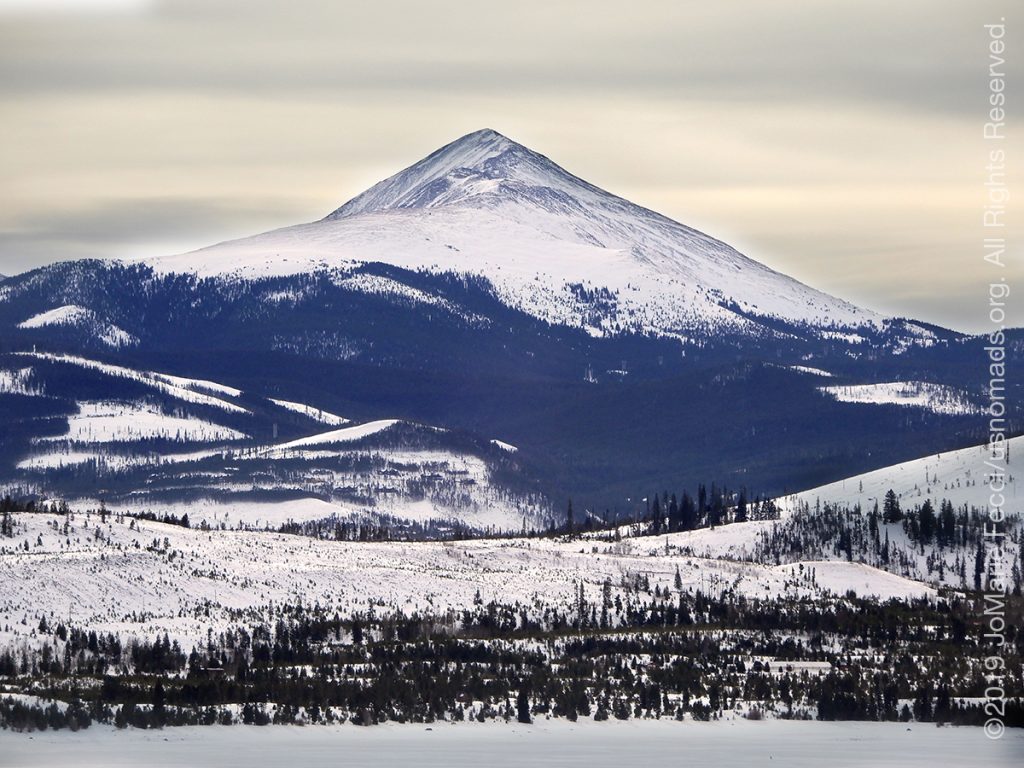
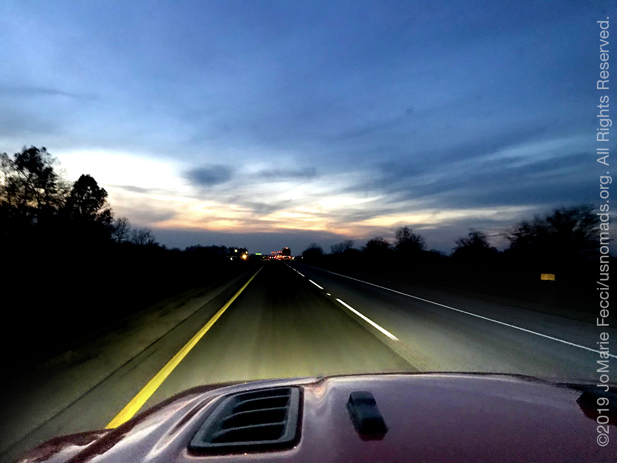
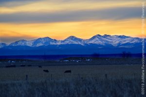
22 December 2019: Transitioned from the I-80 after days of driving straight west and finally turned southward on the I-76 late in the afternoon. The terrain through Nebraska remained that same flatland with endless horizons, huge farms and cows. As soon as I turned southwest around the Colorado border it began to change and there were some hills which I only noticed because everything had been so flat for days. Around sunset I got my first sight of the Rocky Mountains very far off in the distance, and with the late afternoon light and snow on the ground it was a dramatic and inspirational view (check out the Roadtrip Southwest daily field notes for more details) …
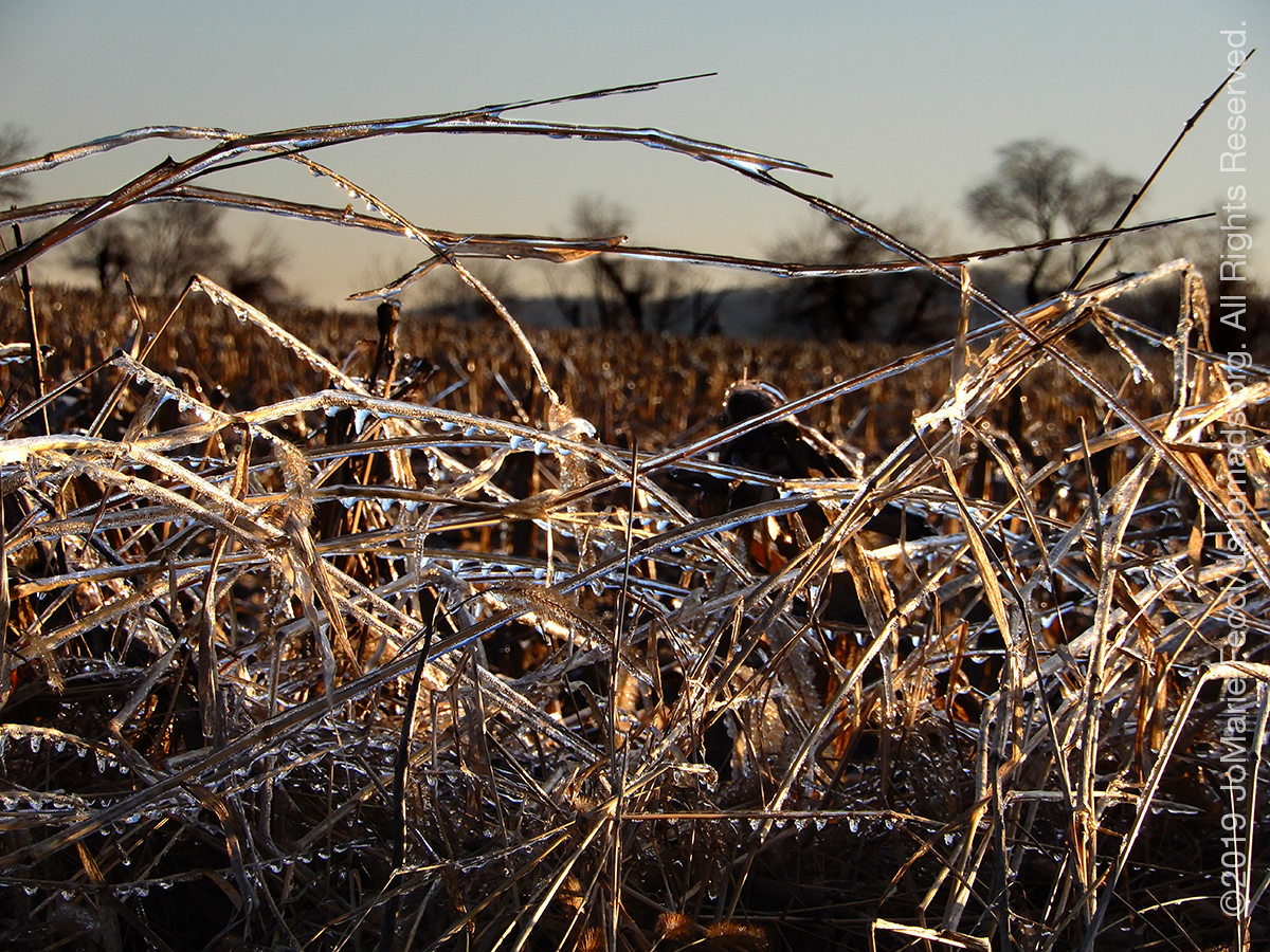
21 December 2019: Took a break from the drive to check out the Starved Rock State Park in Illinois where the snow covered trails led to frozen waterfalls and impressive canyons in a woodland environment on the edge of a wetland (check out the Roadtrip Southwest daily field notes for more details) …
21 December 2019: Gave a nod to the Winter Solstice this morning, then got back on I-80 through the rest of Illinois and into Iowa for much of the day before finally crossing the border into Nebraska. Lots of flat terrain, farmland, cows, and an infinite horizon (check out the Roadtrip Southwest daily field notes for more details) …
20 December 2019: Racked up roughly 1,000 miles since starting the journey earlier this week, and have more than 1,000 still to drive. The same-ness of the Interstate makes it surreal as I-80 goes on for days, straight, continuous, westbound, chasing the sun (check out the Roadtrip Southwest daily field notes for more details) …
19 December 2019: A long drive day from Pennsylvania through Ohio and into Indiana today. The weather remains extremely cold and winter-y and it seems likely to continue like this all along the route westward (check out the Roadtrip Southwest daily field notes for more details) …

18 December 2019: By day’s end the Jeep was ready to take on the new adventure with great style and increased capabilities. We hit the road westward as daylight faded …

18 December 2019: Spent much of the day at OK4WD getting some goodies installed on the Jeep as we start our journey west. New wheels and tires, rock sliders, bumpers and a winch as the first step of the build to make our JL Rubicon the ideal vehicle for our off-road and overlanding adventures …
17 December 2019: Got the map set together and finished loading the Jeep in time to get a head start on the drive tonite, doing the trickiest leg traffic-wise which is getting off Long Island and beyond the New York metro area into New Jersey …
THIS MONTH:
Its almost holiday roadtrip time and there is plenty of planning for what’s next. Perhaps a surprise or two as we head into the new year…
COMING UP SOON:
![]()
Advanced sand dune training with Barlow Adventures at the Imperial Sand Dunes in southern California. This three day driving and navigation program focuses on moving safely and effectively through large dunefields. Skills-building exercises are intended to improve pace, line choice and vehicle control, as well as developing precision map and compass navigation technique…

More southwest exploration with the original USnomads team taking some time to just appreciate the journey…
![]()
Tierra del Sol’s 58th annual Desert Safari at Ocotillo Wells from February 28th to March 1st. The event is one of the biggest Jeep events of its kind and the proceeds go towards the fight to keep Public Lands open. …
THE ROCKY MOUNTAINS
The Rocky Mountains, also known as the Rockies, are a major mountain range located in western North America. The Rocky Mountains stretch 1,900 miles in straight-line distance from the northernmost part of British Columbia, in western Canada, to New Mexico in the Southwestern United States. Located within the North American Cordillera, the Rockies are distinct from the Pacific Coast Ranges, Cascade Range, and the Sierra Nevada, which all lie farther to the west. The Rocky Mountains formed 80 million to 55 million years ago during the Laramide orogeny, in which a number of plates began sliding underneath the North American plate. The angle of subduction was shallow, resulting in a broad belt of mountains running down western North America. Since then, further tectonic activity and erosion by glaciers have sculpted the Rockies into dramatic peaks and valleys. At the end of the last ice age, humans began inhabiting the mountain range. After Europeans, such as Sir Alexander Mackenzie, and Americans, such as the Lewis and Clark expedition, began exploring the range, minerals and furs drove the initial economic exploitation of the mountains, although the range itself never experienced a dense population. Of the 100 highest peaks in the Rocky Mountains, 78 (including the 30 highest) are located in Colorado, ten in Wyoming, six in New Mexico, and three in Montana. Public parks and forest lands protect much of the mountain range, and they are popular tourist destinations, especially for hiking, camping, mountaineering, fishing, hunting, mountain biking, skiing, and snowboarding…
ABOUT I-76
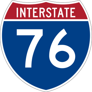
Interstate 76 (I-76) runs from Interstate 70 in Arvada, Colorado (near Denver) to an intersection with Interstate 80 near Big Springs, Nebraska near the Platte River. All but 3 miles of the road’s route is in Colorado…
STARVED ROCK STATE PARK

Starved Rock State Park is located just southeast of the village of Utica, IL, along the south bank of the Illinois River. The park has over 13 miles of hiking trails with 18 deep canyons, some of which feature dramatic waterfalls. The unique topography was created by a catastrophic flood from a melting glacier, approximately 14,000-17,000 years ago before humans occupied the area. The flood exposed the rock canyons which are very unusual for the central plains area. Starved Rock is named for a prominent sandstone butte that overlooks the river, where according to local legend, a group of Native Americans of the Illinois Confederation had fled under attack by the Ottawa and Potawatomi who besieged the butte until all of the Illiniwek had starved. The area around The Rock was designated a National Historic Landmark in 1960…
ABOUT I-80
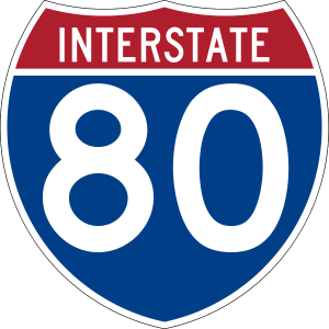
Interstate 80 (I-80) is an east–west transcontinental freeway in the United States that runs from downtown San Francisco, California, to Teaneck, New Jersey, in the New York City metropolitan area for approximately 2,900 miles. The highway was designated in 1956 as one of the original routes of the Interstate Highway System. The second-longest Interstate Highway in the United States, its final segment was opened to traffic in 1986. I-80 roughly follows the route of the historic Lincoln Highway, the first road across the United States and also traces other historically significant routes across the western United States, including the Oregon Trail across Wyoming and Nebraska, the California Trail across most of Nevada and California, the first transcontinental airmail route, and the First Transcontinental Railroad…
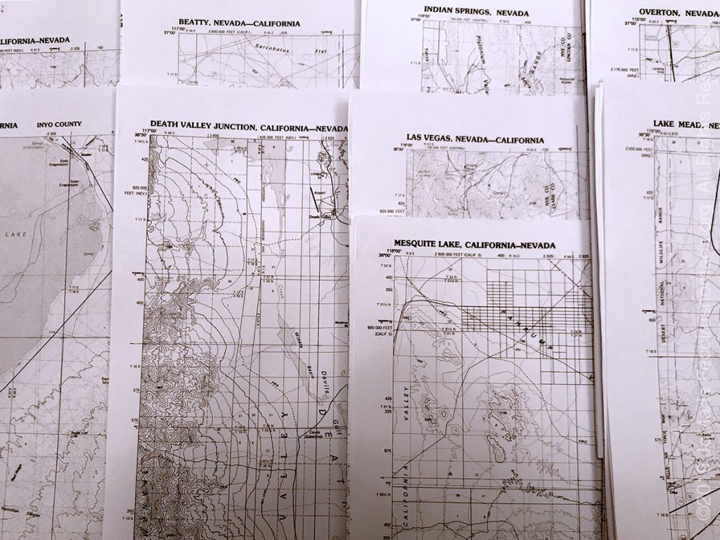
MAP NAMES
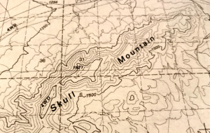
Looking at topo maps from the southwest of the U.S.A. there are plenty of “odd” place names to be seen, leading us to wonder how and why these places are called what they are. Apparently there is a governmental body that decides what names appear on maps. According to the National Geographic Society, it is the U.S. Board on Geographic Names (BGN) that has been standardizing place names on government maps for over 125 years. The board was created after the Civil War, when the U.S. was expanding westward and place-name inconsistencies and contradictions were making maps of the new territories confusing for surveyors, cartographers, and scientists. In 1890, President Benjamin Harrison, tasked the BGN with clearing up all “unsettled questions concerning geographic names.” The BGN comprises members from six federal departments and the Central Intelligence Agency, the Government Publishing Office, the Library of Congress, and the U.S. Postal Service. It rules on hundreds of naming decisions each year and maintains geographical databases (available at geonames.usgs.gov) containing more than two million domestic records and over 11 million records for foreign names. The BGN doesn’t decide what a place is called. It responds to proposals from federal agencies; state, local, and tribal governments; and the public. But its essential purpose is always the same: clarity and consistency. …
Nesconset | Paris | Danville PA | Akron OH | Toledo OH | South Bend IN | Oglesby IL | Davenport IA | Des Moines IA | Omaha NE | North Platte NE | Denver CO | Grand Junction CO | Moab UT | Hurricane UT | Mesquite NV | Valley of Fire NV | Lake Mead NV | Las Vegas NV | Death Valley CA | Trona CA

MORE NOTES FROM THE ROAD:
9-15 December – New York
1-8 December – Paris
16-30 November – Paris & Rennes
1-15 November – New York
14-31 October – Arizona
8-13 October – LON TOP TEN
1-7 October – Girl Gang Garage
16-30 September – Women’s Wheeling
1-15 September – Long Island
9-31 August – Serbia
1-8 August – #LONCON2019
16-31 July – Roadtrip to Atlanta
1-15 July – Cape Cod
15-30 June – Eastern Long Island
1-14 June – Bantam Jeep Festival
May – PA Trail cleanup
22-30 April – Minnesota
16-21 April – PA Trails
1-15 April – New Jeep
15-31 March – Paris
1-14 March – Arizona
15-28 February – San Antonio
1-14 February – Sedona and Glamis
January – Iran
December – Holiday Road Trip
Archive
REFLECTIONS

A quick overview of impressions from a stop in Cairo during our recent scouting mission in Egypt and Sudan … [read]
SPECIAL REPORT

A look into south-eastern Algeria on the border with Libya and Niger: overlanding with the Tuareg in one of the most remote corners of the Sahara … [read]