
< more recent | 24 – 31 December 2019 | older >
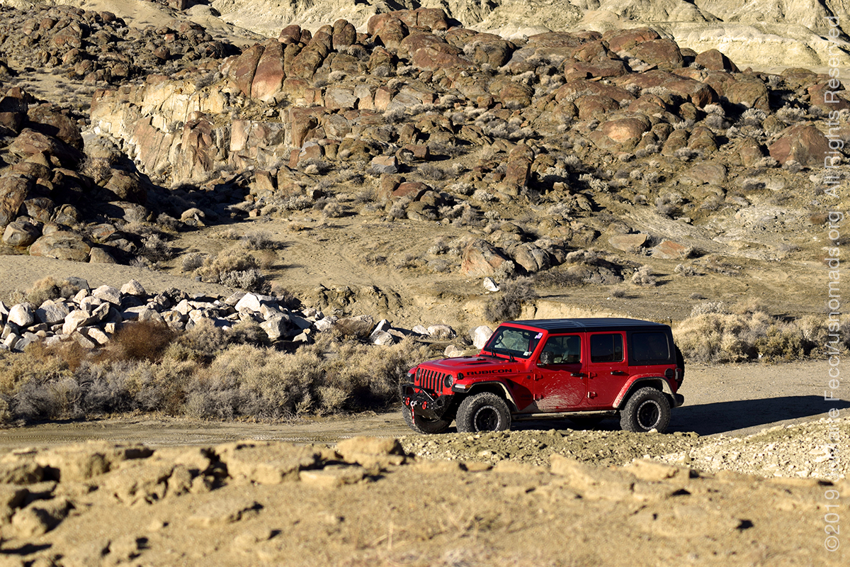
31 December 2019: The recent wet weather meant the area around the Pinnacles was not a good place to set up camp, so decided to go to a comfortable campground at the Lake Mead NRA to welcome in the New Year. Took the slow road and explored a bit around Ridgecrest and the Red Mountain OHV area, then back through Death Valley and into Nevada (check out the Roadtrip Southwest daily field notes for more details) …
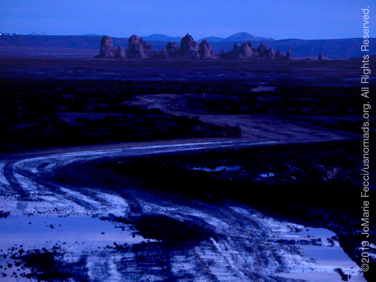
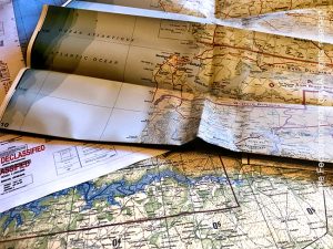
30 December 2019: Left Death Valley and made a stop at Big Dune before looping around towards Trona. Interesting diversion caused by following the GPS at one point. Luckily the paper maps came to the “rescue” once again, and got back on the desired route, arriving around sunset (check out the Roadtrip Southwest daily field notes for more details) …
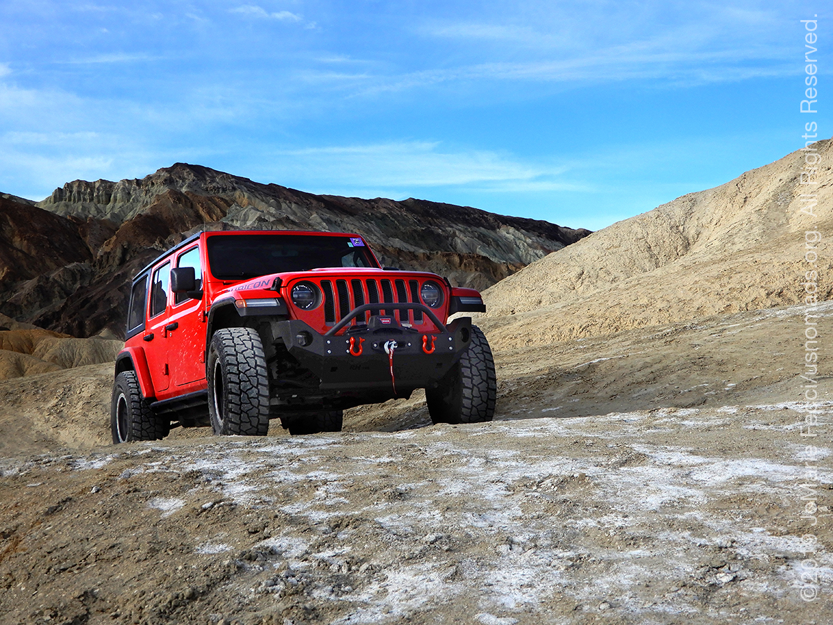
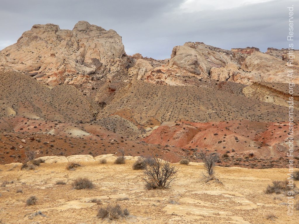
29 December 2019: Checking out several different areas around the lower elevations and badlands today, looking for some good possibilities to get away from the crowds during our upcoming February trip (check out the Roadtrip Southwest daily field notes for more details) …
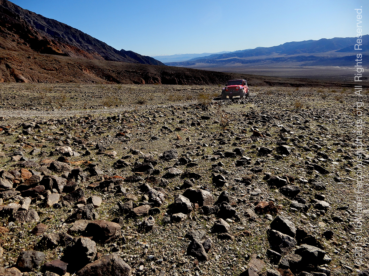
28 December 2019: Spent the day ostensibly looking for coyotes along the Badwater road. Didn’t see any, but did take the time to explore some smaller trails up into the hills (check out the Roadtrip Southwest daily field notes for more details) …
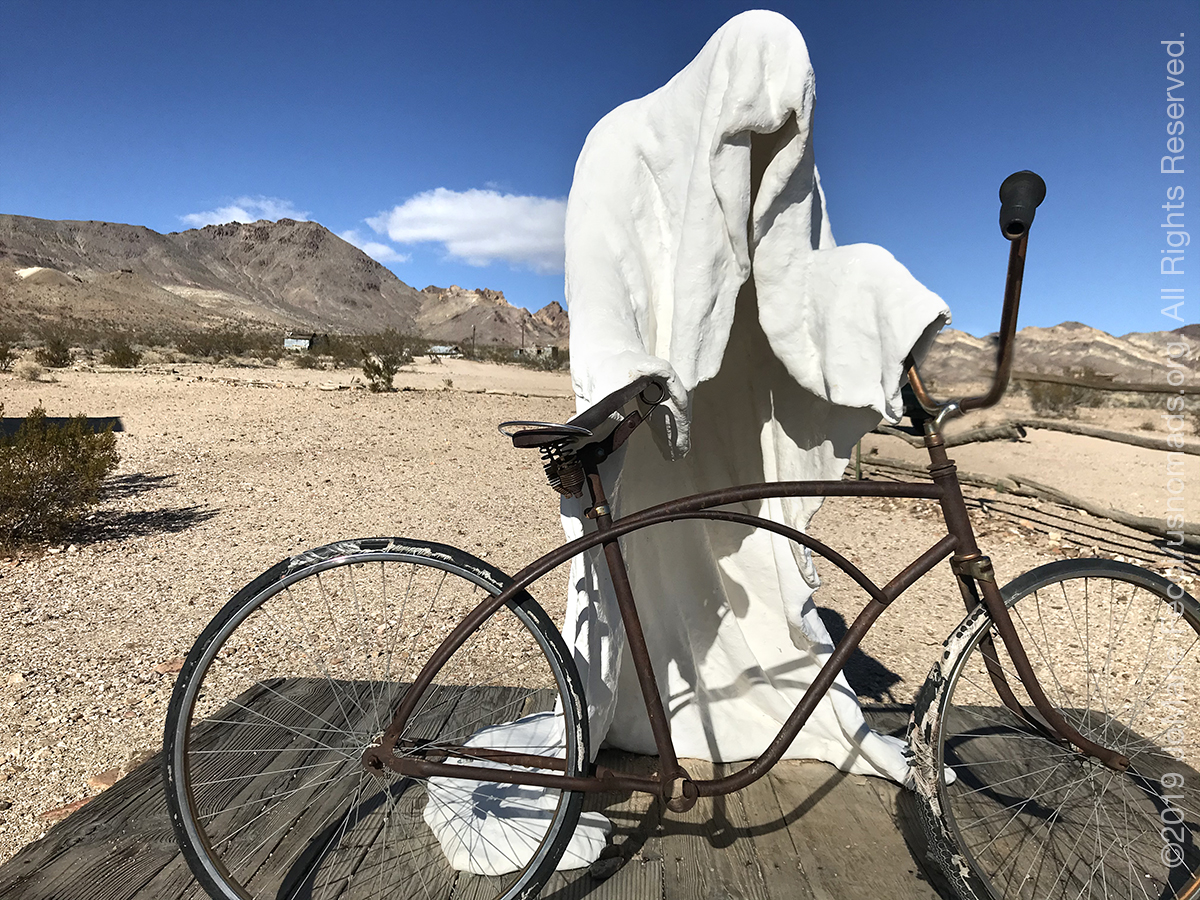
27 December 2019: Backtracked from Tonopah to Beatty and into Death Valley. Today was full of quirky desert ghost towns, art and artifacts along the way (check out the Roadtrip Southwest daily field notes for more details) …
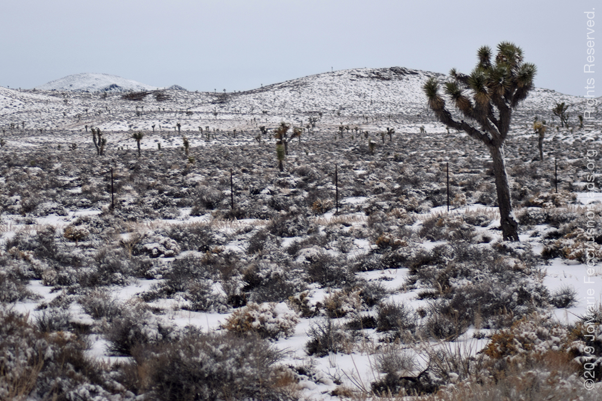
26 December 2019: Had to make a quick change in plans and break camp at Valley of Fire due to unexpected winter weather incoming. Headed towards Death Valley, but the snow had caused the passage to be closed so rerouted up to Tonopah from Beatty, as every hotel was full in Beatty, and got a room for the night at the Mizpah. Was interesting seeing the snow on the Joshua trees en route (check out the Roadtrip Southwest daily field notes for more details) …
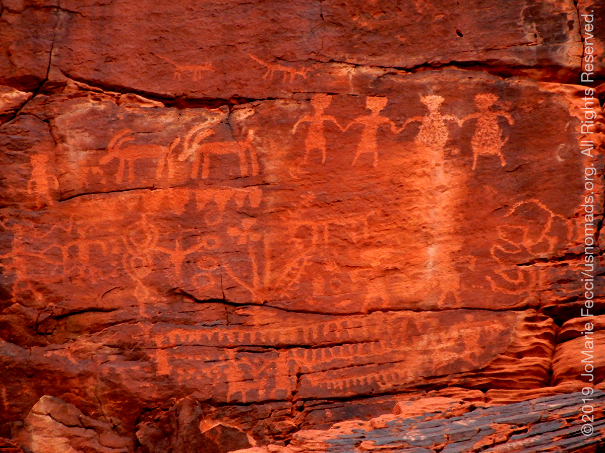
25 December 2019: Spent some time checking out the petroglyphs on the Mouse’s Tank trail (check out the Roadtrip Southwest daily field notes for more details) …
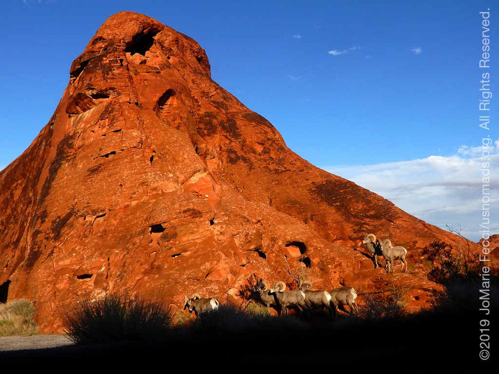
24 December 2019: Just settling into camp before this amazing sighting of Big Horn sheep on the red rock in the magical late afternoon light. What a wonderful Christmas present (check out the Roadtrip Southwest daily field notes for more details) …

24 December 2019: There was a surprisingly large crowd at Valley of Fire considering it was terrible weather and a holiday, but got camp set up in the Atlatl Rock campground in time to prepare Christmas eve celebrations (check out the Roadtrip Southwest daily field notes for more details) …
24 December 2019: Drove the final leg of the cross-country journey this morning continuing on I-70 to I-15 heading southwest through the rest of Utah and into Arizona before making it to Nevada. The weather was the big issue for the morning, but the storm passed by early afternoon just in time for arrival to the Valley of Fire (check out the Roadtrip Southwest daily field notes for more details) …
THIS MONTH:
Its almost holiday roadtrip time and there is plenty of planning for what’s next. Perhaps a surprise or two as we head into the new year…
COMING UP SOON:
![]()
Advanced sand dune training with Barlow Adventures at the Imperial Sand Dunes in southern California. This three day driving and navigation program focuses on moving safely and effectively through large dunefields. Skills-building exercises are intended to improve pace, line choice and vehicle control, as well as developing precision map and compass navigation technique…

More southwest exploration with the original USnomads team taking some time to just appreciate the journey…
![]()
Tierra del Sol’s 58th annual Desert Safari at Ocotillo Wells from February 28th to March 1st. The event is one of the biggest Jeep events of its kind and the proceeds go towards the fight to keep Public Lands open. …
DEATH VALLEY
Death Valley National Park is the largest national park outside of Alaska. A desert valley located in Eastern California, in the northern Mojave Desert bordering the Great Basin Desert, it is one of the hottest places in the world. Death Valley’s Badwater Basin is the point of the lowest elevation in North America, at 282 feet (86 m) below sea level. Near the border of California and Nevada, in the Great Basin, east of the Sierra Nevada mountains, Death Valley is the principal feature of the Mojave and Colorado Deserts Biosphere Reserve. It is located mostly in Inyo County, California. It runs from north to south between the Amargosa Range on the east and the Panamint Range on the west. The Grapevine Mountains and the Owlshead Mountains form its northern and southern boundaries, respectively.Endless exploration and a diversity of experiences await: Hiking, exploring historic sites, traveling backcountry roads, viewing the night sky—these are only a few of the opportunities available. With over 3 million acres of federally designated Wilderness it is possible to walk along majestic sand dunes, navigate twisted slot canyons, climb rocky peaks and stroll along salt flats. The variety of terrains offer everything from easy to very challenging adventures.
ABOUT BIG HORN SHEEP
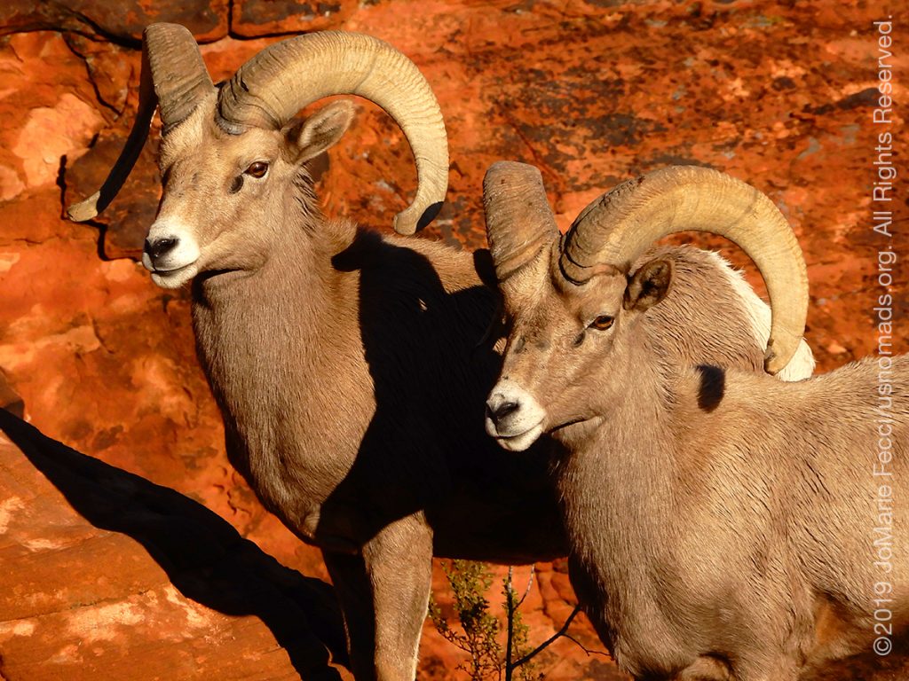
The bighorn sheep is a species of sheep native to North America known for its large horns — a pair of horns might weigh up to 30 pounds. The large curved horns are only found on the males. the females’ horns are shorter with less curvature. Bighorns range in color from light brown to grayish or dark, chocolate brown, with a white rump and lining on the backs of all four legs. Bighorn sheep generally inhabit alpine meadows, grassy mountain slopes, and foothills near rugged, rocky cliffs and bluffs. They cannot move through deep snow, so they prefer drier slopes, where the annual snowfall is less than about 60 inches per year. A bighorn’s winter range usually lies at lower elevations than its summer range. The bighorn sheep play an important role in some Native American mythology. Bighorn sheep were among the most admired animals of the Apsaalooka (Crow) people, and what is today called the Bighorn Mountain Range was central to their tribal lands. In the Bighorn Canyon National Recreation Area book, storyteller Old Coyote describes a legend related to the bighorn sheep. A man possessed by evil spirits attempts to kill his heir by pushing the young man over a cliff, but the victim is saved by getting caught in trees. Rescued by bighorn sheep, the man takes the name of their leader, Big Metal. The other sheep grant him power, wisdom, sharp eyes, sure-footedness, keen ears, great strength, and a strong heart. Big Metal returns to his people with the message that the Apsaalooka people will survive only so long as the river winding out of the mountains is known as the Bighorn River. The bighorn population in North America peaked in the millions but by 1900 the population had crashed to several thousand, due to diseases introduced through European livestock and overhunting. A program of reintroductions, natural parks, and reduced hunting, together with a decrease in domesticated sheep near the end of World War II, allowed the bighorn sheep to make a comeback.
THE VALLEY OF FIRE
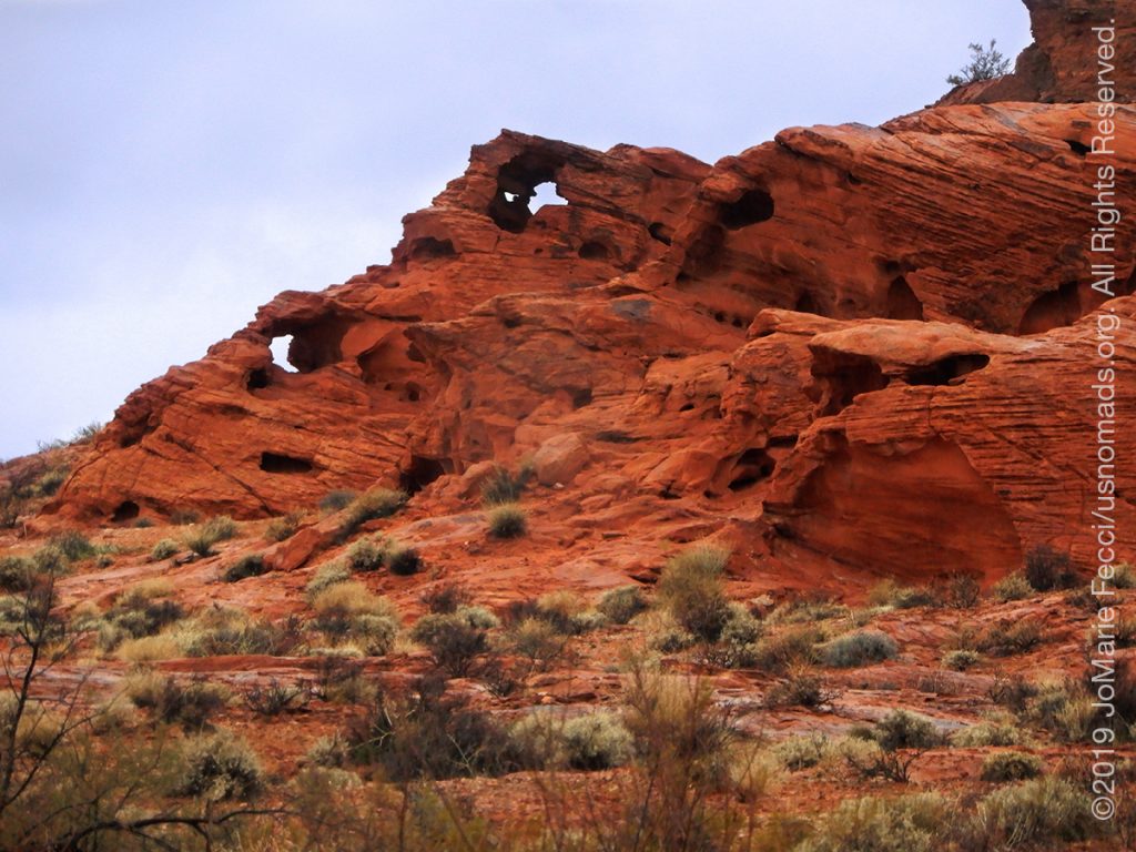
Valley of Fire State Park covers nearly 46,000 acres south of Overton, Nevada. The state park derives its name from red sandstone formations, the Aztec Sandstone, which formed from shifting sand dunes 150 million years ago. These features, which are the centerpiece of the park’s attractions, often appear to be on fire when reflecting the sun’s rays. It is Nevada’s oldest state park and was designated as a National Natural Landmark in 1968. The unique landscape was created by complex uplifting and faulting of the region, followed by extensive erosion. The rough floor and jagged walls contain brilliant formations of eroded sandstone. The site was home to Ancestral Puebloans from 300 BC to 1150 AD. The ancestral Puebloans farmed in the Moapa valley and their interaction with the park landscape probably involved hunting, food gathering, and religious ceremonies, although scarcity of water would have limited their stay. There are several petrogylph sites within the park. With an elevation between 1,320–3,009 feet, the Valley of Fire has a dry and warm climate typical of the Mojave Desert in which it lies. Winters are mild with daytime temperatures ranging from 54 °F to 75 °F and overnight lows in the mid 30’s °F to mid 40’s °F. Storms moving east from the Pacific Ocean occasionally bring rain during winter months. Daily summer highs usually range from 100 °F to 115 °F and on occasion may reach near 120 °F. Thunderstorms from the Southwestern Monsoon can produce heavy showers during summer. The average annual precipitation is 6.50″.
MAP NAMES
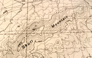
Looking at topo maps from the southwest of the U.S.A. there are plenty of “odd” place names to be seen, leading us to wonder how and why these places are called what they are. Apparently there is a governmental body that decides what names appear on maps. According to the National Geographic Society, it is the U.S. Board on Geographic Names (BGN) that has been standardizing place names on government maps for over 125 years. The board was created after the Civil War, when the U.S. was expanding westward and place-name inconsistencies and contradictions were making maps of the new territories confusing for surveyors, cartographers, and scientists. In 1890, President Benjamin Harrison, tasked the BGN with clearing up all “unsettled questions concerning geographic names.” The BGN comprises members from six federal departments and the Central Intelligence Agency, the Government Publishing Office, the Library of Congress, and the U.S. Postal Service. It rules on hundreds of naming decisions each year and maintains geographical databases (available at geonames.usgs.gov) containing more than two million domestic records and over 11 million records for foreign names. The BGN doesn’t decide what a place is called. It responds to proposals from federal agencies; state, local, and tribal governments; and the public. But its essential purpose is always the same: clarity and consistency. …
Nesconset | Paris | Danville PA | Akron OH | Toledo OH | South Bend IN | Oglesby IL | Davenport IA | Des Moines IA | Omaha NE | North Platte NE | Denver CO | Grand Junction CO | Moab UT | Hurricane UT | Mesquite NV | Valley of Fire NV | Lake Mead NV | Las Vegas NV | Death Valley CA | Trona CA

MORE NOTES FROM THE ROAD:
16-23 December – Cross-Country Drive
9-15 December – New York
1-8 December – Paris
16-30 November – Paris & Rennes
1-15 November – New York
14-31 October – Arizona
8-13 October – LON TOP TEN
1-7 October – Girl Gang Garage
16-30 September – Women’s Wheeling
1-15 September – Long Island
9-31 August – Serbia
1-8 August – #LONCON2019
16-31 July – Roadtrip to Atlanta
1-15 July – Cape Cod
15-30 June – Eastern Long Island
1-14 June – Bantam Jeep Festival
May – PA Trail cleanup
22-30 April – Minnesota
16-21 April – PA Trails
1-15 April – New Jeep
15-31 March – Paris
1-14 March – Arizona
15-28 February – San Antonio
1-14 February – Sedona and Glamis
January – Iran
December – Holiday Road Trip
Archive
REFLECTIONS

A quick overview of impressions from a stop in Cairo during our recent scouting mission in Egypt and Sudan … [read]
SPECIAL REPORT

A look into south-eastern Algeria on the border with Libya and Niger: overlanding with the Tuareg in one of the most remote corners of the Sahara … [read]