
POCOMOKE RIVER, MD (15 July 2020) — Up early and did a bit of exploring around Trap Pond before setting off for the nearby Blackwater National Wildlife Refuge. My search for the “swamp” was turning out to be more difficult than I’d expected. Instead of finding masses of spooky bald cypress trees I was finding farmland everywhere. Cornfields tucked in between woodlands. And lots of white tailed deer grazing along the edges (though I haven’t been able to get a photo of any of them, as they are way too quick to jump into the woods when I attempt to pick up a camera). The farmland had definitely displaced the essence of the swamp.
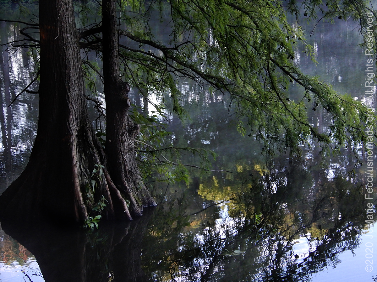
Its hard to believe that once this was all 50,000 acres of swampland. Today almost all of it is gone. The Delaware Wilds association has purchased around 10,000 acres and is in the process of restoring it, and there are a few remnants of the swamp’s existence in the form of bald cypress stands and swamp-like terrain along the edges, protected within the Trap Pond state park in Delaware and the Pokomoke state park in MD. But it is difficult to “feel” the presence of the swamp.
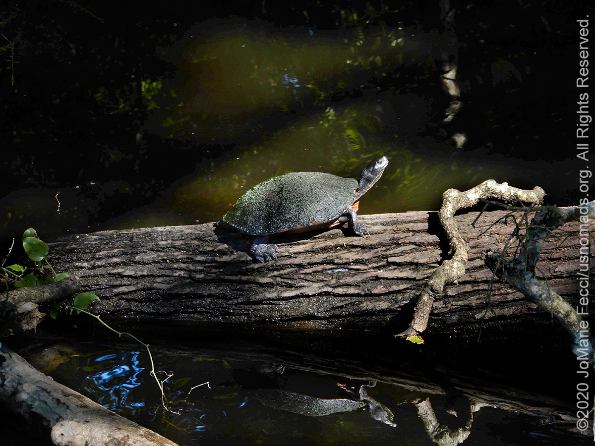
Walking around the edges of the wetlands around the park I saw some of the cypress trees and spotted a turtle sunning itself on a log. The sun was shining brightly and the pond was reflecting the blue of the sky, definitely making for an ambiance that was about as far from a spooky dark swamp as I could imagine.
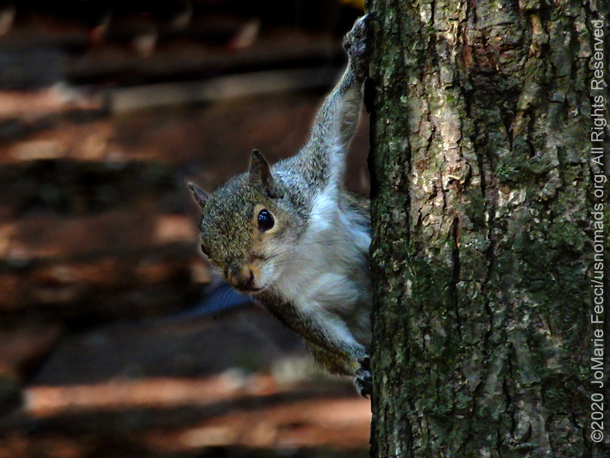
I packed up my tent as a curious squirrel watched from a nearby pine tree. Mapping out my route from Trap Pond to the Refuge I tried to keep to more of the back roads, deciding to attempt to make this as much of a wilderness journey as possible. My route took me through a lot more farmland but also ended up criss-crossing with the Harriet Tubman Byway, an interesting historical roadtrip itinerary that visits many key locations in Tubman’s life and along the route of the old Underground Railroad. Apparently the area of the swamp and the marshlands that are now the Blackwater NWR were a critical link in the escape route for slaves heading north to freedom. Tubman who grew up in this area and knew it well guided many people to freedom through what would have been a very harsh and remote environment during those days. Part of the Blackwater Refuge has been transformed into a National Historical Park documenting Tubman and her work with the Underground Railroad. As I stopped at a few of the sites on the itinerary I realized that I really don’t know much about Tubman apart from that she was an important “conductor for the underground railroad.” I will have to read up on her history when I have more time.
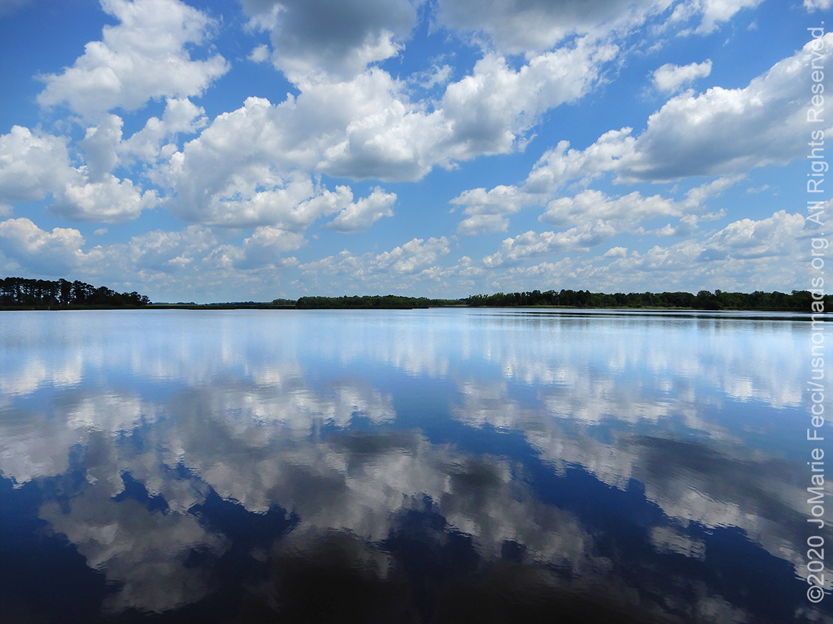
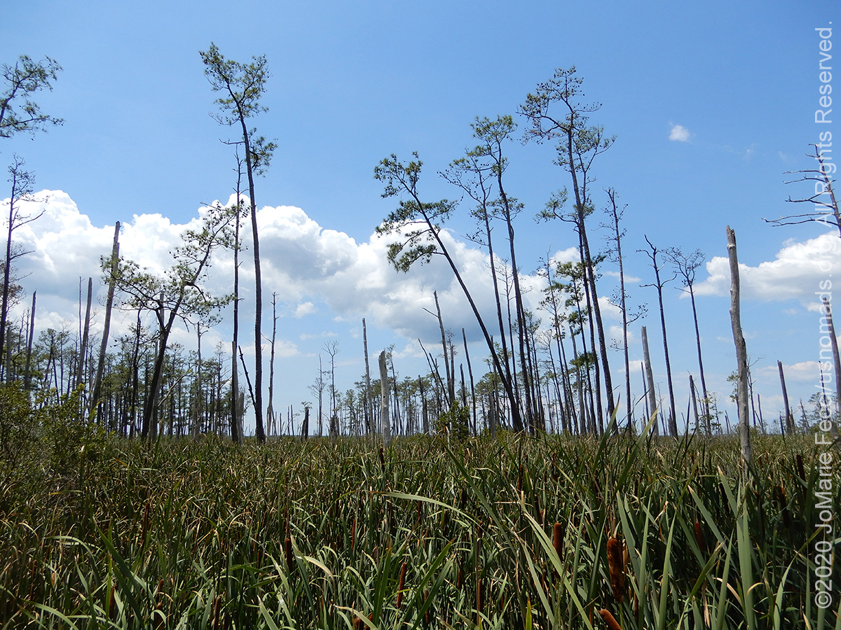
As I reached Blackwater my first sighting of the area’s unique landscape came as I approached the entry to the marsh, a small strip of land that “bridged” the refuge area across the waters. It was so narrow and from it I could see other narrow strips of land with a few trees in the distance. These tiny bits of land separating vast spaces of water created an awe-inspiring landscape, a sense of vastness, not unlike the desert, except with water instead of sand. But it was something of the same kind of enormous spaces of “sameness” punctuated by bits of difference. In this case it was an overwhelming sense of “blue” as the sky reflected in the water, with only a thin like of black land off in the distance — it was almost disorienting as if the sky was both above and below us, and there was just this tiny strip of land that we were standing on, like a black line across a page, and somehow I had the irrational fear that if I lost my balance I would fall into an abyss of blue.
I quickly understood that though they are both wetlands, there is a world of difference between swamp and marsh ecosystems. I had to look up the difference between the two, as they were kind of blended in my mind. It turns out the main easy to understand difference is that swamps are more still water whereas marshes are flowing water. I entered the refuge on Wildlife Drive, which is the scenic loop road that starts not far from the Visitor Center. Of course the Visitor Center was closed due to the pandemic. And unfortunately it seemed that a lot of the other interpretive things were closed too, and there were no maps or handouts available to explain anything. Luckily I had downloaded a few of the brochures in advance so I could at least know what I was looking at, even if it was clumsy to view them on my phone rather than having a physical piece of paper.
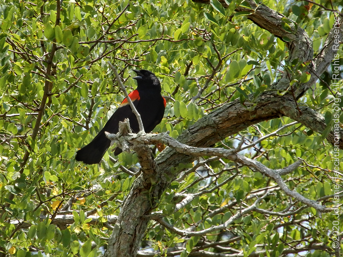
I had hoped to take a short hike on the Marsh Edge Trail, but that was closed because of nesting birds. Feeling a bit frustrated I continued on the drive, stopping to walk out onto a boardwalk that extended into the marsh, then again at an area where the landscape was quite different. There were some cool birds, and I listened to a red-winged blackbird for a little while, which helped me get over my earlier frustration.
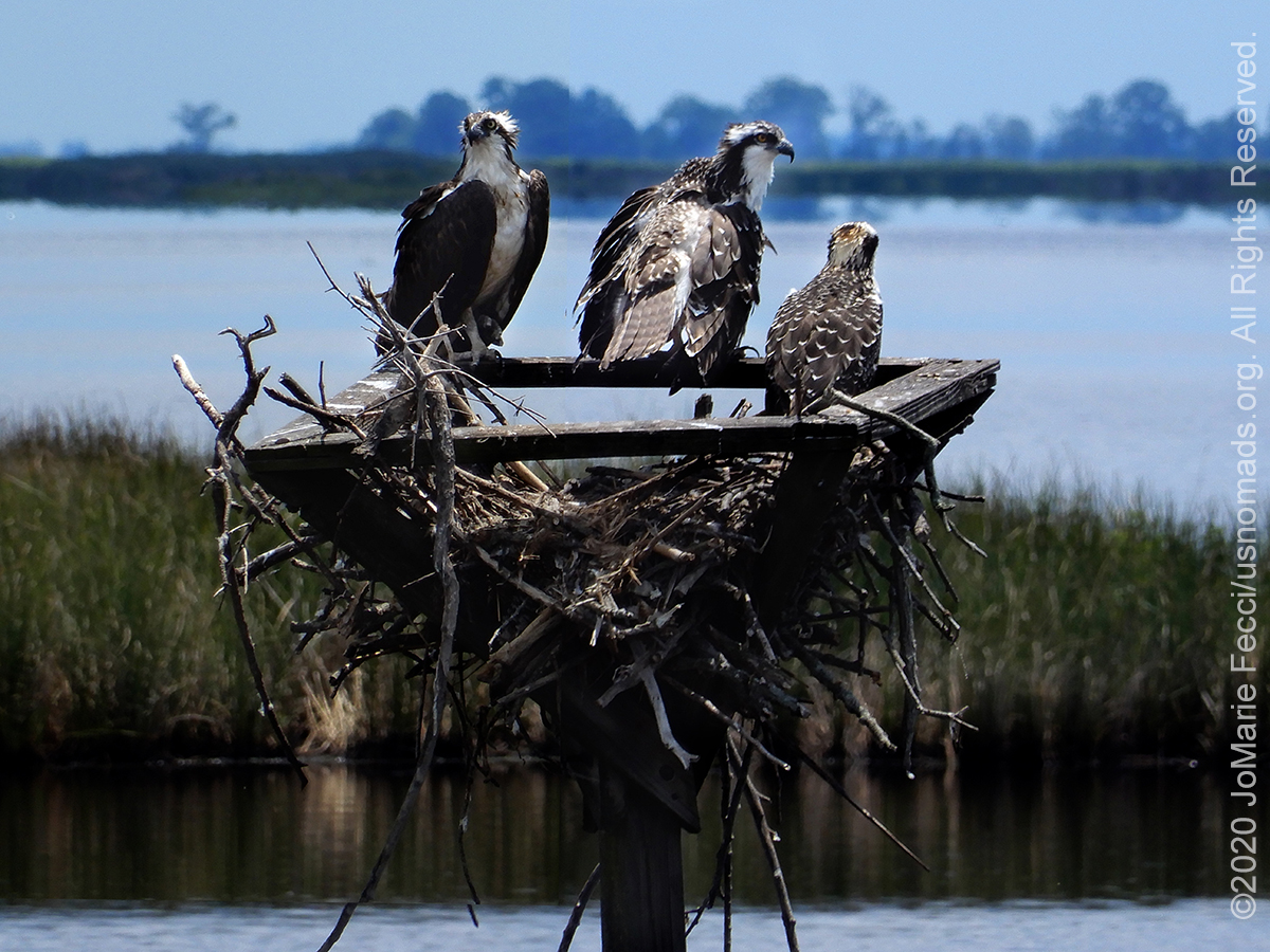
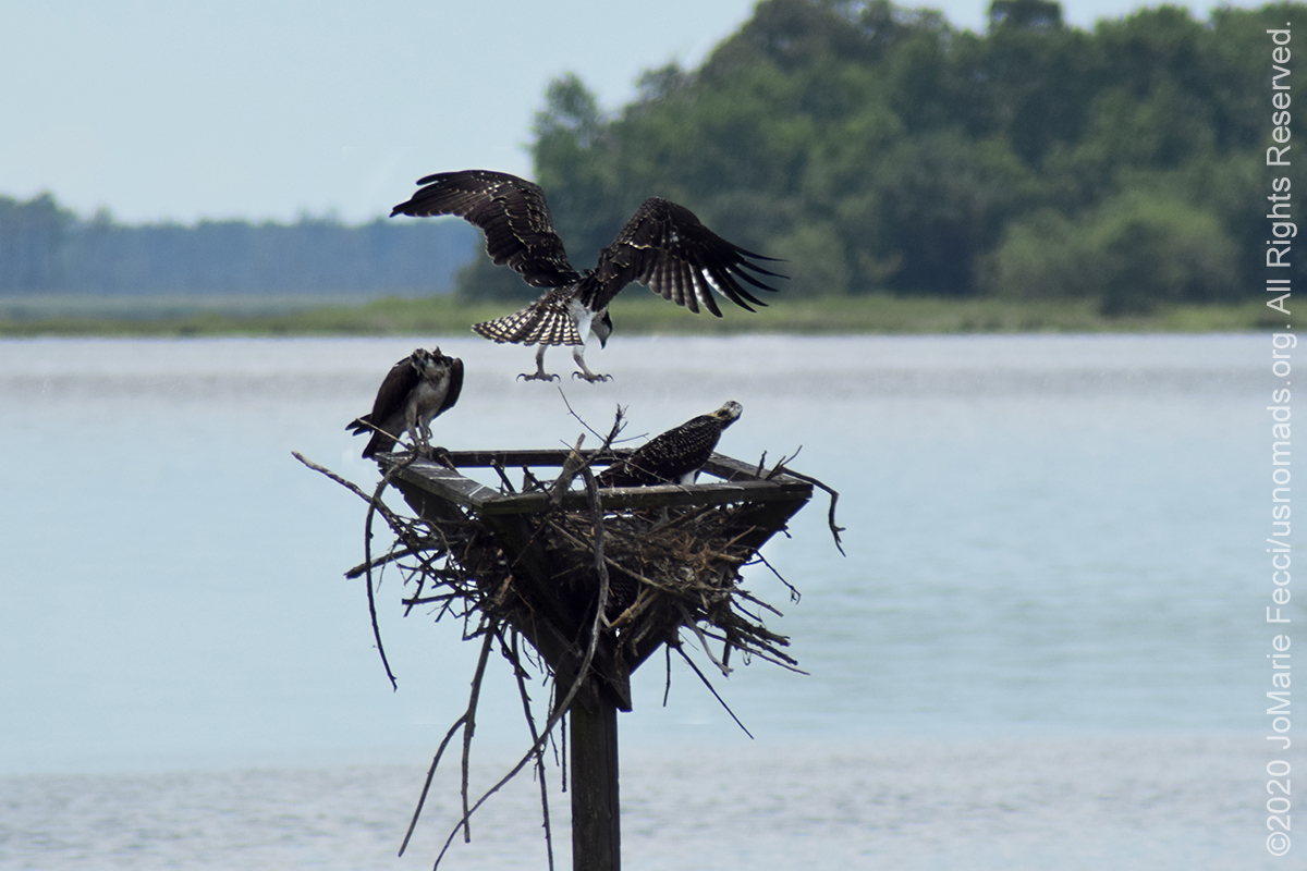
Then I spotted the ospreys. I wasn’t sure at first if they were in fact “ospreys” as I had never seen one before. I watched them for a while and made a few photos. It looked like a family, two bigger birds and one smallish one. It was hard to get a good photo as they were kind of far and two of them had their backs to the road. But I hung around hoping they would all look my way at some point. Eventually I think they got tired of my presence, or else something flustered them, either way, one of the birds kind of flew up in the air and hovered puffing its wings and making noise, and I got some photos of this, which I think may be cool. I left the ospreys and saw a blue heron wading in the marsh on the other side. The osprey family had made my day and as I finished the Wildlife Drive loop my mood had turned completely upbeat.
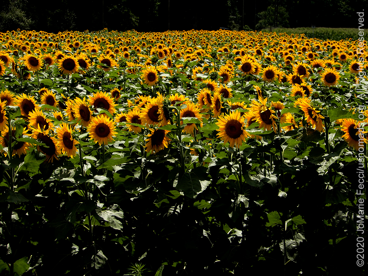
After a picnic lunch in a shady spot at the Refuge, I picked up the “scenic” route towards the Pocomoke State Park which would be my destination for the night. Once again I was driving through large tracts of farmland. I had never realized there were so many farms on the east coast. I always think of this area as very urban, industrial, and densely populated, but driving in this part of Maryland I felt like I was deep in the rural heartland. And there were sunflowers — I spotted a whole field of them on the side of the road, and couldn’t help but stop. Sunflowers are my favorite flower. I got out and just made some photos of them because I love them. It had nothing really to do with anything on my “program” for this “segment” of the journey that is focused on coastal wetlands, but nevermind.
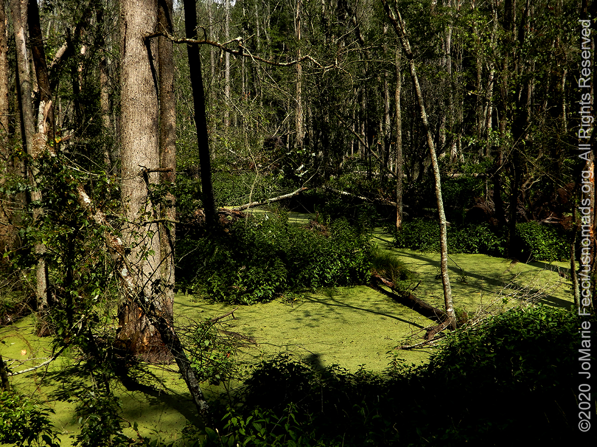
Back on track after the sunflower parenthetical I reached the Pocomoke State Forest, which surrounds the state park, and found myself back in the thick woodlands and a more “swampy” environment than the area around Trap Pond. Bright green algae-covered water flooded the forest, and masses of tangled fallen trees poked up here and there. This was definitely not a “cypress swamp” even though it was “swampy” and a little bit spooky too. But it was part of the ecosystem around the edge of the “Great Cypress Swamp” so merited a few photos.
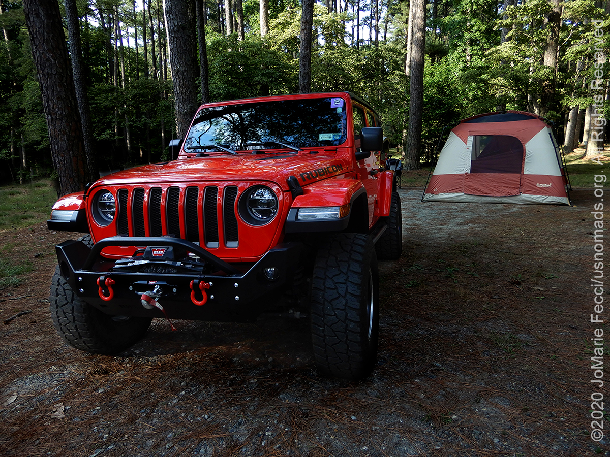
I got to the Milburn Landing campground by late afternoon and set up the big tent as I would be staying for two days. The campground was nice and clean and open, and I vaguely remembered it from the last time we had been here over ten years ago. Back then we stayed in one of the small cabins right on the edge of the river. I took a walk around the area and found the spot I had made some cool photos from. The ambiance was different now, both time of day and time of year, and the spot did not seem particularly visually interesting, but I made a mental note to check it out in the morning tomorrow. I continued my quick recon of the area, looking for the trailhead for the “Bald Cypress Nature Trail” which I want to explore tomorrow. With the Visitor Center closed here too, there were no maps available and no one to ask. Luckily they had at least set up a system for selling firewood (outside wood is prohibited). I loaded up my wood, and determined I would just have to drive around and find the trailhead somehow. There are four different directions you can go from the main intersection, and as luck would have it, I had to try each of them, finally finding the trailhead on the fourth one — the one leading to the parking area for the boat launch. I was now set for the morning and returned to my site to settle in for the evening.
The sun was low in the sky behind the trees as I started my fire and began preparing dinner. I was not in a hurry, and happily spent a relaxing evening under the stars, making sure to find the Big Dipper and the north star before calling it a night.
ABOUT THE EXPEDITION
JoMarie Fecci, of USnomads, sets off on a summer roadtrip around the east coast of the U.S. for a few weeks of exploration, camping, and Jeep fun. The focus of this trip is really just enjoying what the road has to offer and checking out some different trails in the region.
WHERE WE ARE
This trip will be a loop starting and ending on Long Island in New York.