
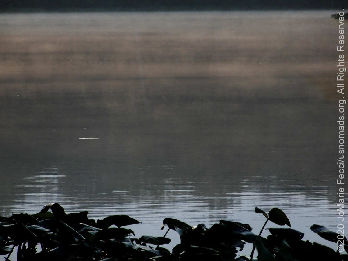
POCOMOKE RIVER, MD (16 July 2020) — The silence of dawn, before even the birds wake up, covered the riverbank as I made my way to its edge early in the morning. The water itself seemed still, even though I know it was not. I had hoped to see the “smoke on the water” that I once photographed here, but its the middle of summer now and there is just not that much difference between day and nighttime temperatures. There was only the tiniest wisps of fog rising from the river, almost imperceptible. I shot off a few frames, then waited for the sun to appear over the trees in the distance. The birds began to wake, with the resident ravens starting a rousing chorus of cawing.
It was time to start my day, and I had some ambitious plans. First on the agenda was a hike along the “Bald Cypress Swamp Discovery Trail” which I intended to do before it got too hot. There was no one at the boat launch parking area when I got there, and I went directly to the trailhead. I vaguely remembered some details of the trail from the last time, but it was so long ago, it wasn’t quite clear in my head and I wished that there was a trail map or interpretive brochure to explain the different ecosystems the loop passes through.
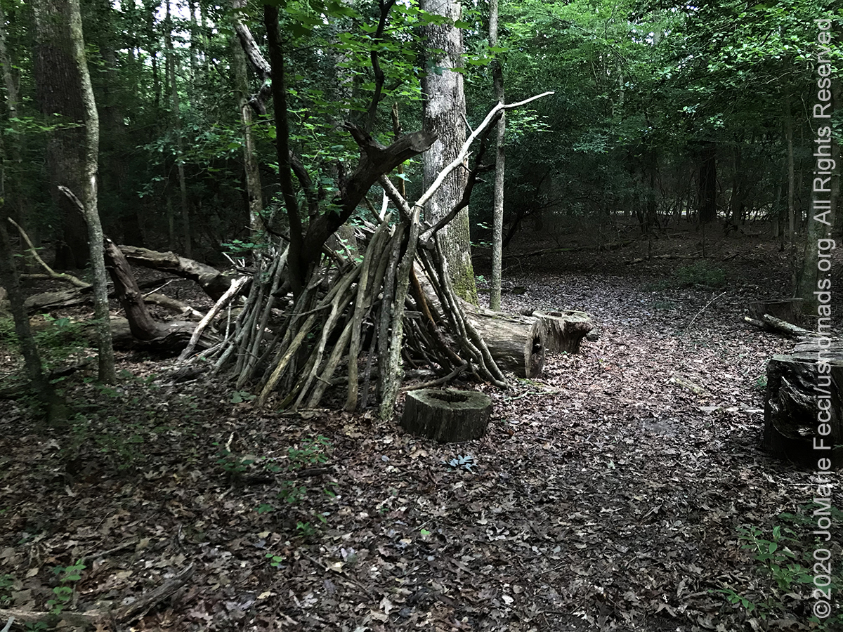
I set off following a path that seemed clear enough at first. The walk was easy on a nice wide trail through the forest and I continued along, going straight ahead following the white blazes for a while. At one point I passed the beginnings of a kind of wikiup shelter, and I thought that maybe they use this trail for some kind of lesson plan, either on native cultures or woodland survival — without the interpretive brochure it was hard to know.
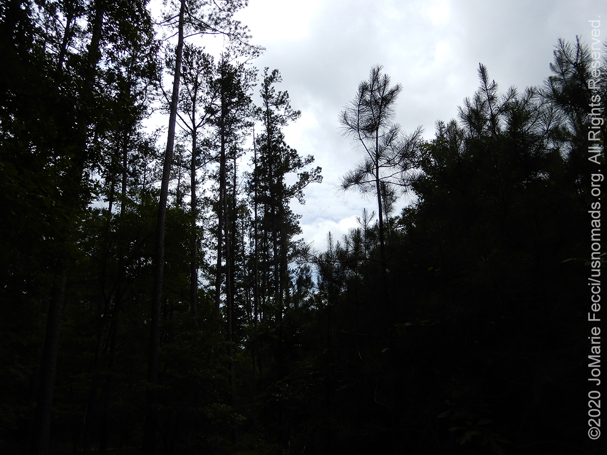
When I reached an intersection I had to choose a direction, and I picked straight ahead, as that was the more used trail. But after a while of continuing to walk straight, I had the feeling something was wrong. The discovery loop was supposed to go through pine groves, mixed hardwoods and finally the bald cypress swamp. But I had been walking among the same kind of trees the whole time, and there was no transition of ecosystems and definitely not any kind of swamp environment — and I had been walking for quite a while. I remembered the last time that there had been a wooden boardwalk at one point that led out over a really swampy area, and while that was over ten years ago, and perhaps the boardwalk would have rotted away, the swampy terrain should still be there. I decided to keep walking for another little bit, but if the vegetation didn’t change, I would turn back and explore one of the other trails at that first intersection.
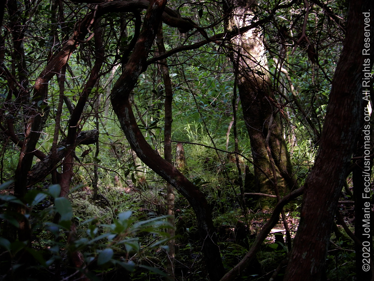
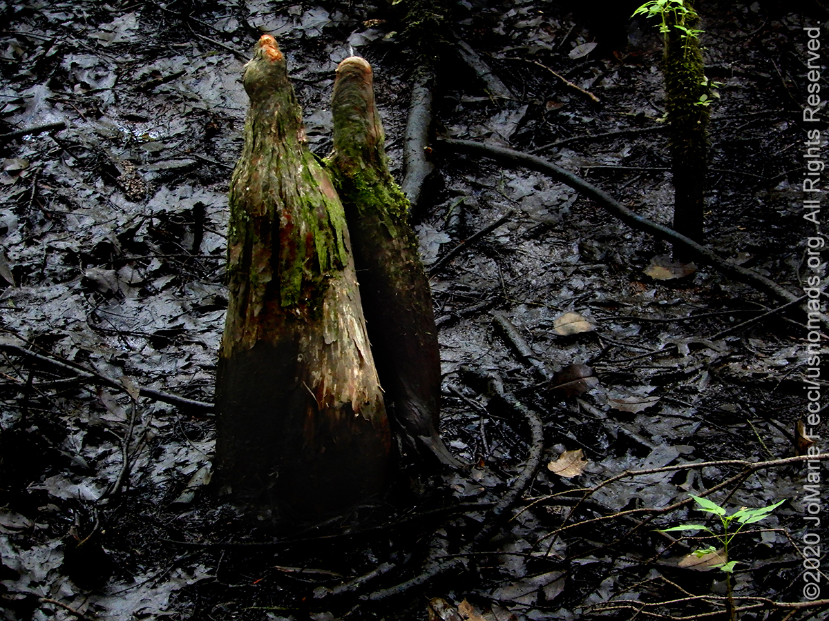
After maybe ten more minutes of walking through the same type of trees, I turned back and made my way to one of the intersections where I took a narrow side trail that began winding deeper into the woods. I wasn’t sure if this was “the” trail, but the vegetation was beginning to be different, and that seemed hopeful. Thin twisted trees and vines became denser and the whole trail seemed to be getting darker. When I saw the first cypress “knees” I knew I was on the right path. Not long after, I saw the wooden planks of the boardwalk, and I wandered out over the swamp’s edge where the surreal landscape had a whole different feel.
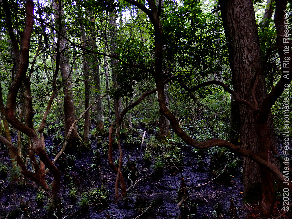
The darkness. The eerie cypress knees sticking up everywhere. The “black water.” The sense that the vegetation is closing in. It is definitely a bit spooky. I had found the “remnants” of the “Great Cypress Swamp” hidden here in the forest. I took my time making photos and noticed that it seemed much “drier” than the last time. The edges of the water had receded leaving some of the cypress knees just sticking up out of the mud and decaying leaves. I wondered if the swamp was dying or if it was just a question of rainfall.
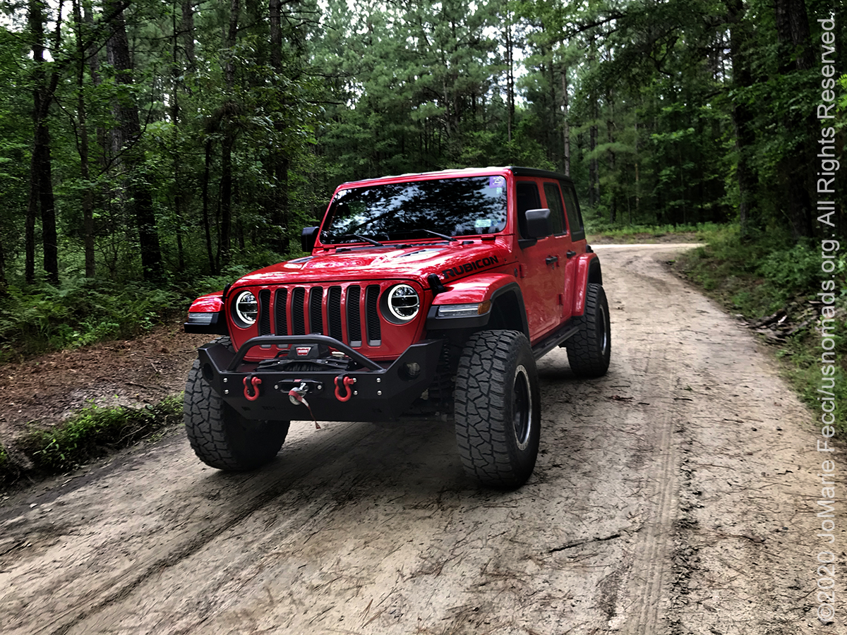
I finished the trail loop and made my way back to the Jeep thinking about how the swampland ecosystem was sort of hidden within the larger forest environment. It was interesting to see that this little “core” of blackwater, cypress knees and thick twisted swamp vegetation could exist surrounded by a different kind of forest. I was glad I finally found it, even if I was a bit tired from the extra hiking involved — apparently the white blazes I had been following were for the Algonquin Cross Country Trail, a 12.5-mile out and back trail that connects Milburn Landing and Snowhill Road south of Salisbury. Luckily I turned back when I did!
After a quick lunch at camp I felt revived and set out for my second hike of the day, on a trail near the old Nassawango Iron Furnace in the Pocomoke State Forest. I got out my maps and planned a route that included some dirt roads to get to the trailhead which was near something called “Furnace Town.” When I had researched this area originally I found that the Pocomoke State Forest is supposed to be one of the “most haunted” places in Maryland, and Furnace Town was mentioned. Thinking it might be a cool old ghosttown, I decided to go check it out, picking my hiking trail nearby on some land managed by the Nature Conservancy.
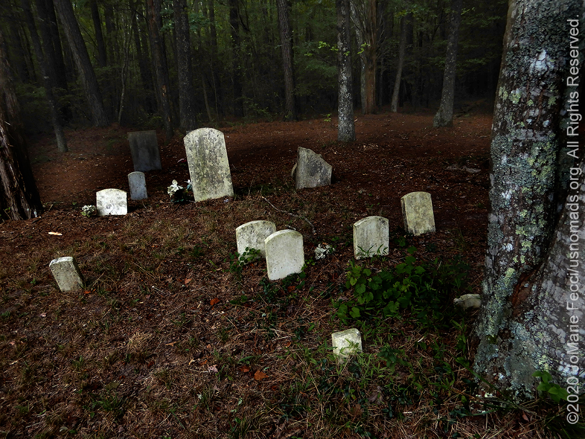
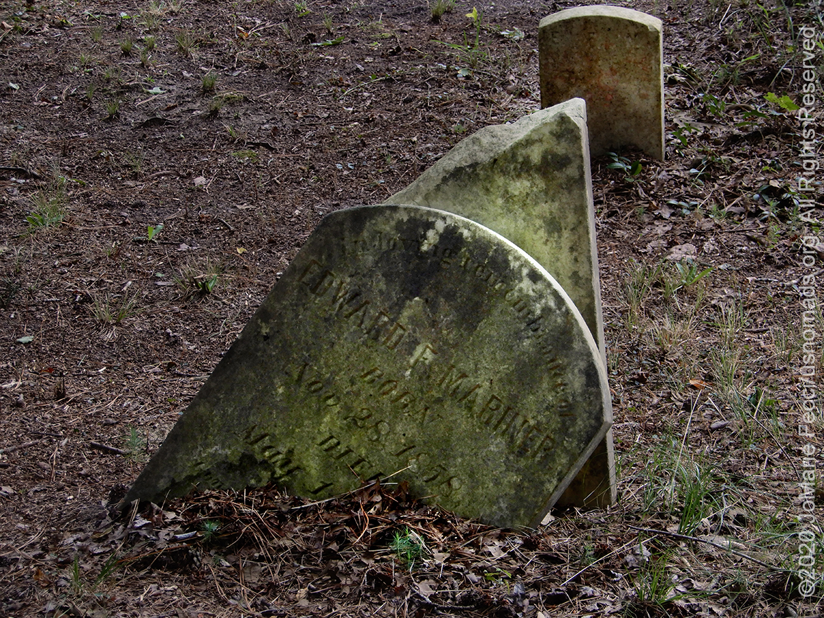
The route to the trailhead took me via what looked like active logging roads, though “dirt roads” the hard-packed sand was nicely graded and the brush was cut back so you could drive at “paved road” speeds. This part of the forest was not at all swampy, and not particularly “spooky” either. I didn’t find any ghosts, but I did find a strange cemetery seemingly hidden in the forest. It was a small patch between the trees and some of the tombstones were so weathered they could not be read. As I wandered between the graves I found a few that were legible, and the dates were in the mid- to late-1800s. There was no historical site marker or interpretive sign or anything that could tell me the story of the place or the people who were buried here — it remains a mystery — but I did notice there were some plastic flowers next to a few of the stones, so someone “modern” must know who lies beneath them.
After my visit to the graveyard I made my way to “Furnace Town” which ended up being some kind of pay-to-visit attraction rather than any kind of ghost town or ruins. And it seemed closed due to Covid-19 in any case. I went directly to my hiking trail which was outside the limits of the paid attraction. The Yellow Furnace Loop was a little less than two miles on nice easy terrain that passes through a globally rare shortleaf pine and mixed oak forest on an inland sand dune. Though the walking was easy I had done a lot of hiking in the morning already and by the end of the trail I was starting to “feel” it in my old knees. When I finished I drove directly back to camp and collapsed into my favorite camp chair, glad to just relax for what remained of the day. I was really tired, but the good kind of tired you get from physical activity. I soon caught my “second wind” and started my fire early, hanging out until the stars were clear against the dark sky.
ABOUT THE EXPEDITION
JoMarie Fecci, of USnomads, sets off on a summer roadtrip around the east coast of the U.S. for a few weeks of exploration, camping, and Jeep fun. The focus of this trip is really just enjoying what the road has to offer and checking out some different trails in the region.
WHERE WE ARE
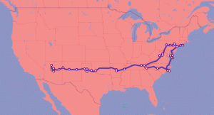
This trip will be a loop starting and ending on Long Island in New York.