
< more recent | 1-15 August 2020 | older >
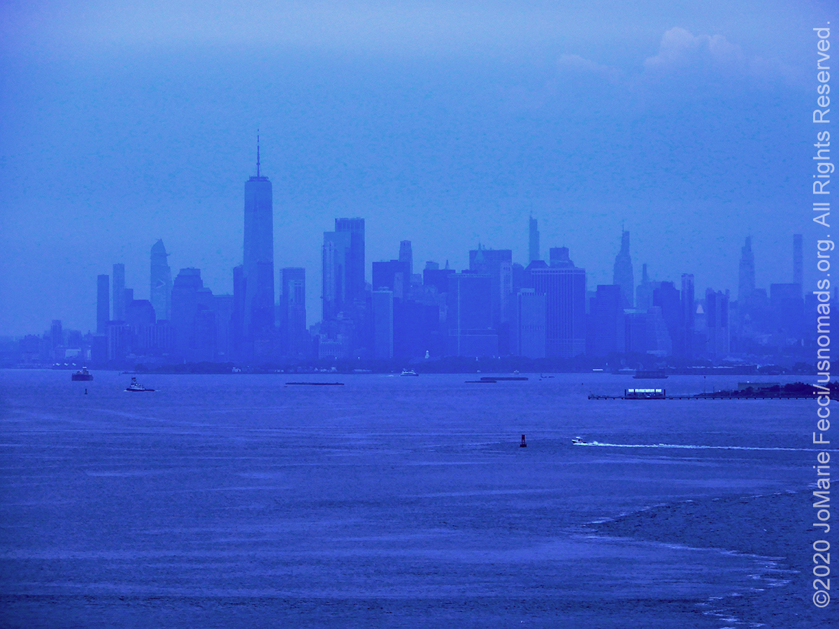
13 August 2020: After crossing the border from New Jersey into New York, we made a little detour on Staten Island to check out the site of Fort Wadsworth at the base of the Verazzano Bridge where we could see New York Harbor and the iconic cityscape of Manhattan through the mist …
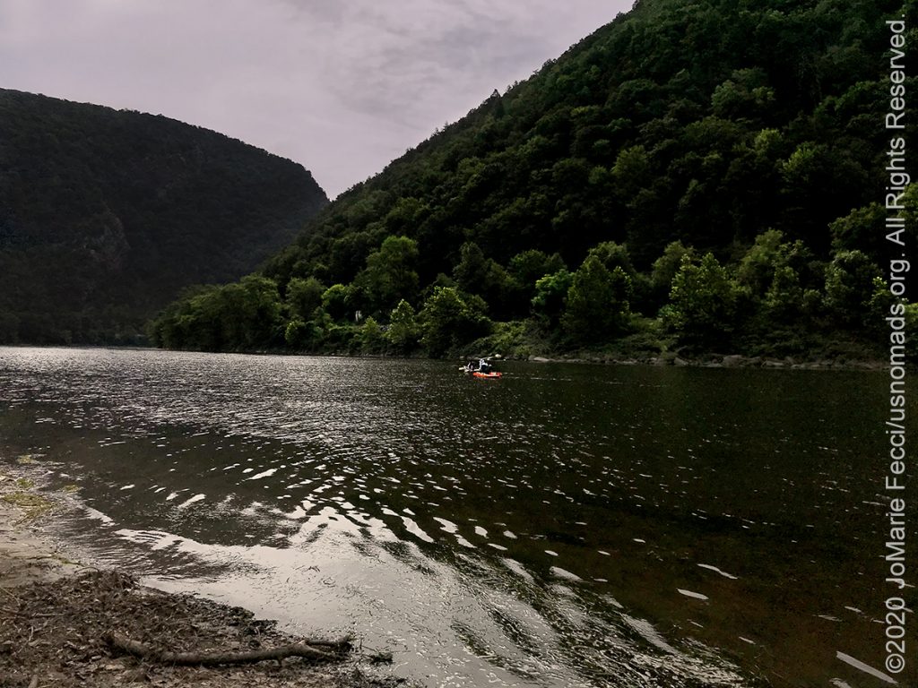
13 August 2020: Spent the morning exploring a little bit of the Delaware Gap National Recreation Area and the Worthington State Forest in New Jersey, discovering some cool places to come back to in the future, then continued the drive towards home…
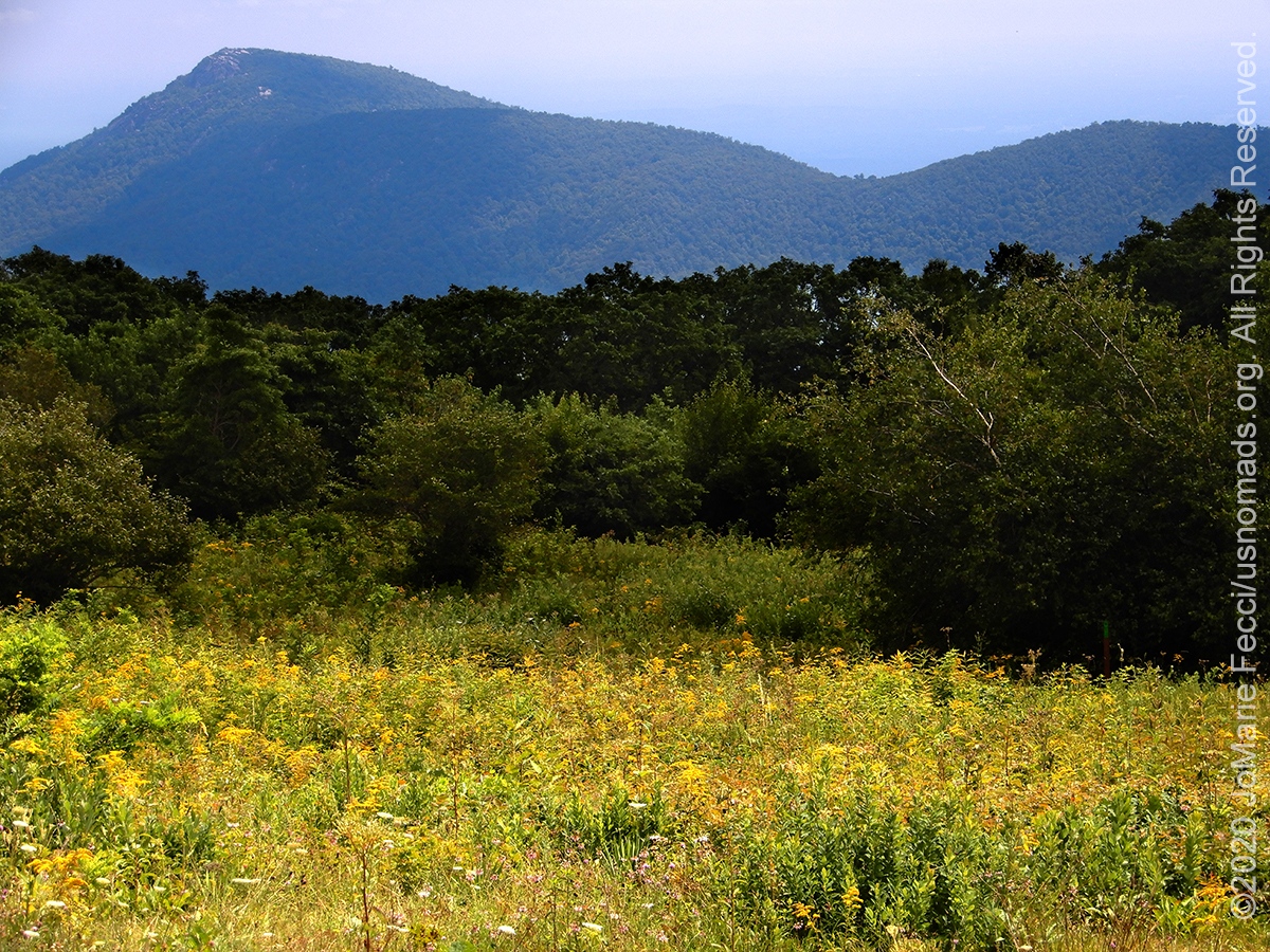
12 August 2020: Left Hone Quarry campground in the GWJNF and picked up the northbound route via the scenic Skyline Drive in the Shenandoah National Park for the day’s drive, continuing on up into Pennsylvania for the night…

11 August 2020: Headed north a bit into the Lee Ranger district of the GWJNF and picked up the Peter’s Mill Run trail that is part of the OHV area there. The trail was nice and easy as it has been relatively dry out, but it was clear that it would be a bit more challenging when wet…

10 August 2020: Joined up with a friend for camp and trails at the GWJNF, beginning with the Flagpole Knob trail, which we did following a route via Switzer Lake, and Meadow Knob, adding a loop to Reddish Knob to the end for a great scenic vista…
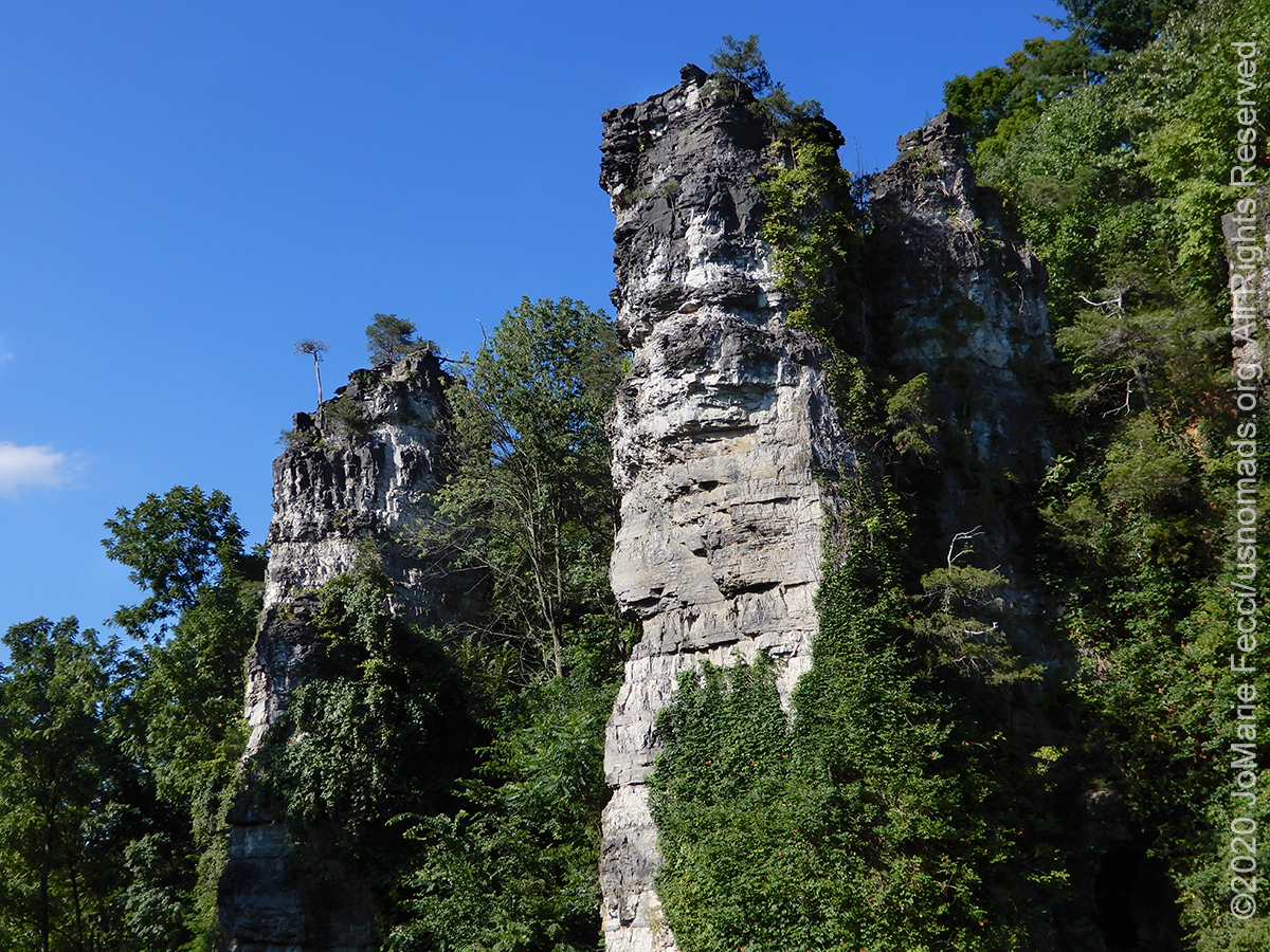
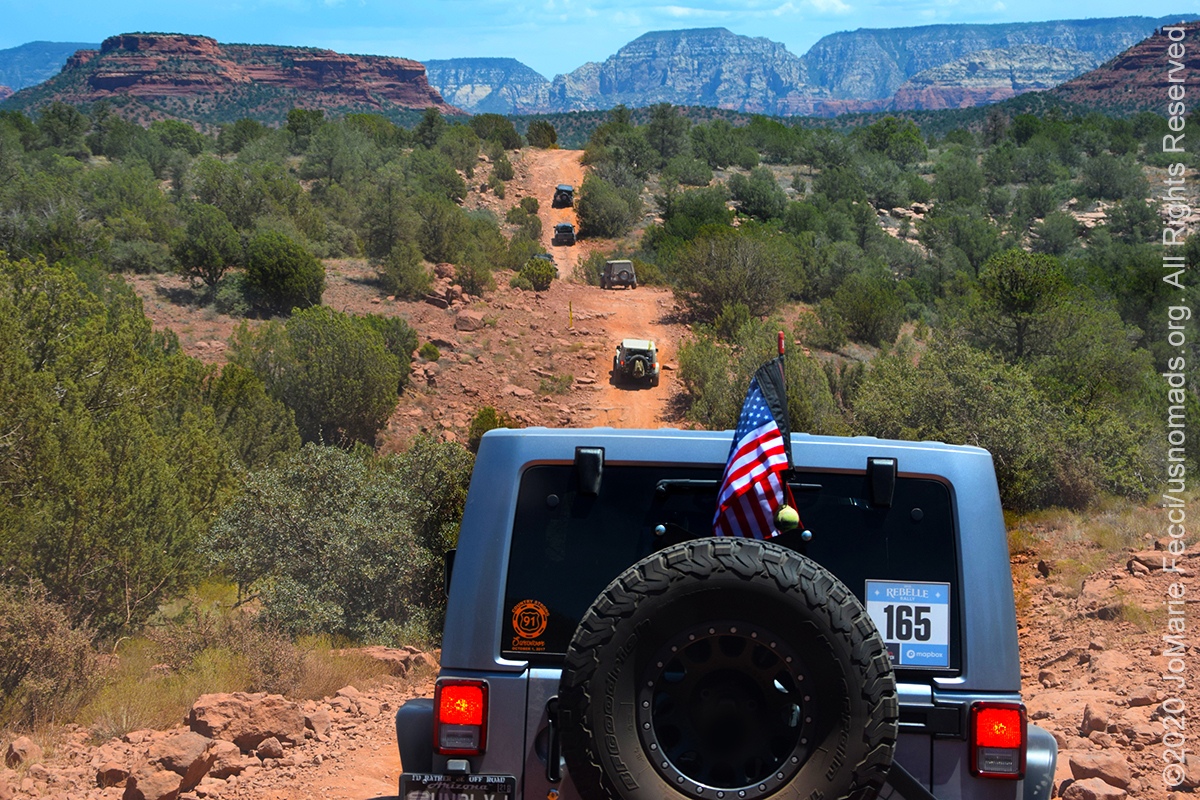
9 August 2020: Made the final leg of the “marathon” to return to the initial east coast roadtrip loop at the segment that should have followed Catoosa WMA, which picked up in the George Washington and Jefferson National Forest not far from Harrisonburg VA. First stop was a scenic point at the Natural Chimenys State Park…
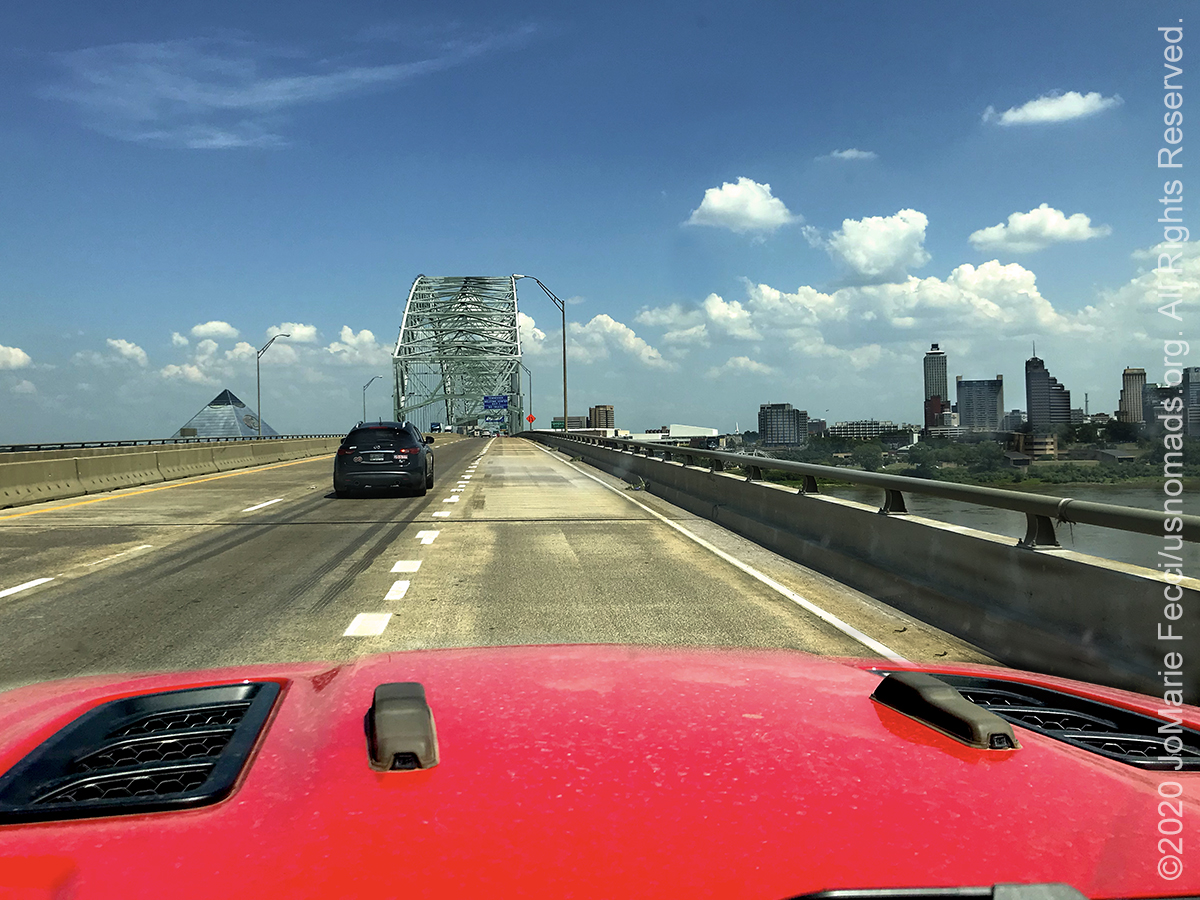
8 August 2020: Continued the drive with full intensity today making it from Little Rock to Knoxville without any long stops. Had hoped to take a break at the Mississippi crossing between Arkansas and Tennessee, but on arriving to the area realized the bridge over the river leads directly to the urban metropolis of downtown Memphis which would definitely break the “wilderness” spirit of the journey…
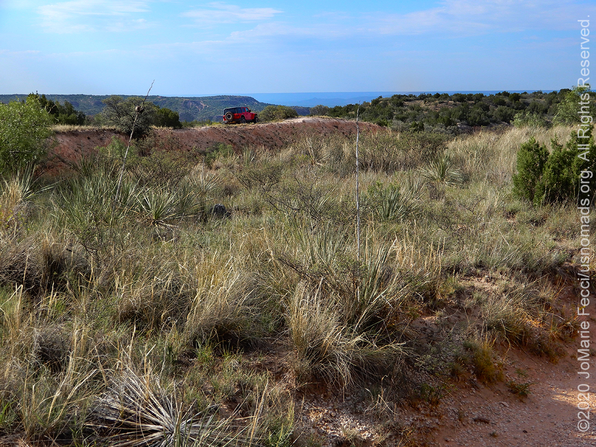
7 August 2020: Departing from the west seems hard. Took a very slow road from Palo Duro that went around the canyon’s perimeter through some beautiful Texas landscapes and into an almost-ghost Oklahoma border town, but had to move faster after that. Found the “transition” from west to east happened around Oklahoma City as the scenery began to take on more of the eastern woodland appearance from that point on…
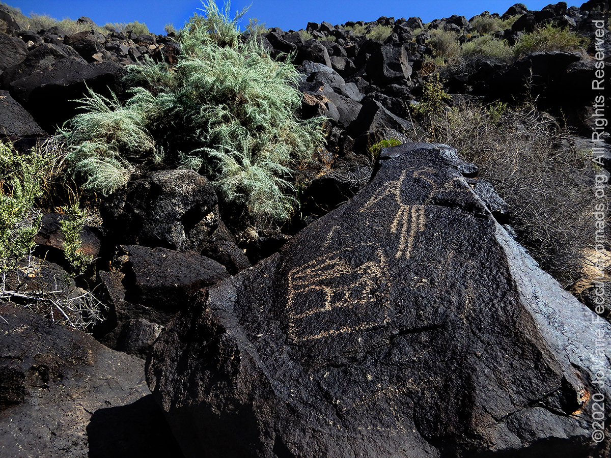
6 August 2020: Took a few breaks on the road today while crossing New Mexico, first for a short hike at the Petroglyph National Monument near Alburquerque, then again to explore some ghost town remains not far from Santa Rosa…
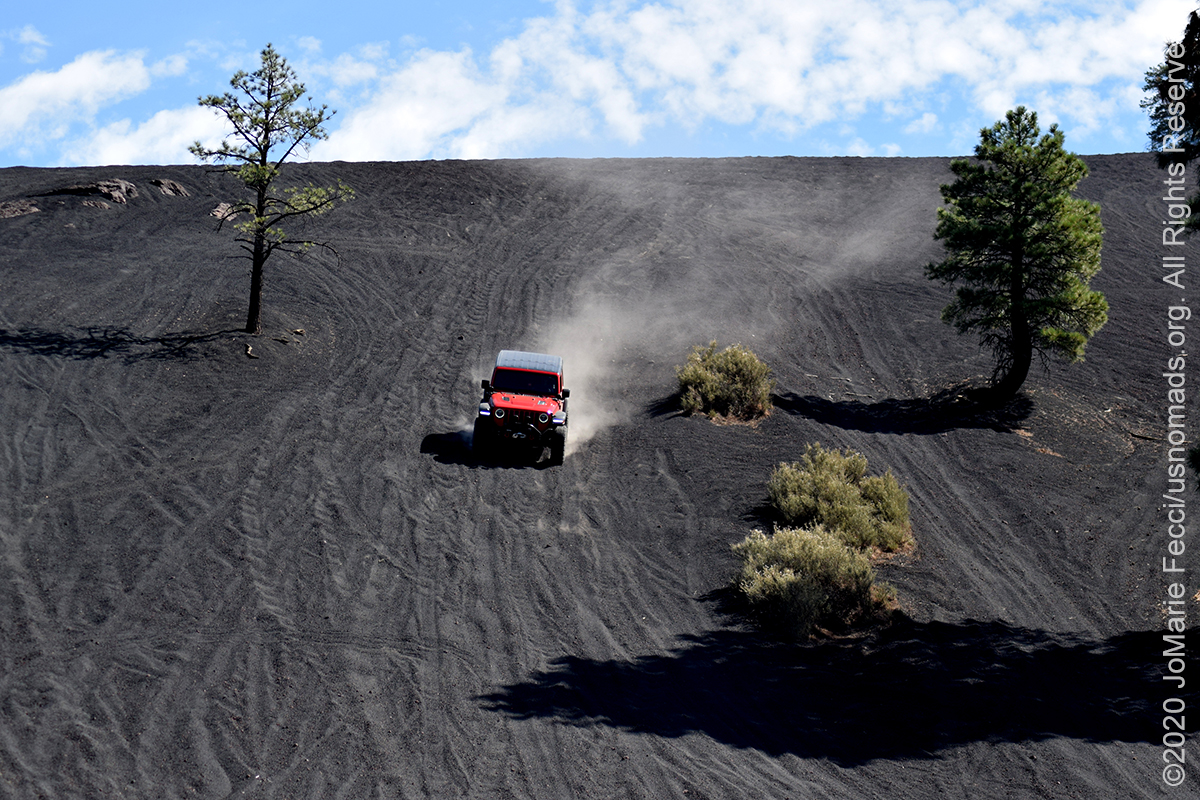
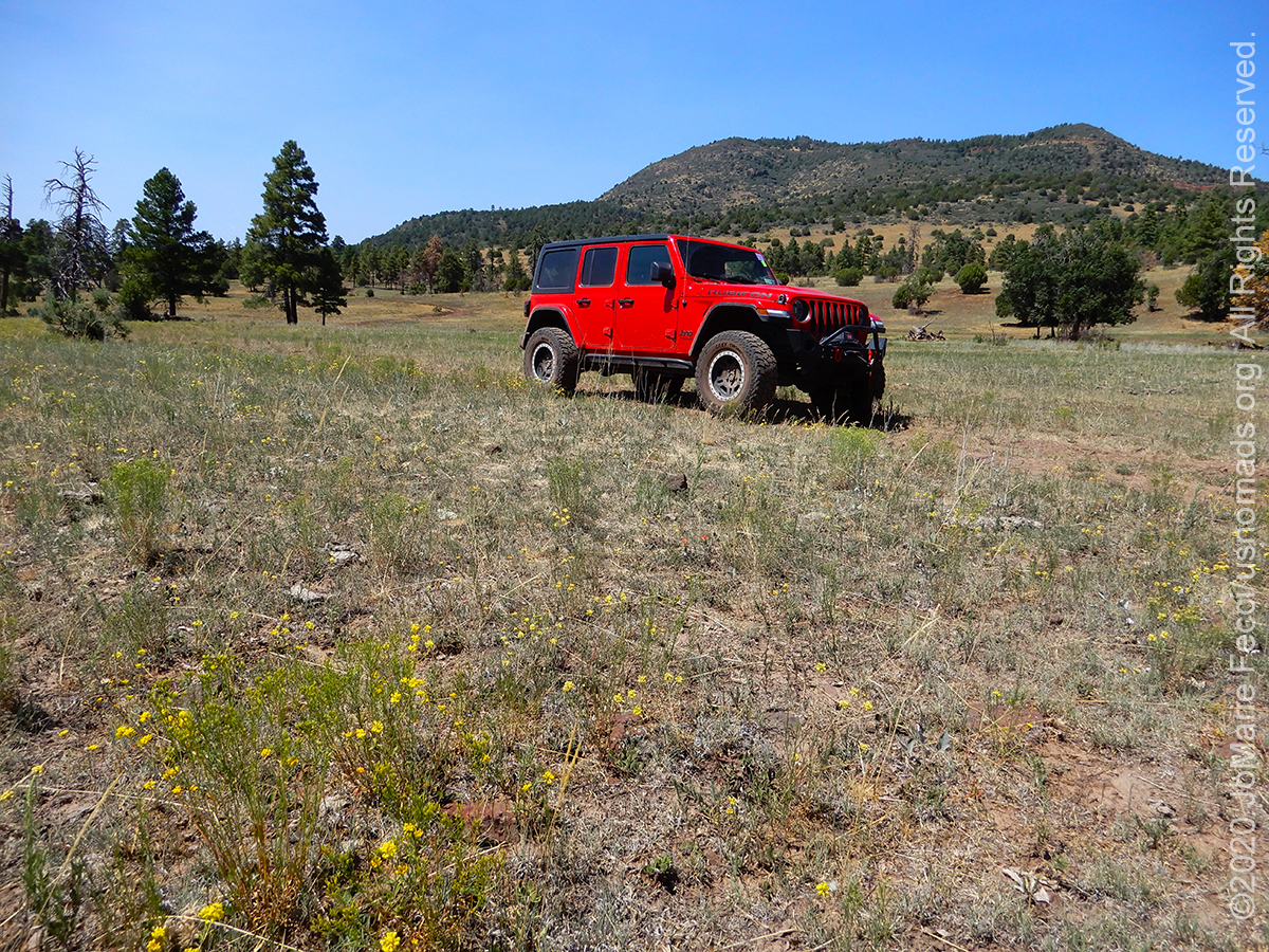
5 August 2020: Met up with some friends to spend the day wheeling around the Cinder Hills OHV area before leaving Arizona to begin the drive back east. Was a great day out on the trails in an otherworldly landscape, then some nice easy backcountry dirt roads down into the desert and on to Winona where the marathon eastbound began…
4 August 2020: Wildfires not far from Sedona interrupted some planned exploration around the Apache Maid mountain today, but we took the opportunity to make it a relaxed day meandering along scenic dirt roads in a less familiar part of the Coconino NF…
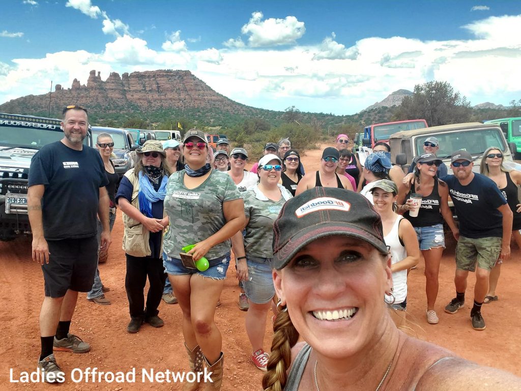
3 August 2020: The Ladies Offroad Network “NonCon” turned out to be an exceptional event, though it had come together at the last minute, with just a rough outline at the start. Everyone who came out and participated took a leap of faith that was well rewarded–what a great group to be part of. [Check out the full recap: THE LON NONCON 2020] …
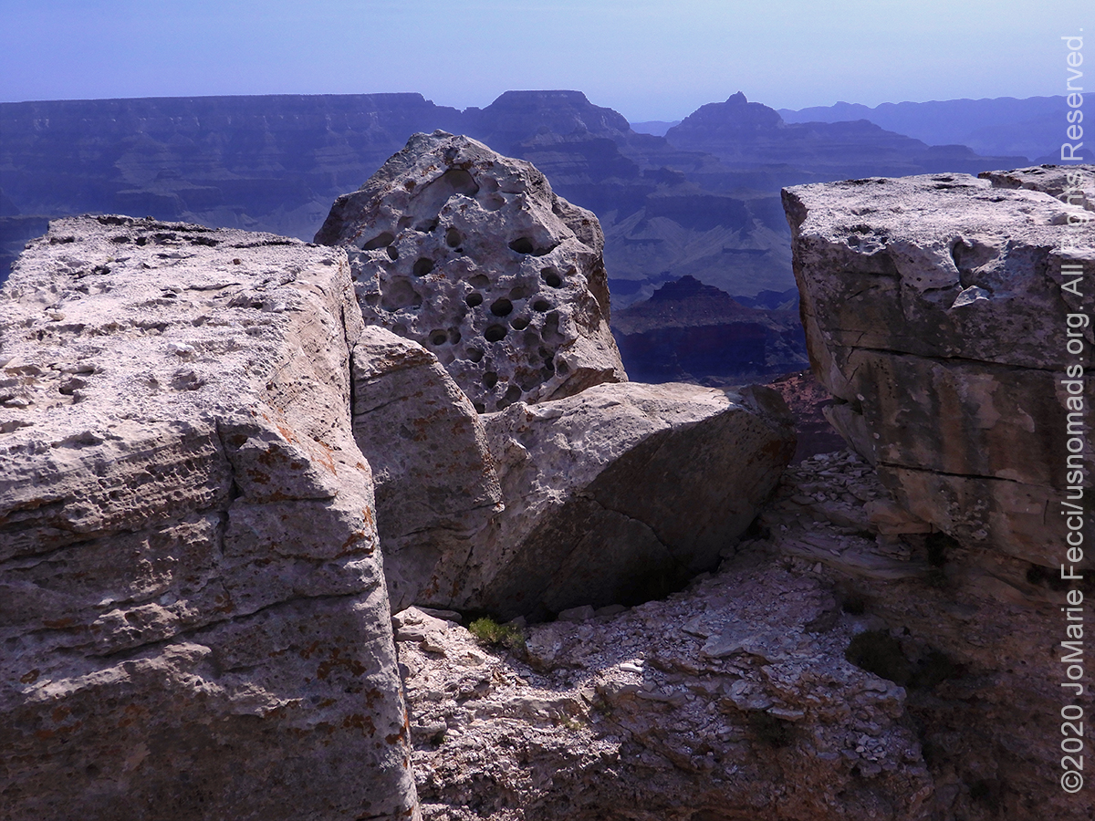
3 August 2020: The final day of the Ladies Offroad Network “NonCon” included a relaxed trip out to see the Grand Canyon before packing up camp and saying goodbyes. The event was well worth the marathon drive out, and we look forward to the next LON event. [Check out the full recap: THE LON NONCON 2020] …
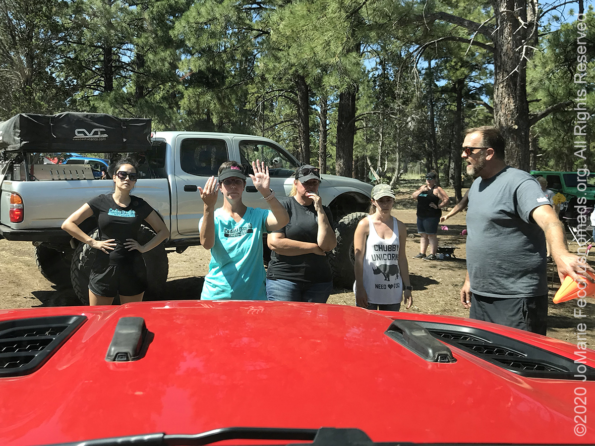
2 August 2020: The third day of the Ladies Offroad Network “NonCon” built on the previous two, and focused heavily on learning, including more formal hands-on instruction on aspects of recovery, spotting and trail guiding, followed by a short outing to check out the site of some ancient volcanic activity. [Check out the full recap: THE LON NONCON 2020] …
1 August 2020: Our second day out with the Ladies Offroad Network “NonCon” continued the learning and fun. Working on driving and spotting techniques out on the trail and enjoying the incredible beauty of the region during the day, then more skill-building activities back at camp. [Check out the full recap: THE LON NONCON 2020] …
THIS MONTH:

Time for an impromptu summer road trip post-pandemic style. Given the current situation, this means planning a journey to keep away from the crowds–so into the wilderness we go. Heading down the east coast on the coastal route then turning inland and looping back up via the mountains with some fun camping and wheeling along the way…
COMING UP SOON:
![]()
The 5th Annual 2020 Ladies Offroad Challenge starts on May 4th. Ladies will participate in a series of challenge tasks that are built to educate and encourage stepping into some unknown territories. The Challenge goes on over ten weeks with participants striving to “Do the Best They Can” at each of the tasks. Ten Participants from the Challenge will be invited to the very special Top 10 Weekend hosted by Charlene Bower…

Looking ahead to a return to Paris as soon as possible to reconnect with friends and some favorite places in the city of light. Timing is still uncertain due to the pandemic, but the trip is back on the calendar for late summer/early fall…
PETROGLYPH NATIONAL MONUMENT
Petroglyph National Monument stretches 17 miles along Albuquerque, New Mexico’s West Mesa, a volcanic basalt escarpment that dominates the city’s western horizon. The western boundary of the monument features a chain of dormant fissure volcanoes. Beginning in the northwest corner, Butte volcano is followed to its south by Bond, Vulcan, Black and JA volcanoes. The monument protects a variety of cultural and natural resources including the five volcanic cones, hundreds of archeological sites and an estimated 24,000 images carved by Ancestral Pueblo peoples and early Spanish settlers. Many of the images are recognizable as animals, people, brands and crosses; others are more complex. Their meaning was, possibly, understood only by the carver. These images are the cultural heritage of a people who have long since moved into other areas and moved on through history. The monument has four major sites that visitors can access, Boca Negra Canyon, Rinconada Canyon, Piedras Marcadas Canyon, and the Volcano Day Use trails. The petroglyph images within the monument have complex and varied meanings and hold deep cultural significance to Native peoples. Archaeologists have dated some carvings in the Boca Negra Canyon area as far back as 3,000 years ago. The relative age is determined based on the darkness of the image, its context, and its comparison to other works of the same age. It is estimated that about 90 percent of the petroglyphs were created during the period between AD 1300 until the end of the 17th century because of the “Southwestern Style” used. At this time, the Native population was increasing quickly and Pueblo adobe villages were being built along the Rio Grande River and at the base of the Sandia Mountains. There were many reasons for creating the Petroglyphs, most of which are not well understood by modern society. Petroglyphs are more than just “rock art,” picture writing, or an imitation of the natural world. They should not be confused with hieroglyphics, which are symbols used to represent words, nor thought of as ancient Indian graffiti. Petroglyphs are powerful cultural symbols that reflect the complex societies and religions of the surrounding tribes. They are central to the monument’s sacred landscape where traditional ceremonies still take place. The context of each image is extremely important and integral to its meaning. Note each petroglyph’s orientation to the horizon and surrounding images, as well as the landscape in which it sits. Today’s native people have stated that the placement of each petroglyph image was not a casual or random decision. Some petroglyphs have meanings that are only known to the individuals who made them. Others represent tribal, clan, kiva or society markers. Some are religious entities and others show who came to the area and where they went. Some petroglyphs still have contemporary meaning, while the meaning of others is no longer known but is respected for belonging to “those who came before.”…
ARIZONA’S VOLCANIC FIELDS
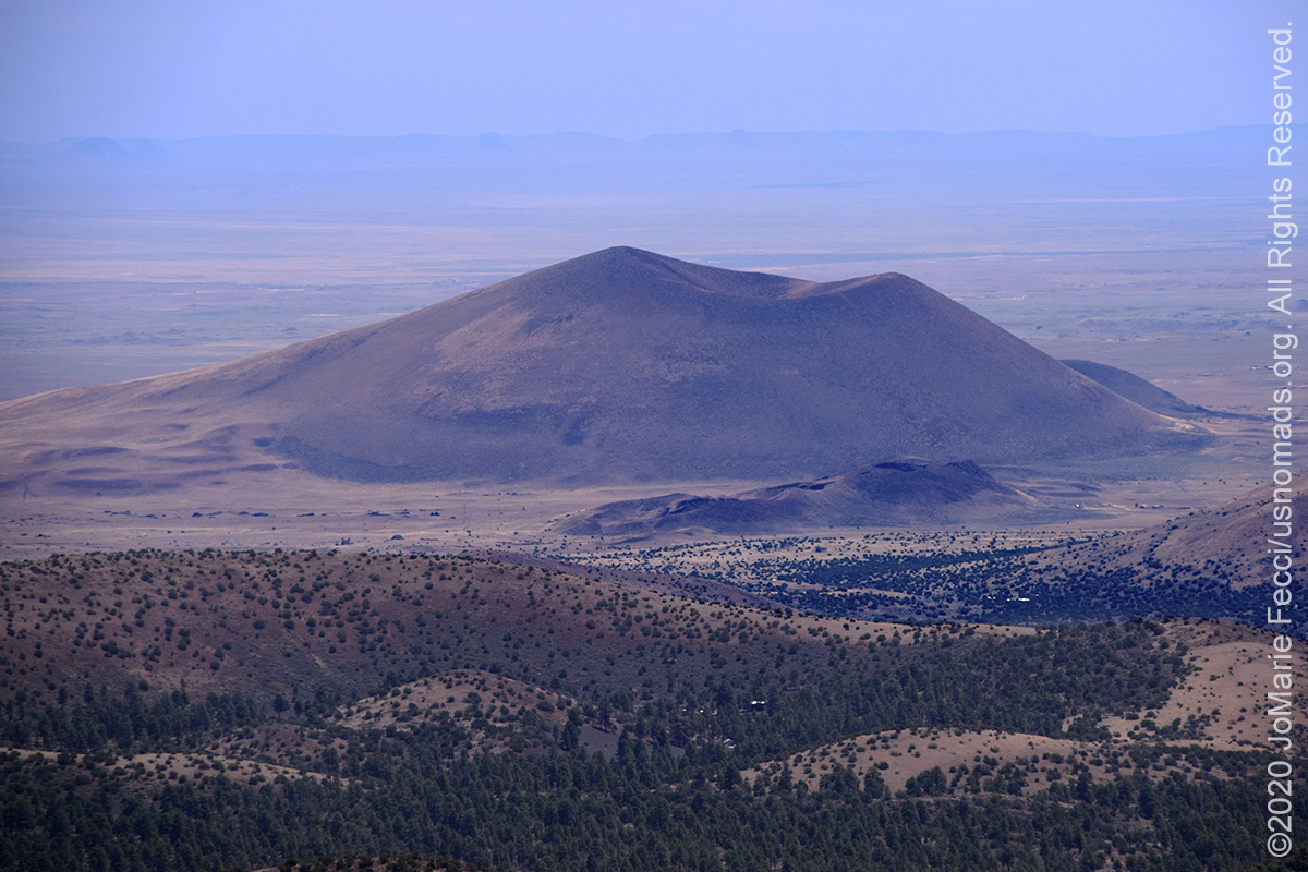
The San Francisco volcanic field is an area of volcanoes in northern Arizona, north of Flagstaff, that covers 1,800 square miles of Colorado Plateau’s southern boundary. The field contains 600 volcanoes ranging in age from nearly 6 million years old to less than 1,000 years, of which Sunset Crater is the youngest. This volcanic field seems to have formed from a geological hotspot. As the North American Plate moves over the spot, new volcanoes appear. Thus, the newest volcanoes are at the east side of the field. Most of the volcanoes are basalt cinder cones, but there are also large lava domes consisting of rhyolite and dacite. Given that Sunset Crater is such a young volcanic feature of this area and that eruptions have occurred every several thousands of years in frequency, it is likely that there will be a future eruption in the San Francisco Volcanic field. However, it is impossible to predict when and exactly where a new eruption might occur. The United States Geological Survey (USGS) says that a future eruption would likely be in the eastern side of the volcanic field, where the most recent volcanic activity has occurred. Such an eruption is likely to be small and pose little hazard due to the remoteness of the area. Sunset Crater National Monument preserves two volcanoes. The first is the park’s namesake, a 1000-foot-tall cinder cone that erupted sometime around 1085 CE. The second is Lenox Crater Volcano, another cinder cone that is much older. Lenox Crater Volcano is approximately 300 feet or 91 meters tall. Cinder cones form when runny basalt magma is mixed with water beneath the ground. As the rock-water soup reaches the surface of the earth, the water flashes into steam, causing the liquid rock to explode from the ground. When Sunset Crater Volcano erupted, it created a curtain of fire 850 feet tall. As these tiny bits of lava cooled off, they fell back to earth as tiny rocks called cinders or lapilli. These cinders piled up around the volcano’s vent, creating a cone-shaped pile we know today as Sunset Crater Volcano. Along with the explosion of cinders, the volcano ejected larger chunks of material called lava blocks and lava bombs. And even more lava poured over the land to create the Bonito and Ka’naa lava flows. This slow-moving liquid rock cooled and hardened on the surface, but the liquid lava underneath it broke through, only to cool and dry again. Over and over, this repeated process created the jagged landscapes seen today. Sunset Crater Volcano’s eruption incinerated the landscape. For over 400 years, the area surrounding the volcano was barren, sterile, and utterly devoid of plant life. The first plants did not return until around 500 years ago. Within the Bonito lava flow today are the remains of several unique features left behind after the eruption. Part of the fissure that broke open at the beginning of the eruption is preserved. Nearby is a squeeze-up, where thick lava pushed up through a crack in the ground and dried in a sharp fin of basalt rock. A spatter cone looks like a miniature volcano of its own near Sunset Crater Volcano’s base. Cool air rises from the remains of a collapsed ice cave. Not far from Sunset Crater is another cinder cone volcano known as Strawberry Crater. More than 1,000 feet high, Stawberry Crater sits along Forest Road 545 between the Wupatki National Monument and Sunset Crater National Monument in the Strawberry Crater Wilderness at a base elevation of about 5,500 feet. The northwestern end of the crater is covered with lava flows, while the southern end is filled with low cinder cones. A volcanic cinder cone and lava flow form the centerpiece of this 10,141 acre wilderness. Though the area last erupted around the time that knighthood was about to flower in Europe, the volcanic features you’ll see here look as if they had happened much more recently. Molten rock frozen in time still shows scrape marks left as it squeezed up through cracks in the cooler surface. Petrified bubbles of once boiling stone look as fresh as the sparse vegetation that struggles for a foothold on this rugged moonscape. Plentiful ruins scattered across this inhospitable landscape prove the resourcefulness of an ancient people who lived here even as the land still fumed and spouted. In places you can also see remnants of the gardens they cultivated using volcanic cinders as a water-retaining mulch…
THE CINDERS
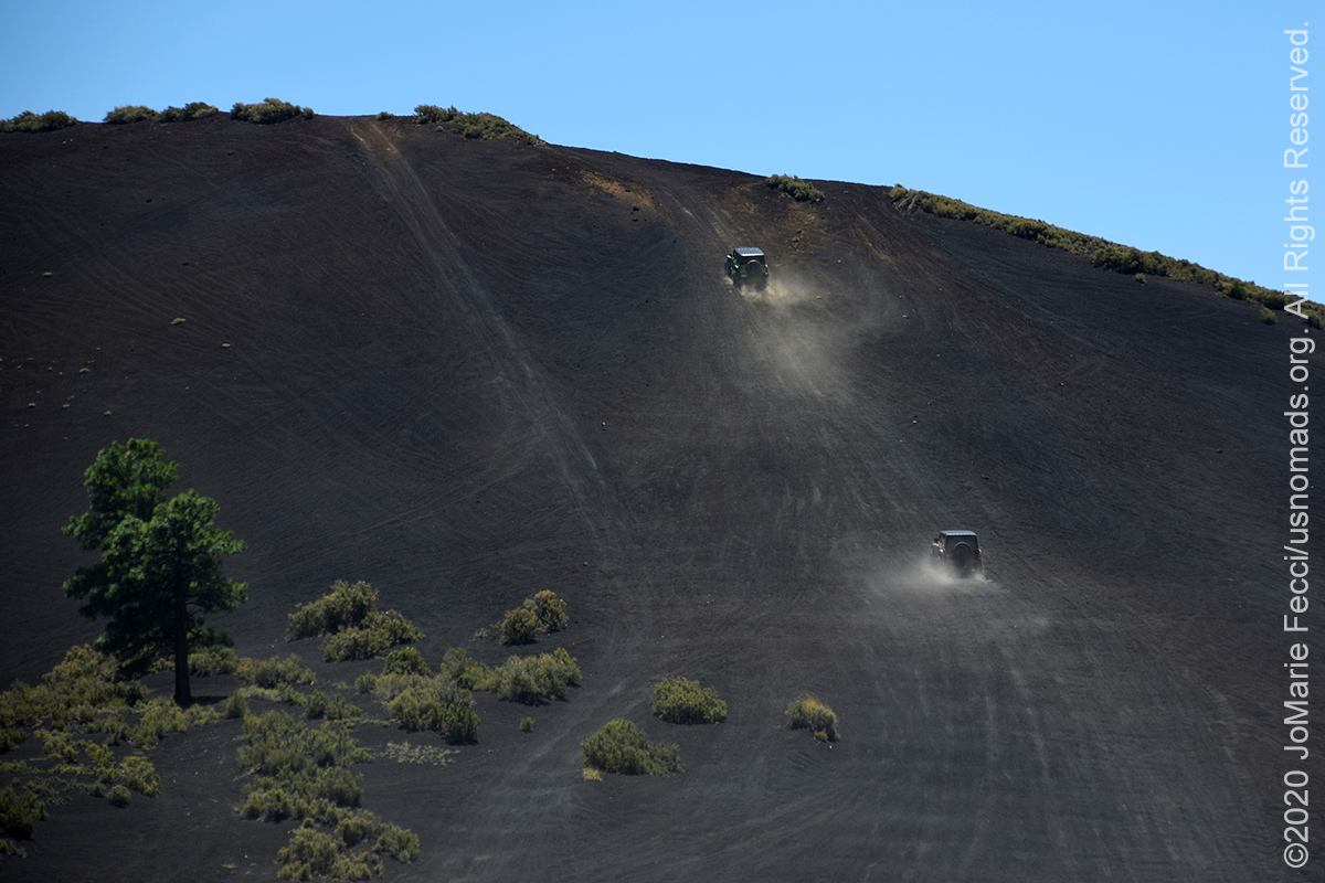
The Cinder Hills OHV area is a scenic recreation area where off-highway vehicle enthusiasts can drive across the unique terrain of a volcanic cinder field. Its numerous volcanic cinder cones and craters surrounded by a ponderosa pine forest environment gives the area an otherworldly character. Approximately 13,500 acres in the Cinder Hills has been designated for off-highway vehicle recreation. Currently most of this area is available for motorized usage, but future management plans may restrict use to a relatively dense network of designated routes which will be identified at a later date. According to the Forest Service website, generally unrestricted use will only be allowed on areas devoid of vegetation or with sparse vegetation and without such things as sensitive plants, archaeological sites, critical wildlife habitat, excessively steep slopes, or visually sensitive areas. Note that currently a sensitive resource area of 53,000 acres surrounding the designated off-highway use area has been set aside as closed to cross-country travel. Designated travel routes provided in this area are shown on the map as forest routes. There is no direct access between FR 776 and FR 545 (Sunset Crater-Wupatki Scenic Loop Drive). Access to the Cinder Hills OHV area is through the junction of FR 776 and Highway 89. Off-road travel between FR 545 and FR 776 is prohibited. FR 776 runs roughly SW to NE along the western and northern boundary of the park. FR 777 leaves FR 776 just after Cinder Lake (the large open area near the beginning) and runs east to west near the southern boundary of the recreation area. After about 1 mile, the gravel portion of the road ends and it becomes a track through cinders. It passes several cinder cones before reconnecting with FR 776 near the locked gate at the end. At the far eastern end of FR 777 is Double Crater, a unique volcano that has two craters, or holes where lava erupted at one point. On the west flanks of this volcano is the steep, challenging hill climb known to the locals as $100 hill. Before heading out to this area, make sure to check the most current MVUM for updates…
APACHE MAID MOUNTAIN
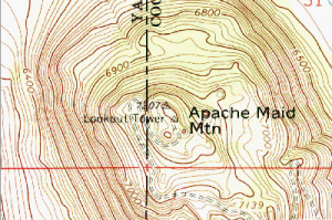
The trail up the mountain to the The Apache Maid fire lookout tower is roughly 2 miles of narrow shelf road, but the views from the top are definitely worth it. From the summit of Apache Maid Mountain at 7301 feet, you can see pine forests, open grassland meadows, the San Francisco Peaks north of Flagstaff, the red rocks of Sedona, the Mogollon Rim, and Mingus Mountain on a clear day. Both the road and the tower were completed in 1961. The drive up switchbacks along the southern side of the mountain providing stunning views at each turn. There are a few different stories about how the mountain got its name all centering on different versions of a mysterious Apache woman. One account tells of a battle between soldiers from Camp Verde and native Americans in which an Apache woman was killed in 1873. The soldiers took the dead woman’s daughter to Camp Verde, then an Army fort. The mountain was named for the young Apache maiden. Another story attributed to Saxton Seth “Boss” Acker, who moved into the area in 1884, says that the mountain was named after a young Apache girl who came with the troops from Camp Verde in 1874. A third story recounts that it was emigrants to the region who sent a scout ahead to send up smoke signals when he had found a route. The scout’s fire attracted a lost and starving young Apache girl who was adopted by one of the travelers. No one knows for sure…
THE COCONINO NF
The Coconino National Forest is a 1.856-million acre area located in northern Arizona in the vicinity of Flagstaff containing diverse landscapes, including deserts, ponderosa pine forests, flatlands, mesas, alpine tundra, and ancient volcanic peaks. Originally established in 1898 as the “San Francisco Mountains National Forest Reserve”, the area was designated a U.S. National Forest in 1908 when it was merged with lands from other surrounding forest reserves. The Coconino surrounds the towns of Sedona and Flagstaff and borders four other national forests; the Kaibab National Forest to the west and northwest, the Prescott National Forest to the southwest, the Tonto National Forest to the south, and the Apache-Sitgreaves National Forest to the southeast. The elevation in the forest ranges from 2,600 feet in the southern part of the forest near the Verde River to 12,633 feet at the summit of Humphreys Peak, the highest point in the state of Arizona. Much of the forest is a high altitude plateau that is located in the midst of the largest contiguous ponderosa pine forest in North America. On the southern border of this plateau is the Mogollon Rim, a nearly 400 mile long escarpment running across central Arizona that also marks the southern boundary of the Colorado Plateau. The Coconino National Forest is divided into three districts that each possess their own distinct geography and environments. The northernmost district, known as the Flagstaff District, is home to the San Francisco Peaks, an ancient group of volcanic summits. The San Francisco Volcanic Field is an 1,800 square mile area containing over 600 volcanic features. The landscape around Flagstaff is dotted with tree-covered cinder cones, lava flows, and lava tubes. There are also three National Monuments nearby: Walnut Canyon National Monument, Sunset Crater Volcano National Monument and the Wupatki National Monument. The Red Rock district of the Coconino NF, centered on the town of Sedona, encompasses many of the area’s famous red rock buttes and mesas, and canyons…
Nesconset | Paris | Belgrade | Flagstaff | Sedona | Albuquerque | Amarillo | Oklahoma City | Little Rock | Memphis | Knoxville | Harrisonburg | Stroudsburg

MORE NOTES FROM THE ROAD:
22-31 July – Summer Roadtrip
14-21 July – Summer Roadtrip
1-13 July – Long Island
16-30 June – Long Island
1-15 June – Bald Eagle
16-31 May – Central PA
1-15 May – Re-opening Trails
April – Lockdown NY
16-31 March – Lockdown NY
9-15 March – Roadtrip Home
1-8 March – Moab
23-29 February – Vegas to Anza Borrego
15-22 February – Southwest Roadtrip
8-14 February – Southwest Roadtrip
1-7 February – Glamis to Vegas
27-31 January – Yuma to Glamis
15-26 January – Nevada to Arizona
1-14 January – Starting the New Year
24-31 December – Holidays on the Road
16-23 December – Cross-Country Drive
9-15 December – New York
1-8 December – Paris
16-30 November – Paris & Rennes
1-15 November – New York
14-31 October – Arizona
8-13 October – LON TOP TEN
1-7 October – Girl Gang Garage
16-30 September – Women’s Wheeling
1-15 September – Long Island
9-31 August – Serbia
1-8 August – #LONCON2019
Archive
EVENTS

LADIES OFFROAD NETWORK NONCON 2020
Recap from the Ladies Offroad Network camping and wheeling event, dubbed the “NonCon” as in “not the convention,” that came together after the official convention was cancelled due to the pandemic… [read]
RE-OPENING
Report from the first trail run with the Off Road Consulting group at Rausch Creek Off Road Park as the post-pandemic phased re-openings begin in Pennsylvania and some of our favorite local trails re-open to the public after the two-month shutdown… [read]
REFLECTIONS

EGYPT: CAIRO REFLECTIONS
A quick overview of impressions from a stop in Cairo during our recent scouting mission in Egypt and Sudan … [read]
SPECIAL REPORT

A look into south-eastern Algeria on the border with Libya and Niger: overlanding with the Tuareg in one of the most remote corners of the Sahara … [read]