
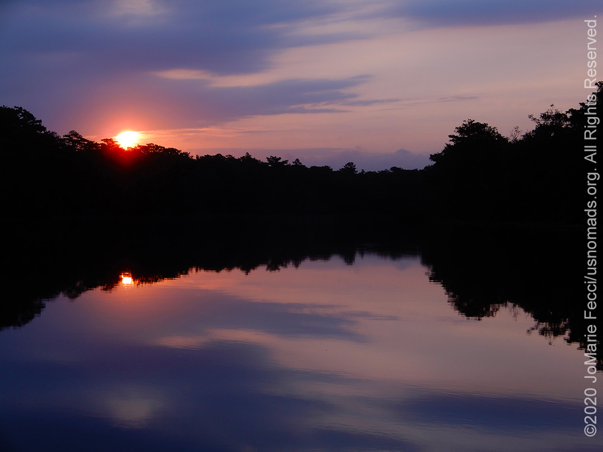
The locations featured in this series were waypoints along an east coast roadtrip loop from Long Island NY south to Cape Lookout NC, then turning westward across North Carolina and over the Smoky Mountains into Tennessee before turning back north via the George Washington and Jefferson National Forest and Shenandoah National Park. The original trip was done over a few weeks in the summer of 2020, during the extended period of concern over the Covid-19 pandemic. The loop covered roughly 2,700-miles of highways, with the locations featured here being the off pavement highlights. The primary goal of the trip was to scout a string of outdoor wilderness destinations that could make a good overland loop with fun off-road segments while maintaining “social distance” and avoiding crowds or serious risks of exposure to the virus.
The Great Cypress Swamp once stretched across 50,000-plus acres of the Delmarva Peninsula in south Delaware and southeastern Maryland. Over the years it was drained, leveled, timbered, and burned almost out of existence until today most of the original swamp area is covered with farm land. A small section of the once vast swamp was rescued from obliteration by the Delaware Wild Lands organization which consolidated 10,000 acres beginning in 1961 in order to protect it. Though it remains the largest contiguous forest on the Delmarva Peninsula, finding remnants of the northern most bald cypress swamp is not so easy. Designated the Great Cypress Swamp Conservation Area, the protected land is off-limits to visitors.
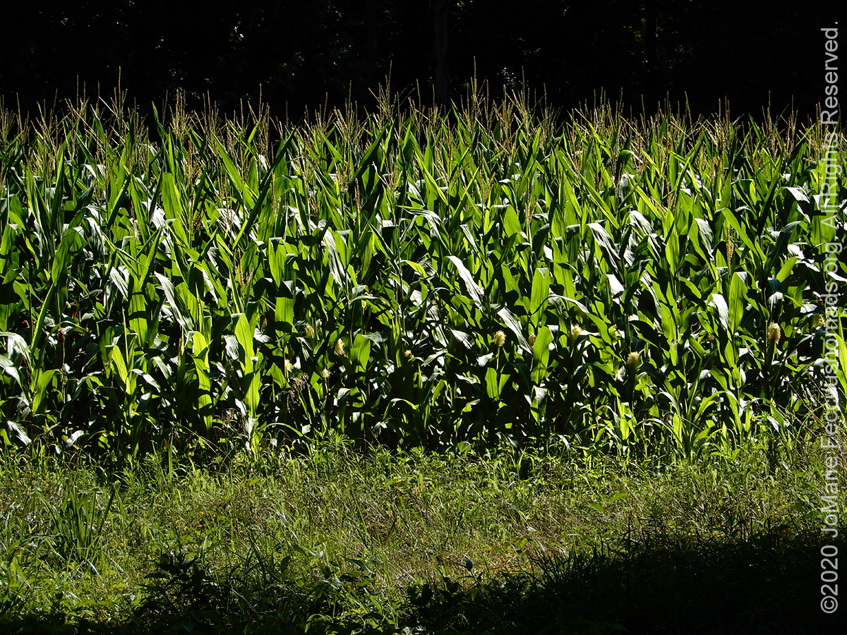
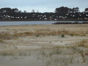
Rows of tall corn sway in the breeze and a white tailed deer grazing along the edge of the field leaps off into the woods as we drive past, looking for traces of the old swamp. It is possible to get a sense of the wild remoteness by driving along Route 54 west of Route 113 where the road cuts through an area with a view of large bald cypress trees. But to get more up close and personal we decided to look for the few corners of the old swamp that are still accessible.
Our first stop was at Trap Pond State Park in Delaware which is on the edge of the limits of the old swamp and where a few of the Bald Cypress trees still stand, though the park itself is definitely not swampy. A comfortable campground sits on the water’s edge and, at first glance, apart from a few Cypress trees near the bank, there was little evidence that it had ever been part of a “swamp.”
Yet the very existence of the lake-sized “pond” and the park that surrounds it is thanks to the swamp. Wood from the bald cypress tree was prized for its rot-resistant quality, and in the 18th century lumbermen began extensively harvesting in these wetlands. They dammed the swamp’s outflow to power their sawmill. It was the dam that created what is now Trap Pond. Once all the old-growth cypress timber was gone, the pond and adjacent surviving wetlands became a drainage sump for nearby farmers, until the Delaware legislature took over the land and made it the first state park in Delaware on June 22, 1951.
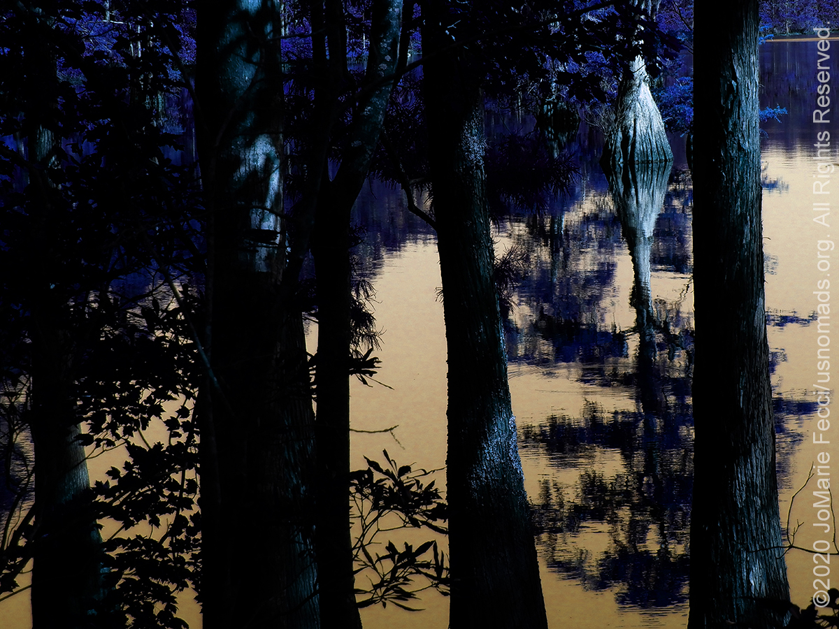
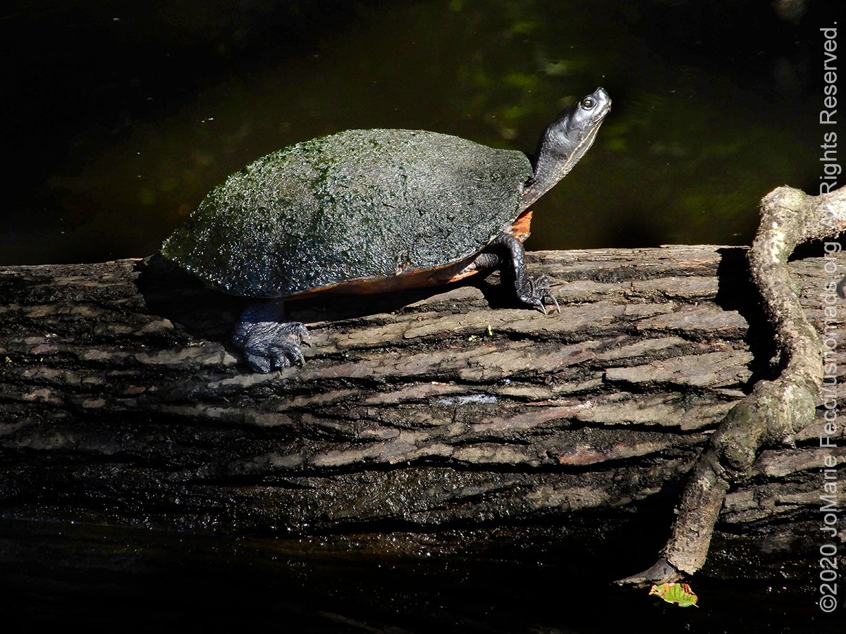
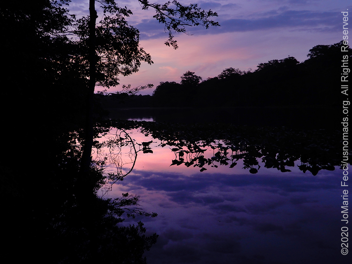
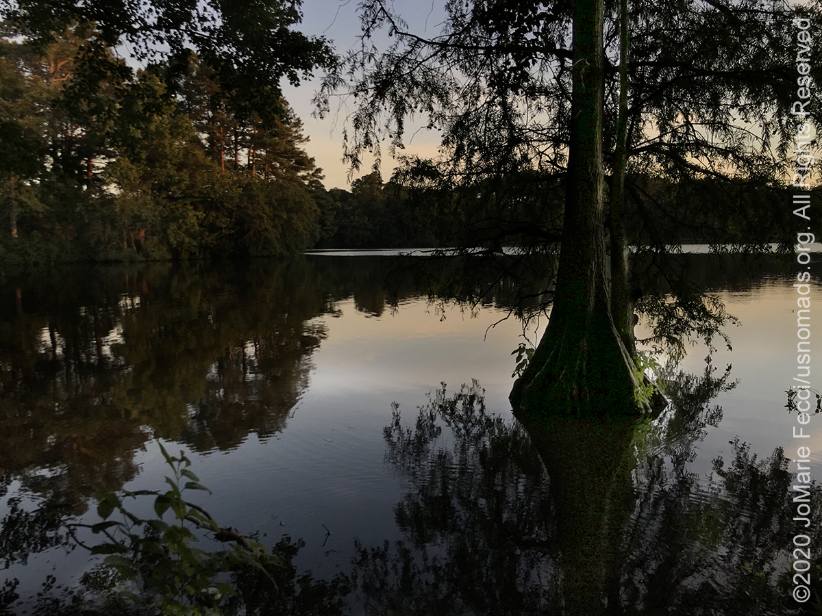
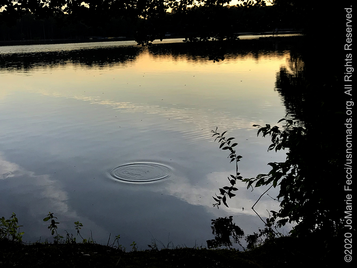
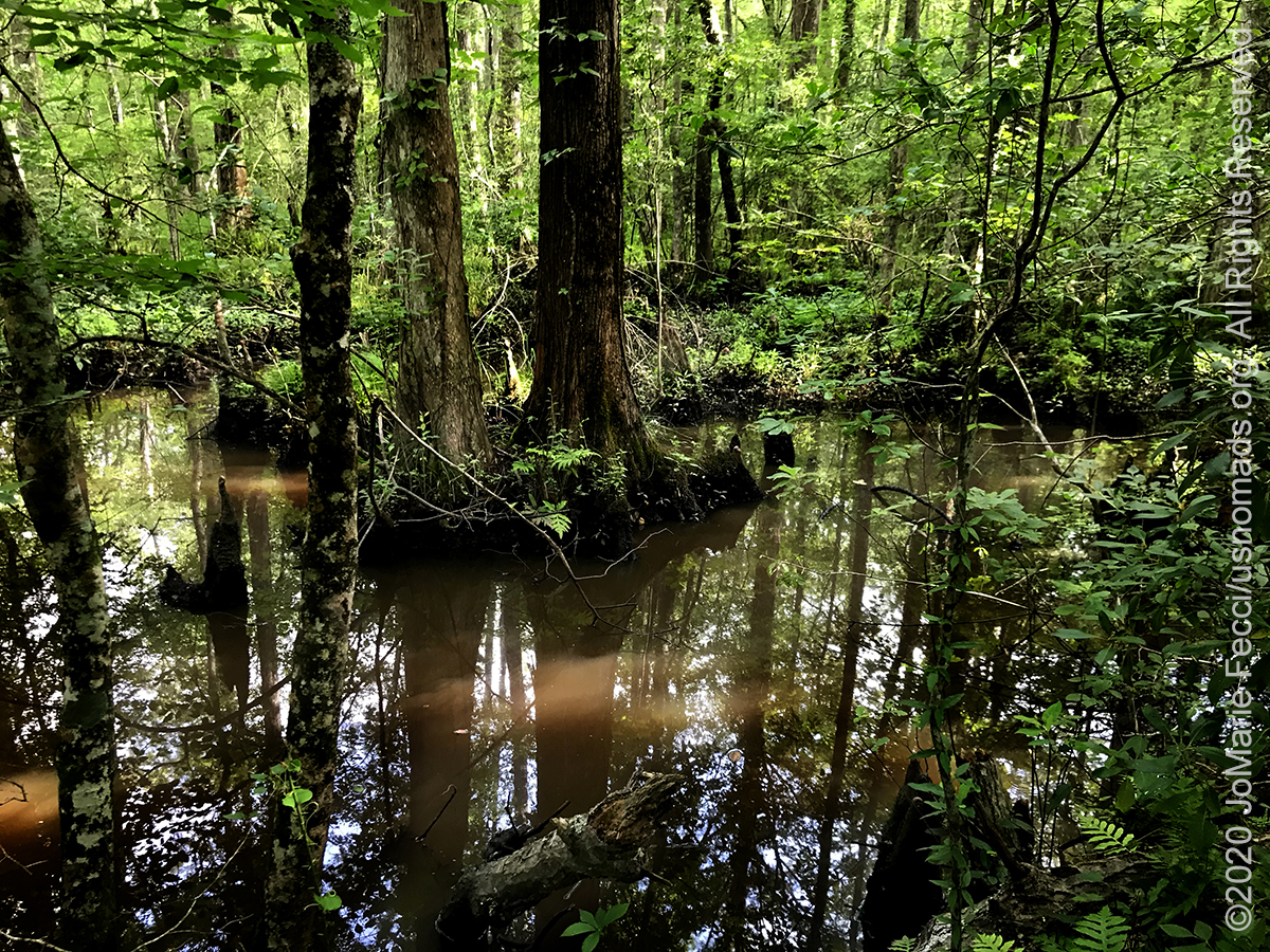
At the park it is possible to rent a kayak and paddle the Terrapin Branch Water Trail, a wilderness canoe trail down a stream that feeds into the pond. Starting from the pond it takes about 20 minutes of paddling to reach the dense swamp area. The route through a swath of bald cypress trees is a unique opportunity to experience the sights, sounds and smells of the old swamp in a landscape that remains much as it was centuries ago. Even on a bright sunny day it is semi-dark and a bit “spooky” as we slowly glide through the dark water punctuated by the even darker reflections of the cypress trees. The iconic “black water” of a cypress swamp is due to the tannic acid found in the trees’ needles, which as they decay, seep into the river giving the water that deep dark brown color. It takes a little while for our eyes to adjust to the darkness and begin to make out the details hidden in the shadows. A turtle sits motionless on a log, warming itself in a patch of sunlight, and a frog splashes into the water, leaving ever expanding concentric rings rippling ahead of us.
The Swamp is the headwater or source for the Pocomoke River, and the Pocomoke River State Park is the next stop on our journey. The Pocomoke River stretches approximately 70 miles from southern Delaware through southeastern Maryland eventually leading into the Chesapeake Bay. Its upper reaches flow through the old swamp lands, where we can find more intriguing remnants of the original landscape. We set up to explore this area from a “base” at the campground in Milburn Landing, which sits along the river’s edge.
The Pocomoke River basin has a rich history with archaeological evidence indicating the area’s first inhabitants lived here more than 10,000 years ago. When the Europeans arrived they encountered Pocomokes, Nanticokes, Nassawattox, and several other tribes of the Algonquin Nation, who had villages along the river’s banks. By the late 1600s, these Native American communities were scattered and settlers began logging the swamp, using the cypress wood for shipbuilding, shingles, siding on homes, water tanks and coffins. As the demand for the hardwood of the bald cypress increased in the 1800s, lumber operations took over. The Pocomoke River swamp forest had been completely timbered by the 1930s when the federal government began acquiring abandoned land in the watershed. The state assumed control of the land in the mid-1950s and with subsequent protection, some areas of swampland have returned to a more natural state.
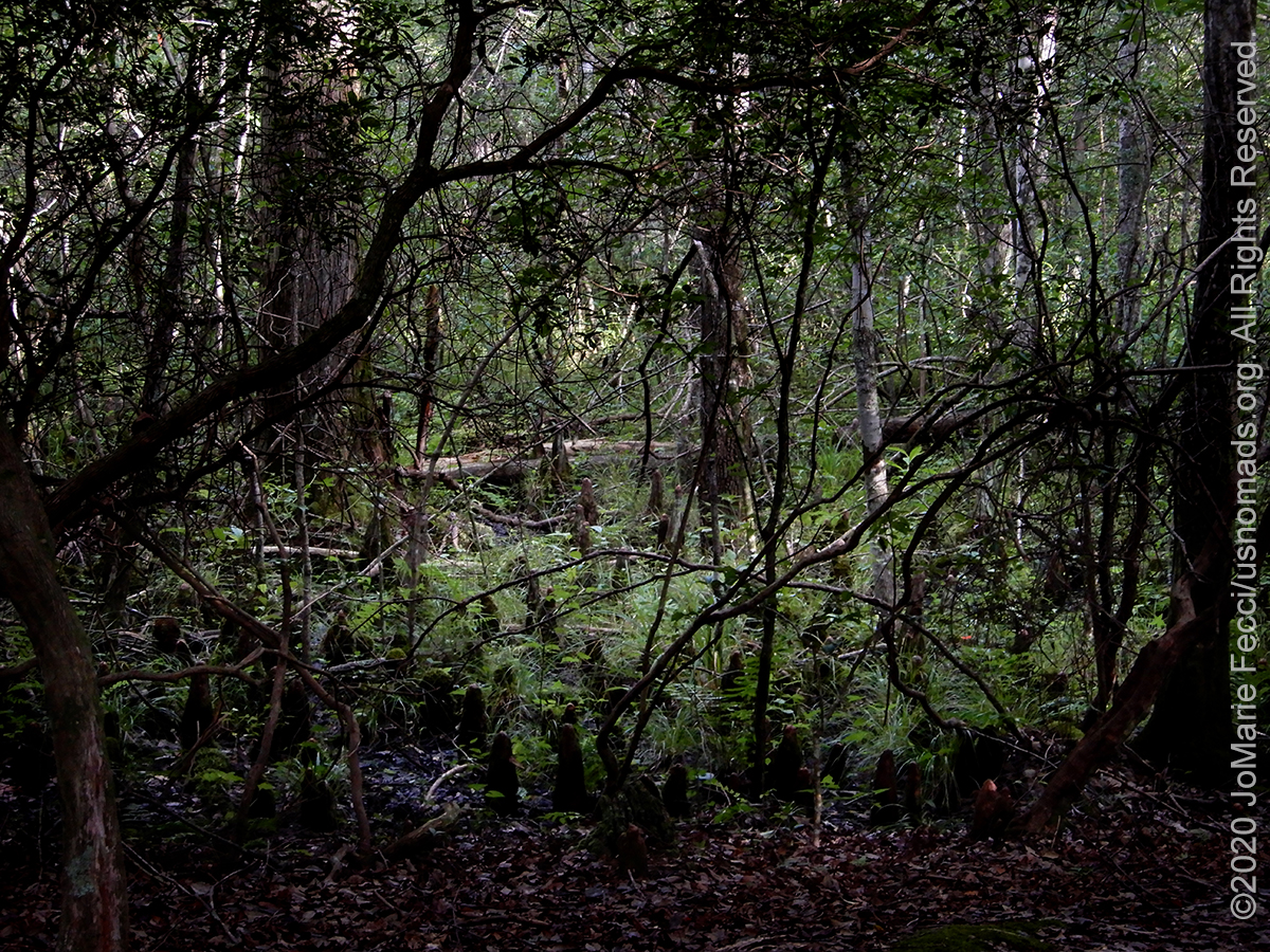
To get a real sense of this landscape, we set out on a hike along the “Bald Cypress Swamp Discovery Trail” which starts from a trailhead in the parking lot of the boat launch at Milburn Landing. There were no interpretive brochures or maps of the trail available when we were there (possibly due to the Covid-19 restrictions), so we just followed the path into the woods. The trail is a loop that passes through three different types of forest — pine groves, mixed hardwoods and the bald cypress swamp — with a small wooden “dock” that goes out into the swamp for an excellent view of the dense tangled areas of vegetation that seem primevally mysterious. It is an easy walk but without the map it is possible to get confused where the discovery trail intersects with a longer trail that continues straight ahead. We initially missed the turn-off to the dock area and had to go back and look for it.
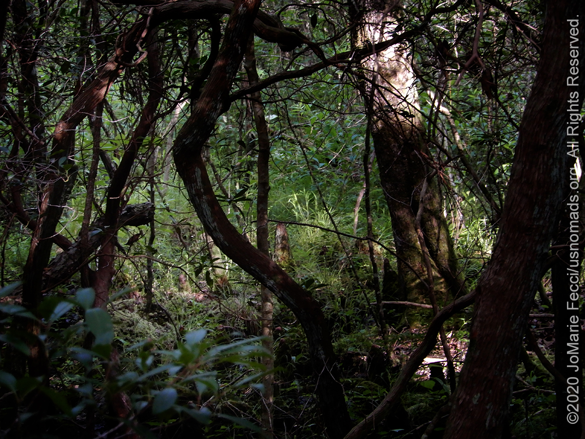
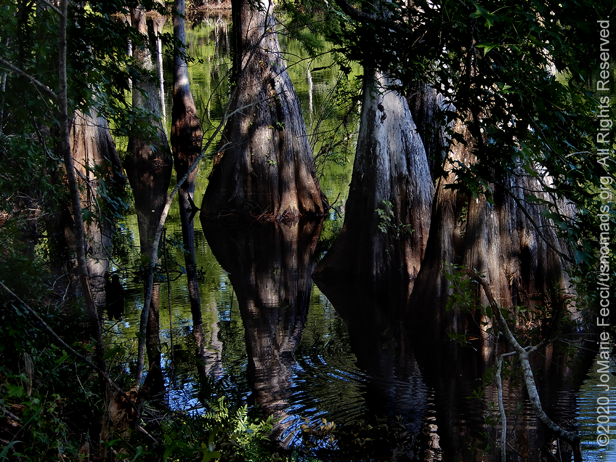
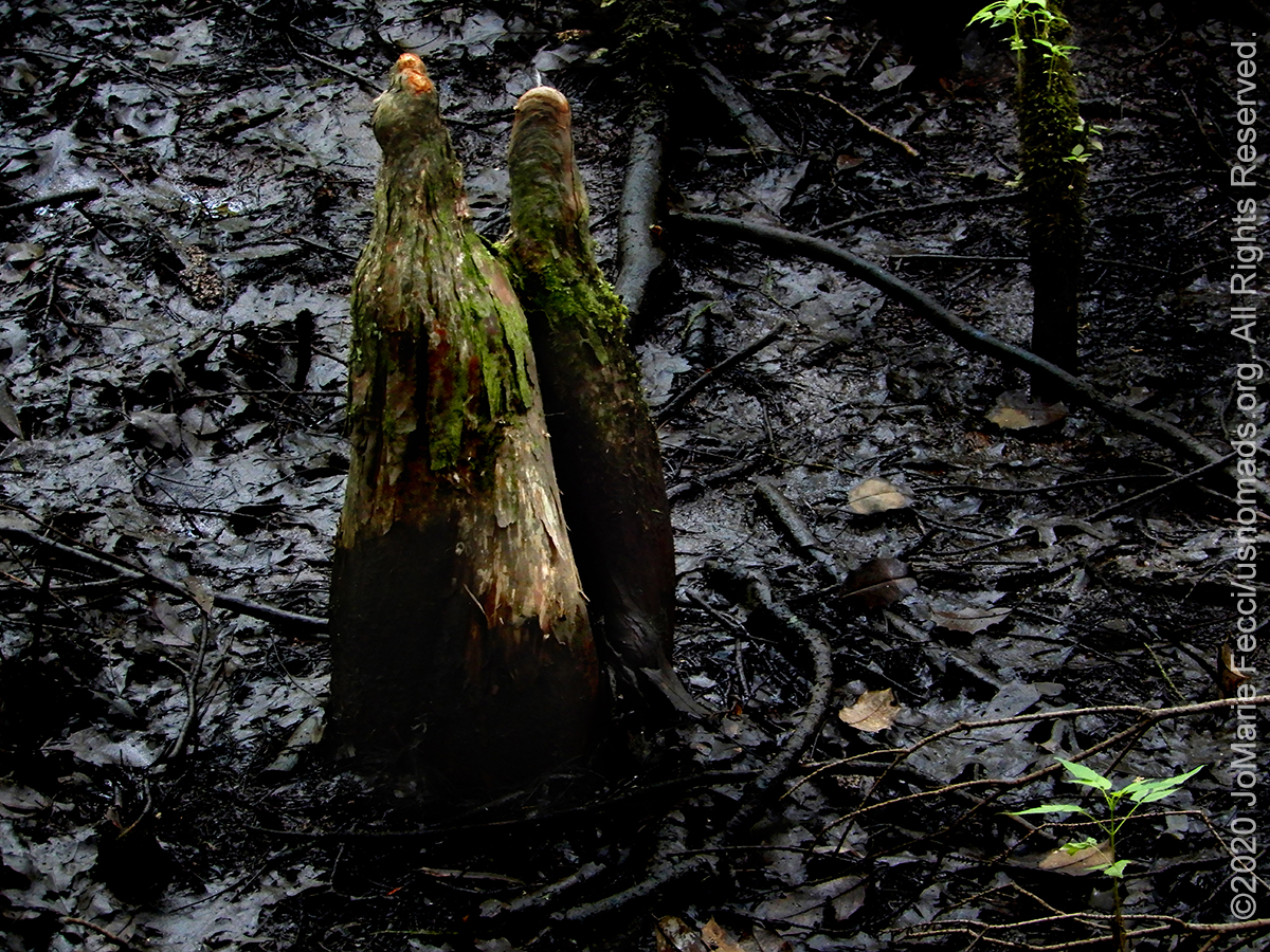
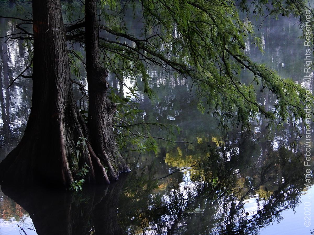
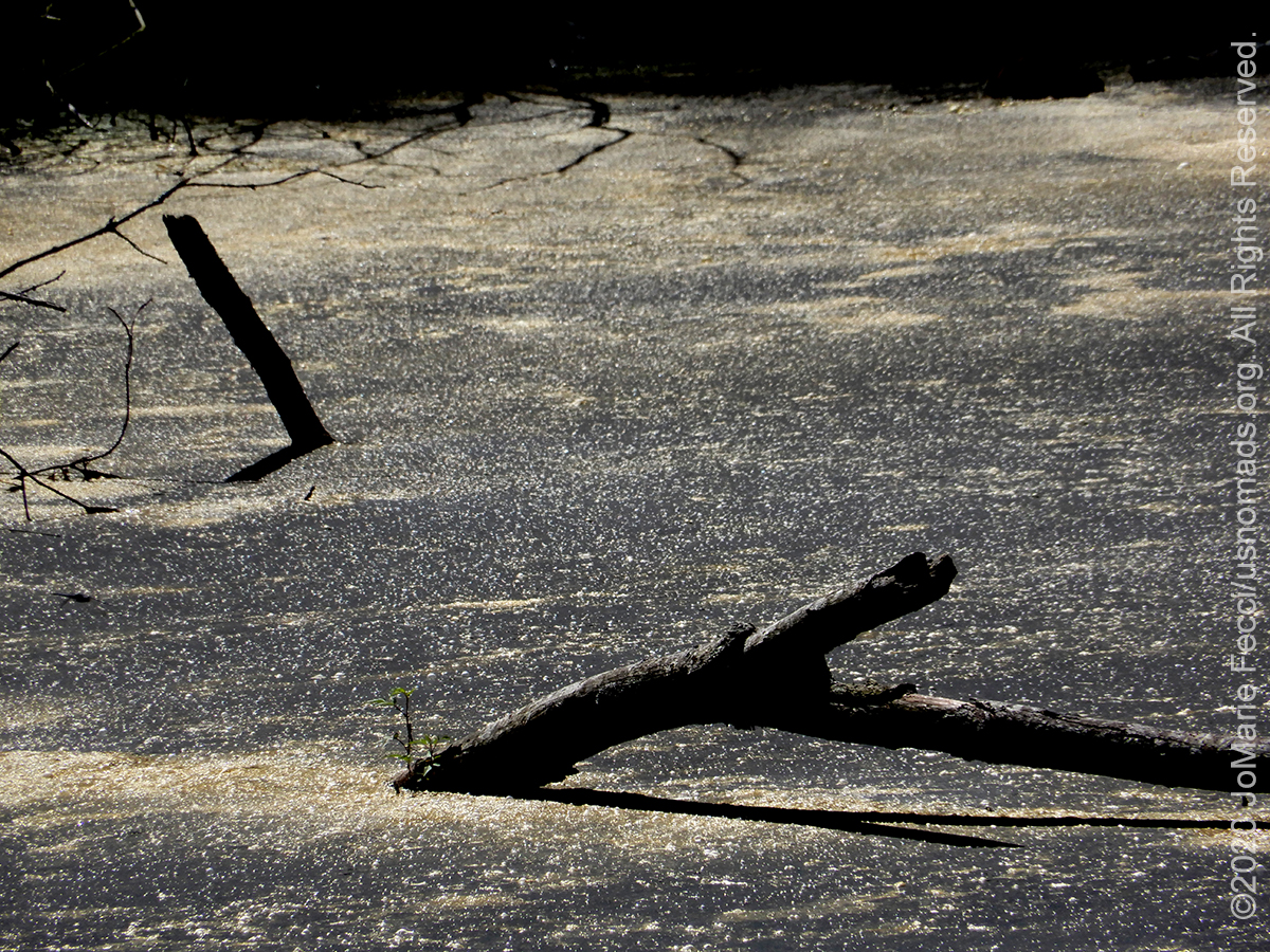
It was well worth backtracking for, as the path narrows taking you slowly into the thicker twisted tangle of vegetation, as it leads to the wooden planked walkway that continues precariously over the wetlands and out into the edge of the densest part of the swamp. It is a very different experience than paddling between the cypress stands, where the swamp is still somewhat “open”, here in the middle of thick vegetation it is hard to tell there is even water below the tangle of green with the strange cypress “knees” rising up out of the mass as if in defiance.
The cypress “knee” is a distinctive structure that forms above the tree’s roots and protrudes up from the swamp water. Their exact function is unknown, but it is believed the knees serve as an oxygen supply to the submerged root system and help protect the trees from high wind and unstable environments. They look otherwordly, and add to the eerieness of the swamp environment.
Most of the trees here now are only approximately 100 years old. Once dominated by Atlantic white cedar and bald cypress, much of the old swampland has become a seasonally flooded forest of loblolly and pond pine and hardwoods, including red maple, sweetgum, black tupelo and black gum. This landscape can seem “spooky” and there are many stories involving ghosts and hauntings here. In fact the Pocomoke State Forest is allegedly the “most haunted” forest in Maryland. Some of the stories involve old history — deserting Union and Confederate troops, outlaws, bootleggers and smugglers, who all found refuge in the inaccessible wilderness beneath the tall cypress trees. Other stories are more “modern” and there are actually commercial “ghost tours” of the forest.
We didn’t encounter any ghosts during our exploration, but we did stumble upon an old graveyard seemingly hidden in the forest. It was tucked between some trees along a quiet forest road without a historical site marker or interpretive sign. Some of the tombstones were so weathered they could not be read, but we found some that were still legible, and the dates were in the mid- to late-1800s. There are other artifacts of the region’s history to be found around the forest too. An impressive old iron smelting furnace has been preserved at the Furnace Town site, which has been developed into a “historical village” attraction based around several restored nineteenth-century buildings and artisans’ studios, surrounding the Nassawango Iron Furnace. From 1828-1850 roughly 300 people lived and worked in this company town built by the Maryland Iron Company. It took many workers – miners, sawyers, colliers, molders, draymen, and bargemen – to make iron. They gathered bog ore from the swamp, brought clam and oyster shells up the canal via the Pocomoke River from the Chesapeake Bay, and made charcoal in the Pocomoke Forest. These raw materials were loaded into the furnace, heated to 3,000 degrees, and the two resulting liquids were drawn off: the slag was cooled and tossed into the swamp and the iron was poured into molds, then loaded onto barges towed down the canal by mule.

Hiking along the Nassawango Joe Trail, which is accessed via Furnace Town, it is hard to imagine all this industrial activity happening in this remote wilderness setting. The 2.4 mile trail, which is part of the Nature Conservancy’s preserve goes along the floodplain of Nassawango Creek where the uplands meet the Bald Cypress Swamp, and has great views into the swamp. Like the Delaware Wild Lands association, the Nature Conservancy is working to restore the swamp, wetlands and forested uplands and reverse the impacts from extensive drainage, grazing, and crop production.
WHERE WE ARE
![]()
The Great Cypress Swamp (also known as Great Pocomoke Swamp, Cypress Swamp, or Big Cypress Swamp), is a forested freshwater swamp located on the Delmarva Peninsula in south Delaware and southeastern Maryland.
THE HUDSON ROAD LOOP

While there are no real jeep trails here, there are a few dirt roads that go through the woodlands in the area of the old swamp. The unpaved Hudson Road loop is a good access point that traverses several forest types in a short distance. To reach it start just north of Selbyville, at the intersection of US 113 and Route 54, heading west on Route 54 towards Gumboro for 5.9 miles. Just before the 3-mile mark, the road enters a nice patch of swamp forest. Continue on, watching carefully on the left (SE) for the unpaved Hudson Road (Rd 418). Follow Hudson Road 0.5 mile, to where it bends sharply right (S). The forest along the next 0.5 mile is excellent for birding. In another 0.7 mile, Bethel Road intersects Hudson from the right. Continuing straight on Hudson will take you almost immediately across the Maryland-Delaware state line, and into more forest. To return to Route 54 from the Bethel-Hudson junction, go right (NW) on Bethel 0.7 mile, then turn right (N) on Donaway Road, which rejoins Route 54 in 0.9 mile.
FOR MORE DETAILS SEE OUR ORIGINAL FIELD NOTES: TRAP POND AND POCOMOKE RIVER.
TRAP POND STATE PARK
Trap Pond State Park is a 3,653 acre state park located near Laurel, Delaware. It is one of the largest surviving fragments of what was once an extensive wetland. The state park features an extensive patch of bald cypress trees. Many birds flock to stands of bald cypress, including great blue herons, owls, warblers, and pileated woodpeckers. The rot-resistant wood of Trap Pond’s bald cypress trees was extensively harvested starting in the 18th century. The lumbermen extensively altered the morphology of the wetland, damming its outflow to create power for a small sawmill to cut the timbers. This dam helped to create what is now Trap Pond, named after the Trap Mills, which were known by that name as early as the 1860s. The pond was enlarged in later years as nearby farmers laid down drainage tiles to de-water their wetlands for agriculture. After the old-growth cypress timber had been harvested, the pond and adjacent surviving wetlands were re-used as the drainage sump for the surrounding farmers of Sussex County. In the 1930s, the federal Civilian Conservation Corps listed the pond as a place of recreation development. The Delaware legislature took over the land and named it as a state park on June 22, 1951, becoming the first state park in Delaware.
Camping: Trap Pond’s campground offers a wide variety of sites beneath its tall loblolly pines, including RV and tent sites with water and electric, walk-in tent sites, and two popular island tent sites. Waterfront climate- controlled camping cabins, each with a living area and bedroom, are available year-round. Yurts, round stationary structures with canvas walls, allow a rustic camping experience without having to pitch your own tent …
THE BALD CYPRESS
Bald cypress trees are deciduous trees with needle-like leaves. They can grow up to 120 feet tall and live up to 600 years. The bald cypress looks like a pine tree, but it thrives in flood-prone places where most other trees would drown and die. The main trunk is often surrounded by cypress knees, a distinctive structure forming above the roots of the tree. Knees are woody projections sent above the normal water level, roughly vertically from the roots, with a near-right-angle bend taking them vertically upward through water. Their function is unknown, but some hypotheses state that they might help to aerate the tree’s roots, create a barrier to catch sediment and reduce erosion, assist in anchoring the tree in the soft and muddy soil, or any combination thereof.
POCOMOKE RIVER STATE PARK
The Pocomoke River State Park in Worcester County, Maryland, comprises two areas within the larger Pocomoke State Forest–Shad Landing on the south bank of the river and Milburn Landing on the north bank. The park’s combination of freshwater swamp and upland, as well as its location between northern and southern physiographic regions, allows for a great diversity of plant and animal life. Cypress swamps border the Pocomoke River which itself originates in the Great Cypress Swamp and flows southwesterly 45 miles to the Chesapeake Bay. The park provides a base for a vast array of outdoor and tourist activities including fishing, biking, birding, boating, hiking and more. The Pocomoke State Forest includes 17,676 acres of woodlands and is famous for its stands of loblolly pine and cypress swamps. Five areas in the forest, including the swamp, are designated wildlands areas. The forest’s combination of swamp and upland offers a great variety of plant and animal life, including white dogwood and pink laurel in the spring, bald cypress, river otters, and bald eagles. Before the establishment of the State Forest much of the land had been cleared for farming or used as farm woodlots. When the depression era hit many of the farmers fell on hard times, resulting in the acquisition of large amounts of land by the Federal Government. In the mid to late 1930s, two Civilian Conservation Camps were located on the Forest. The camp workers did considerable road and trail work, established boundary lines, provided for fire protection and suppression, planted trees and performed recreation improvements. The Pocomoke State Forest is considered “the Most Haunted Forest in Maryland” with tales that include severed heads, hitchhikers and ladies in white…
THE DELMARVA PENINSULA
The geographic region we are driving through is known as the Delmarva Peninsula. The name “Delmarva,” is a combination of the three state names that share the peninsula: Delaware, Maryland and Virginia. Heading southward into Virginia, it narrows into a fingerlike projection that separates the lower Chesapeake Bay from the Atlantic Ocean. It is wild and remote and for many generations seafaring watermen, farmers, and their hard-working families have sustained themselves on the waters of the bay and ocean and the riches of the Eastern Shore soil. Only four decades have passed since mainland Virginians gained access to the peninsula via the 17.6-mile Chesapeake Bay Bridge-Tunnel and the lack of access has served as a barrier to commercialism and development, leaving this part of the Eastern Shore in a more natural state. Regionally, the Delmarva Peninsula lies in the Atlantic Coastal Plain, a seaward sloping province bounded on the west by a fall line and the Chesapeake Bay, and on the east by the Atlantic Ocean. The peninsula extends about 200 miles in a north-south direction and includes the State of Delaware and the eastern shores of Maryland and Virginia. The surficial sediments of Assateague Island are discontinuous Holocene Series deposits (tidal marsh and barrier sands). The subsurface sediments of the Delmarva Peninsula form a wedge of unconsolidated sands, silts, and clays that is over 7,000 feet thick and ranges in age from Cretaceous to Tertiary. The subsurface sediments rest on a seaward sloping basement of Paleozoic crystalline rocks. The basement is folded and faulted into a series of northwest-southeast trending ridges and depressions. The Delmarva Peninsula was formed about 14,000 to 18,000 years ago during the last glacial retreat, when rising sea levels filled the large valley of the lower Susquehanna River, which became the Chesapeake Bay, thus isolating the area from the mainland. Consequently, the Delmarva Peninsula coastline with its barrier islands has changed dramatically since the retreat of the last glacial ice sheets and the melting of the polar icecaps. Sea level has risen more than 300 feet and the shoreline has shifted approximately 50 miles to the west. In general, the continued sea level rise will result in the submerging of the continental shelf and shifting barrier islands landward and upward.
ABOUT SWAMPS
A swamp is a forested wetland. Swamps are considered to be transition zones because both land and water play a role in creating this environment. Swamps vary in size and are located all around the world. The water of a swamp may be fresh water, brackish water, or seawater. Freshwater swamps form along large rivers or lakes where they are critically dependent upon rainwater and seasonal flooding to maintain natural water level fluctuations. Saltwater swamps are found along tropical and subtropical coastlines. Some swamps have hammocks, or dry-land protrusions, covered by aquatic vegetation, or vegetation that tolerates periodic inundation or soil saturation. Though they are both wetlands, a swamp differs from a marsh. Where marshes are frequently flooded by nearby running bodies of water, swamps consist of saturated soils or standing water. Swamps have traditionally held a reputation for being unproductive land and farmers typically drained swamps next to their fields so as to gain more land usable for planting crops. But swamps play an important ecological role. Swamps absorb and use the excess water within the wetland, preventing it from traveling and protecting surrounding areas from flooding. Dense vegetation within the swamp also provides structure to the land, holding sediment in place and preventing erosion and land loss. Swamps are critically important to providing fresh water and oxygen to all life, and they are often breeding grounds for a wide variety of species. Two thirds of global fish and shellfish are commercially harvested and dependent on wetlands. The United States government began enforcing stricter laws and management programs in the 1970’s in efforts to protect and restore these valuable ecosystems.
RESTORING SWAMPLAND
Restoration of swampland is a complex process involving extensive hydrological restoration to allow the return of native plant and wetlands communities as well as habitat improvement projects to increase species diversity and promote desired plant and animal communities. The Delaware Wild Lands association has rehydrated hundreds, if not thousands of acres of the Swamp by installing a series of water control structures in the historic ditches, allowing us to hold back millions of gallons of water that otherwise would have drained away. They’ve planted roughly 200,000 native trees including a few thousand Baldcypress seedlings throughout, and tens of thousands of Atlantic White-cedar in the transitional and upland areas. As ecological systems are restored, a rich diversity of animal species is also returning. Newly-flooded woodlands echo with the mating calls of Carpenter frogs and others. Mature trees that die in standing water provide habitat for Red-headed Woodpeckers, Wood Ducks, owls, and other cavity nesters. Spotted Turtles, one of the top ten species most threatened by habitat fragmentation, now have hundreds of new acres to spread out and spawn. Seed from wetland grasses, aquatic insects, amphibians, and even fish now provide food for wading birds like herons and egrets, and it is not uncommon to see dozens of Bald Eagles and other raptors soaring overhead. The Nature Conservancy is working to “free” the trapped sections of the Pocomoke River to return water to the floodplain. The scale of the Pocomoke floodplain restoration project is massive – encompassing roughly 4,000 acres of floodplain along 9-miles of the river. The restoration itself is focused on a narrow band of dirt, the spoil banks, which were piled over 12-feet high in some areas along the river’s edge during earlier dredging operations. Heavy construction equipment was brought in and operated by local contractors to carve breaches, some up to 100-feet in length, through the spoil banks. When the project is completed the number of breaches will exceed 100. Different methods of stabilizing the breaches from erosion are being tested, including the planting of native vegetation.
NOTE: This is the first in a series of segments highlighting destinations along a route looping south from Long Island NY between the east coast and the Appalachian mountains. These locations were all stops on a solo Jeep-based roadtrip made by JoMarie Fecci of USnomads in July and August of 2020. All text and photos are copyright JoMarie Fecci/USnomads unless otherwise noted. If you would like to use any imagery here, please contact us for permission.