
< more recent | January 2016 | older >
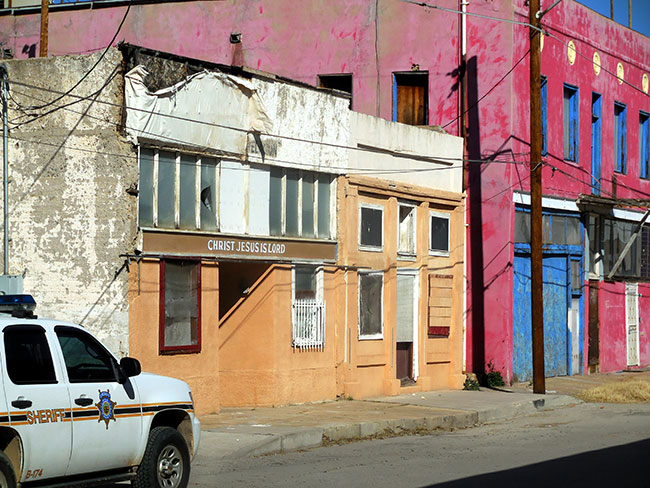
24 JANUARY 2016: Last day of exploration for this trip, passing through the “almost ghosttown” of Miami, where there were colorful but abandoned sections of street, and others that had been recuperated in the hopes of encouraging tourists to visit. A kind of surreal ending to the wilderness journey …
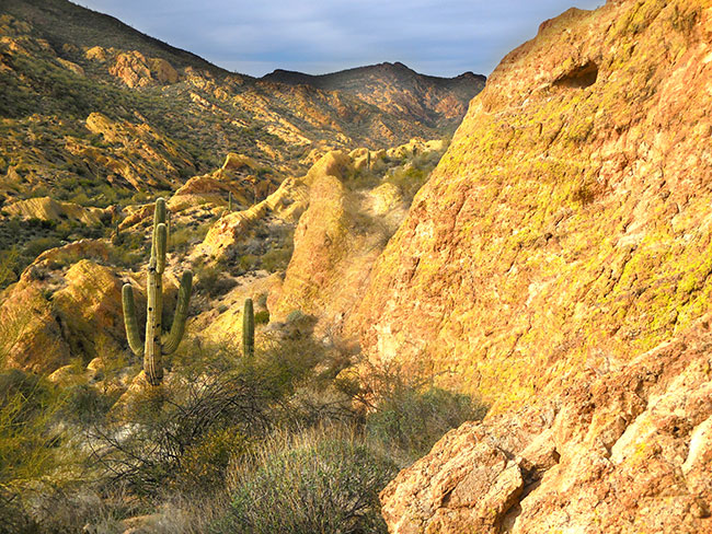
23 JANUARY 2016: Looping around the Apache Trail into the Tonto National Forest to spend the night out under the stars someplace new, and extending the range of terrain knowledge a bit further …
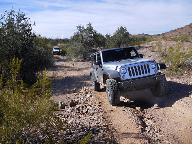
23 JANUARY 2016: Back around the Lost Dutchman mine, cut through Bulldog Canyon on a familiar trail before heading east along the Apache Trail with plans to camp “somewhere” along the way for this last night out …
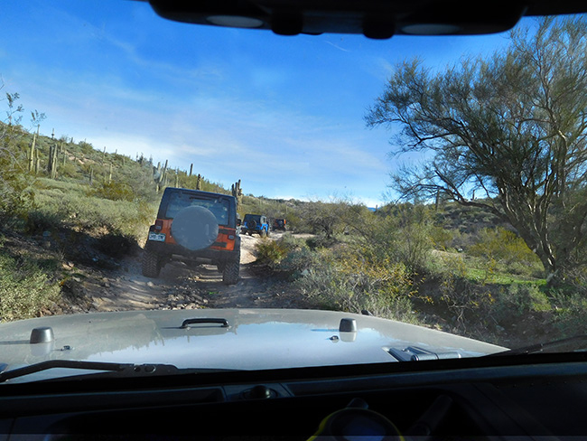
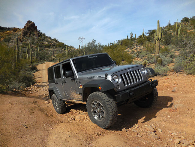
22 JANUARY 2016: Spent a day with Barlow Adventures and a great group of people around Table Mesa where we got some training and trail time with Nena Barlow. Fun to see Jeeps from several different states coming in for the event …
21 JANUARY 2016: The Quartzsite area was very crowded but there wasn’t so much traffic on the trail. We enjoyed an easy trip through the varied landscapes in this section of the desert, though we were a bit frustrated that someone had actually “marked” sections of the trail with little plastic strips discretely tied to bushes to “guide” the ATV rental customers …
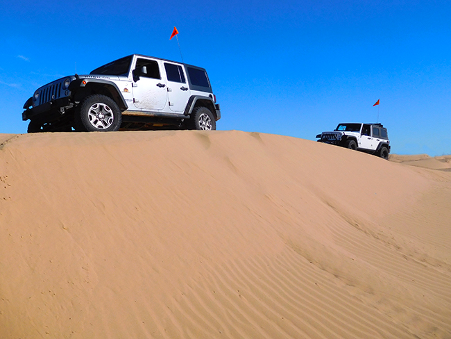
19 JANUARY 2016: Reconnected with friends for a few days of Jeep fun starting with the dunes. The recent rains had even effected the sand here, which was much more solid than usual. There was more washboarding along the flat sections, and the dunes themselves were quite firm. No one was getting stuck at all …
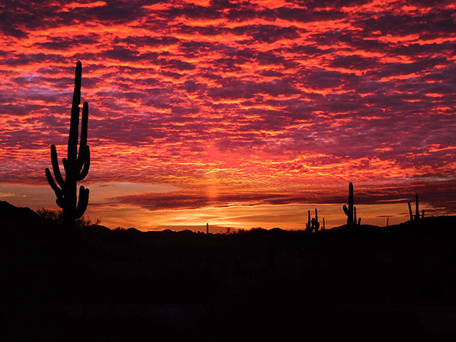
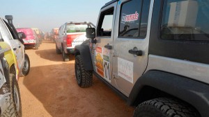
18 JANUARY 2016: The journey across the desolate border lands via el camino del diablo was beautiful, and despite all the concern, there were no security issues. Some of the trail was tougher than expected due to recent heavy rains, but nothing actually complicated. And the biggest reward was the amazing skies …
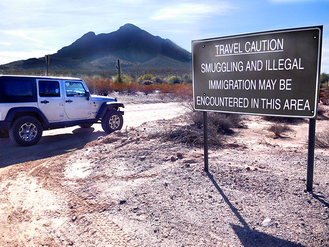
16 JANUARY 2016: Hitting dirt today with the first leg of el camino del diablo, driving down into the desert towards the Mexican border. There has been a lot of concern about security issues for this trip due to the proximity of the border, migrants, smugglers and drug operations, so starting this segment of the journey with heightened situational awareness …
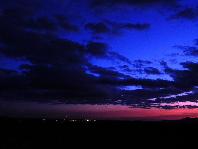
15 JANUARY 2016: Some stunning vistas while heading southwest towards the town of Ajo as evening falls. Turbulent skies offer up textures as the lights of civilization beckon in the distance …
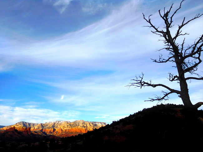
14 JANUARY 2016: This roadtrip starts amid the blue skies and red rock of Sedona, where despite the winter cold, a warm familiar feeling remains. An magnificently beautiful location, it is usually itself the destination, but this time it is the starting point for new explorations…
THIS MONTH:
A solo Jeep trip along the famed trail that runs the border between Arizona and Mexico, el Camino del Diablo, and a longer journey deeper into the desert…
COMING UP SOON:
Heading back west to Arizona and southern California to participate in a Barlow Adventures training event in the sand dunes for teams preparing for the exciting new rally event — the Rebelle Rally…
More desert discovery, camping and jeeping in southern California and Arizona…
Next steps for North Africa, route planning, scouting and more desert prep. Also beginning to look into acquisition of a diesel Jeep to start the project build…
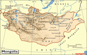
Participating as part of an expedition team headed to Mongolia this spring with Overland Experts on a mission to work with nomadic herders in the Gobi desert. The team will be providing support for the The Mongolian Bankhar Dog Project, which aims to help save a way of life for the Mongolian Nomads and at the same time protect a fragile environment …
Getting some solid trail time in at Rausch Creek, in the mountains of Pennsylvania’s coal country.
THE APACHE TRAIL
The Apache Trail in Arizona was a stagecoach trail that ran through the Superstition Mountains. It was named the Apache Trail after the Apache Indians who originally used the path. The current Apache Trail links Apache Junction with Theodore Roosevelt Lake, passing through the Superstition Mountains and the Tonto National Forest. Much of the trail is paved, and the section east of Apache Junction is known officially as State Route 88. An unpaved section runs from just east of the town of Tortilla Flat to Roosevelt Dam. The Trail winds steeply through 40 miles (64 km) of rugged desert mountains, past deep reservoir lakes like Canyon Lake and Apache Lake. With steep cliff drops and little in the way of safety barriers, the trail requires caution when driving and is not recommended for large SUVs or RVs.
BULLDOG CANYON
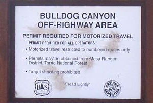
Primarily a 4×4 playground, Bulldog Canyon has numerous rocky desert trails with some great scenery. The main trail passes through scenic Sonoran Desert with views of Goldfield and Superstition Mountains and is suitable for aggressive stock SUVs with high ground clearance. A permit is required for this trail and can be obtained here. Access is through a combination locked gate, and the combination is provided with your permit.
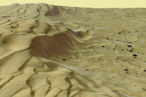
ABOUT THE SUPERSTITIONS
![]()
The Superstitions are a range of mountains in Arizona located to the east of the Phoenix metropolitan area. They are anchored by Superstition Mountain, a large mountain that is a popular recreation destination for Phoenix residents. The mountain range is in the federally designated Superstition Wilderness Area, and includes a variety of natural features in addition to its namesake mountain. The Superstitions are at the center of the legend of the Lost Dutchman’s Gold Mine. According to the legend, a German immigrant named Jacob Waltz discovered a mother lode of gold in the Superstition Wilderness and revealed its location on his deathbed in Phoenix in 1891 to Julia Thomas, a boarding-house owner who had taken care of him for many years. Several mines have been claimed to be the actual mine that Waltz discovered, but none of those claims have been verified. The mountain range is also important in Apache culture. Some Apaches believe that the hole leading down into the lower world, or hell, is located in the Superstition Mountains. Winds blowing from the hole are considered to be the cause of severe dust storms in the metropolitan region.The Superstition Mountains are bounded roughly by U.S. Route 60 on the south, State Route 88 on the northwest, and State Route 188 on the northeast.
ABOUT BARLOW ADVENTURES
Barlow Adventures provides professional 4×4 driving instruction and training in Sedona, AZ, as well as fully outfitted multi-day trips in Moab and on California’s famous Rubicon Trail. In Moab, the undisputed Jeeping capitol of the world, the Barlow team guides drivers over iconic trails, and helps build 4-wheeling skills in the context of a fun adventure through the rugged high desert landscape.
TABLE MESA
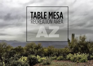
The Table Mesa Recreation Area comprises approximately 11,557 acres easily accessed via Interstate 17 from Phoenix. There are 55 miles of OHV trails, an OHV training area for all ages and six technical vehicle sites for challenging vehicle skills driving. In addition to OHV enthusiasts, the multi-use area is popular with target shooters, hikers, mountain bikers and horseback riders. Dispersed camping is permitted.
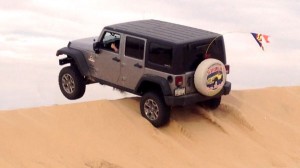
THE IMPERIAL SAND DUNES
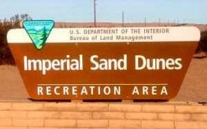
The Imperial Sand Dunes Recreation Area, located in the southeast corner of California, is the largest mass of sand dunes in the state. Formed by windblown sands of ancient Lake Cahuilla, the dune system extends for more than 40 miles in a band averaging 5 miles wide (map). Widely known as “Glamis” it is an off-road paradise, with an extensive open area for OHV use.
ABOUT EL CAMINO DEL DIABLO
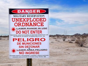
El Camino Del Diablo (“The Devil’s Highway”) is an historic 250-mile (400 km) road which currently extends through some of the most remote and arid terrain of the Sonoran Desert in Pima County and Yuma County, Arizona. In use for at least 1,000 years, El Camino Del Diablo is believed to have started as a series of footpaths used by desert-dwelling Native Americans. From the 16th to the 19th centuries, the road was used extensively by conquistadores, explorers, missionaries, settlers, miners, and cartographers. Use of the trail declined sharply after the railroad reached Yuma in 1870. In recognition of its historic significance, El Camino Del Diablo was listed on the National Register of Historic Places in 1978. Today, the Camino Del Diablo remains a dirt road, suitable for four-wheel drive and high clearance vehicles carrying extra water and emergency equipment. No emergency or tow services are available, and visitors use the trail at their own risk.
CURRENT WEATHER
Nesconset | Phoenix | Sedona | Ajo | Yuma | Glamis| Globe

MORE NOTES FROM THE ROAD:
December – Long Island
November – New York
15-31 October – Moab
1-14 October – Vermont
September – Paris
August – Topless For Tatas
July – Rubicon Trail
June – Bantam Jeep Fest, PA roadtrip
May – Overland Expo, AZ roadtrip
April – Paris, Rausch Creek
March – Uwharrie
February – Back Home
January – Mauritania
The Gazelle Rally Recap
Archive
SPECIAL REPORT

SCOUTING THE SAHARA IN MAURITANIA: WAYPOINT NOUAKCHOTT
The first in a series of reports from our scouting trip in Mauritania takes and indepth look at the capital city of Nouakchott, and its fishing port… [read]
MORE INFO:
About Team 171 US Nomads
Team Training
Practical Matters
In Our Words
Team News
Contact Us
SPECIAL REPORT
ON BECOMING A GAZELLE: THE DESERT’S FIRST CHALLENGE
The second installment in a series of personal reflections on our experience in the Rallye Aiche des Gazelles–Putting our skills to the test in Morocco on the first day out in the desert, known as the “Prologue,” there are a few surprises… [read]