
< more recent | 16 October 2016 | older >
16 October 2016: This morning we had to pack up our tents and gear and get ready to move out of Base Camp 1. The whole Rally was beginning the move southward and the day’s course would be a long one — roughly 150 miles to Base Camp 2. After the first day of the competition we felt we had a pretty good understanding of the process and we were more confident in our capability to navigate the course efficiently. Though the challenge of the Black checkpoints remained an elusive target. We hadn’t expected a change-up in the format, but there it was in the daily CP guide — we would have to make choices. Quite early in the day’s course we would have to decide whether to try for a series of black CPs for higher points, or a series of blues for lesser points. It was the first “strategic” decision of the event, and signaled an important difference between this rally and the Gazelle. The Rebelle was going to force all the teams to make strategic choices along the way. We chose to go with the certainty of the Blues, which turned out to be fortuitous as we later learned that many teams who went for the Blacks did not get any of their points.
16 October 2016: Today we left camp in the opposite direction from yesterday, heading east towards the Humboldt-Toiyabe national Forest. Passing around the Paradise Range, we crossed the Ione Valley where 5,000 years ago a dense and permanent aboriginal population thrived. The valley is flat and sprawling, offering superb views of the looming Shoshone Mountains. The area experienced the boom-bust cycle of mining centered around Ione City, the first county seat of Nye County in 1864. Over 600 people worked in this prosperous town until Belmont wealth attracted most of the miners in 1865, and the county seat in 1867. Alternately prosperous and poor, yet never completely abandoned, Ione suffered mining depressions, milling difficulties, and the loss of miners to richer strikes throughout its history. Today it is a ghost with just a few crumbling remnants. The rally route bypassed the ghost town, turning south instead along the southern edge of the Shoshone mountains. Near the base of the Shoshone Mountains, there is a preserved Nevada ghost town at Berlin-Ichthyosaur State Park, where visitors can take a tour of an old mine and roam about on a self-guided tour that describes the various buildings and artifacts that remain at the Berlin townsite. (Check out this scenic drive itinerary to explore the area more leisurely).
One of the frustrations of the rally format is the lack of time to explore the landscape more deeply. We pass through history without stopping. Continuing south east around the perimeter of the Humboldt-Toiyabe National Forest we pick up a route heading south across the flat terrain of the Big Smoky Valley, delineated only by the various hills and mountains in the distance that serve as landmarks in the desert. The Big Smoky Valley is about 100 miles long, with an open-pit gold mine at the southern end. We are traveling through the eco-region known as the Tonopah Basin, a transitional zone between the Great Basin Desert and the more southerly Mojave Desert.
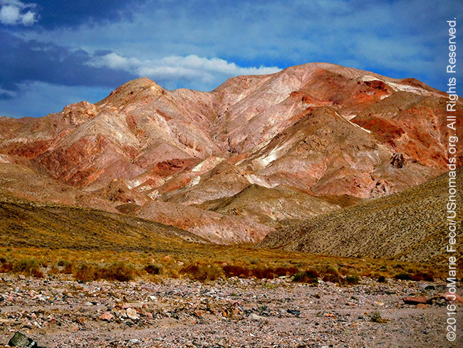
Towards mid-afternoon we reach the Royston Hills, turning westward as the rally route hugs the edge of the hills. Royston has been one of the most productive turquoise districts in all of Nevada, and turquoise was mined here on a small scale by the Paiute and Shoeshone peoples for many years prior to the arrival of the Europeans. The turquoise bearing zones follow small faults and fractures in the rock, with the turquoise forming in small cracks. It comes in a diversity of colors and mixes of matrix patterns all of which are considered valuable.
The whole region is dotted with mines and claims, and some of the terrain can be dangerous because of the mining operations. For this reason, the rally organization provided teams with a roadbook section to cross over the Monte Cristo Range, the last of the days mountain ranges. The Monte Cristo Range is a crescent-shaped chain of highly eroded peaks in the northernmost corner of Esmeralda County. Doyle Peak, its highest point, has an elevation of 7083 feet. In the heart of the range, the abandoned ruins of the mining camp of Gilbert still stand. The web of old mining roads can be confusing, and the topography gets hard to follow as we head almost due south and back down an eroded wash towards highway 95 and beyond–where Base Camp 2 awaits near Coaldale.
16 October 2016: The day was long and Team Engage #124 just made it back to base minutes before they would have timed out, but their strategic choice in the morning to go for the Blues instead of the Blacks was a good one. Overall the team did well, picking up all but one of their Blue CPs and getting one of the Blacks, too. The day went smoothly in the morning, as they moved swiftly over their course with efficiency. Things got a bit more complex in the afternoon, when after hitting the black CP near the Royston Hills they plotted a route that seemed clear and easy on the map. As the team started to drive it, the trail faded off into nothingness where a road was clearly indicated. There was a bit of confusion over whether or not the rules permitted continuing where there were no longer any tracks, so Team Engage #124 turned back to pick up an alternate route. The backtracking and search for an alternate ate up time, putting them under pressure to arrive at the next obligatory Green CP, which they made before deadline. Back on track, they set out for the roadbook portion across Monte Cristo mountains, where they and a few other teams took a wrong turn bleeding off more time before realizing their error and correcting their direction. The loss of time there meant the team had to give up searching for the Blue CP located in that area, and head for the exit and base camp on the other side. They were able to pick up the last Blue where the mountain pass opened up, then had to rush over an undefined washed out trail that made for slow going downhill into the days final stretch. The sun was setting by the time they reached the line, but they were on time making a respectable 81% of the day’s possible points…
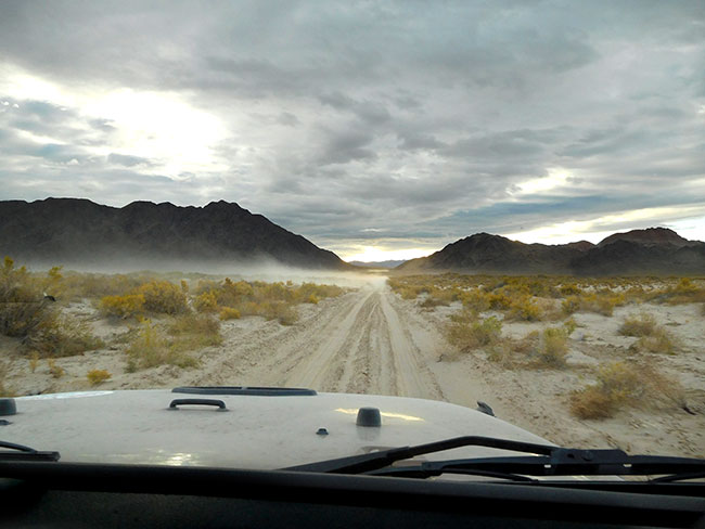
16 October 2016 Rebelle Rally official update: The course today started out with a dry lake bed crossing that turned into a series of soft dunes before reaching the day’s first green checkpoint; which all teams must clear. It proceeded through a set of fast gravel dirt trails before hitting a rugged, remote and almost invisible trail that left several teams unsure of where the road ahead was. The course continued to become more and more difficult, traveling a wash which had recently run, removing any sign of the trail and leaving several teams stranded and forced to take alternate routes. The top teams persevered, reaching and finding the final blue checkpoints, relying on their navigation skills alone, several of these teams moved up in the standings. The second official day of the Rebelle Rally started with a four-way tie for first place—and ended with a significant point-spread between the leaders. Some teams gained multiple positions in the standings—and some fell from the top to the bottom. Every checkpoint, every turn, every second, everything counts in the Rebelle Rally. Emme Hall and Rebecca Donaghe moved into first place thanks to a strong second day result, leaving the team with 228 points, completing the course to date with 93-percent accuracy. The fourth and fifth place race is sure to be highly contested, with Nena Barlow and Kande Jacobsen of the Squirrel Girls leading Rhonda Cahill and Rachelle Croft of the X Elles by only two points. In the crossover class, Team Quail-Hoehn leads in their 2017 Honda Ridgeline, with an impressive 209 points, completing the course with 81% accuracy, over Lisa Woldord and Sandy Conner’s Porsche with 190 points. On another note, the first basecamp transfer had a few unexpected wrinkles, like the food truck getting stuck in deep sand after following the route suggested by Google Maps. Luckily, they had MAXTRAX and made it to camp in time to prepare the dinner. It took eight MAXTRAX to get the 30-foot Hollywood catering truck unstuck! (Photo: Rebelle Rally/Paolo Baraldi…
THIS WEEK:
![]()
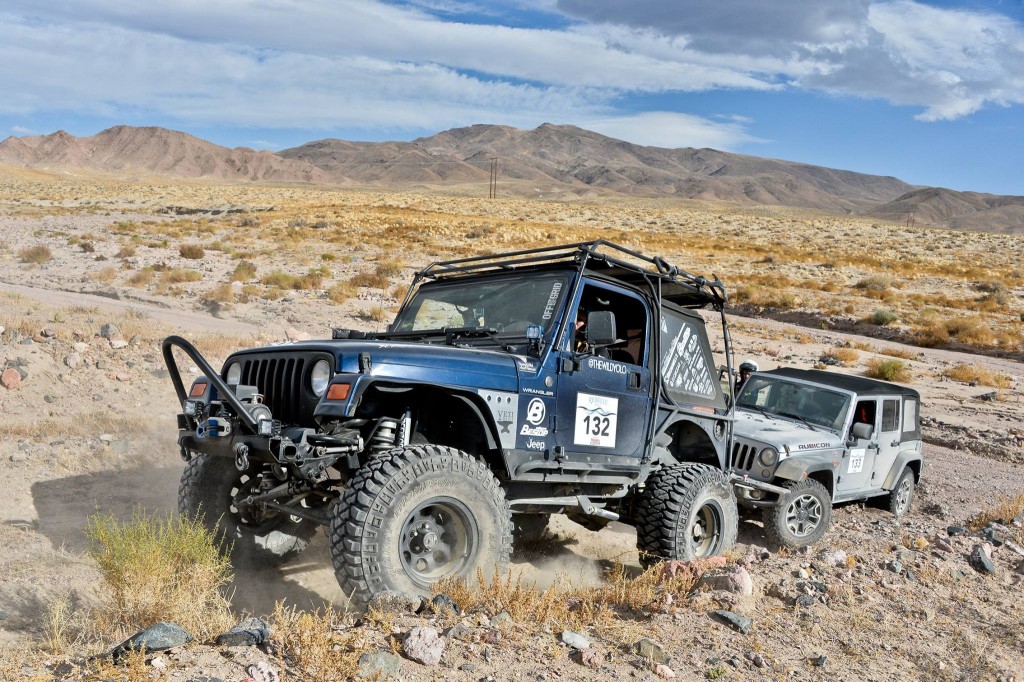
Team Engage is competing as Team #124 in the inaugural edition of the Rebelle Rally 13-22 October 2016. The Rebelle launches on the shores of iconic Lake Tahoe with 76 women from 19 states and 4 countries becoming the first competitors to take part in the women’s 10-day off-road navigation rally raid. The Rebelle Rally is not a race for speed but an event based on traditional compass, map, and roadbook navigation. GPS devices and cell phones will be sealed and prohibited from team use until the event concludes as navigators and drivers traverse the stunning Nevada and California terrain in stock 4-wheel drive and all-wheel drive vehicles. The route covers primarily land managed by the Bureau of Land Management and takes place on legal dirt roads, trails, and OHV areas. The participants will also travel through two National Parks. The unique rally is a hybrid of sorts, combining traditional compass and map navigation with time, speed, and distance sections where the teams use roadbooks and must maintain average, safe speeds. However, the bulk of the challenge is finding hidden checkpoints in a difficulty rating system similar to ski or bike trails, with the highest score winning. Smart, careful driving coupled with the ability to plot latitude and longitude, triangulate using topographic maps and handheld compasses, and mastery of distance and heading are among the skills. A diverse field of vehicles will take to the start, including both new and older models of Land Rovers, Mercedes, Jeeps, and Toyotas in the 4×4 class, and an interesting mix of the new Honda Ridgeline, Porsche Cayenne, and Jaguar F-PACE in the Crossover Class. Jeeps will make a strong presence in the first time event with 15 total ranging from a 1982 Scrambler to a 2016 Rubicon, and a notable showing will also be from Land Rover (6) and Toyota (6). The goal of the rally is to showcase the capabilities of manufacturer vehicles in people’s driveways, as well as the tenacity, teamwork, and capabilities of women off-road. The competition portion will end in the desert near the California-Arizona border and wrap up on the shores of the Pacific Ocean with the final Awards Gala, where competitors will wash off the dirt and celebrate in style at the historic Del Mar Racetrack. For daily updates during the competition or to follow the event online, visit www.rebellerally.com. Viewers can also track the teams live beginning October 15th via: rebellerally.com/live.
SPOTLIGHT ON MINING DISTRICTS
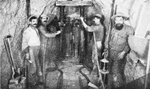
The history of this part of Nevada is infused with the legacy of mining. Mining districts were created in the western United States to enable relatively free access to mineral resources based on concepts of use rather than land ownership. This pattern evolved because many areas lacked formal governments able to administer these resources. A district came into being through the organization of miners to facilitate the keeping of claim records and providing a means of adjudicating disputes. Boundaries were specified only in vague terms, if at all. It was left to common usage which claims were recorded as part of a specific district. Legal aspects of districts disappeared after county governments were formed and became the official repositories of claim information.
TEAM ENGAGE
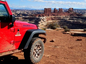
Team Engage is JoMarie Fecci of USnomads and Tracey Ristow driving “Sable,” a Barlow Jeep Wrangler Rubicon, across the American southwest in the inaugural edition of the Rebelle Rally, 13-22 October 2016. The team, hailing from opposite coasts of the USA, came together to compete in the Rebelle with a shared commitment to humanitarian ideals in addition to a love of overland exploration. During the rally Team Engage will be showing its support for the Blue Heart Campaign to raise awareness and help victims of human trafficking through the United Nations Voluntary Trust Fund for Victims of Human Trafficking…
THE BLUE HEART CAMPAIGN
![]()
Team Engage supports the UN’s Voluntary Trust Fund for Victims of Human Trafficking and the Blue Heart Campaign as their platform to raise awareness about global human trafficking— an issue which disproportionately effects women. Human trafficking is modern day slavery and includes sex trafficking (forced prostitution and forced marriage), labor trafficking (domestic servitude, sweatshops and fraudulent bonded labor contracts), child soldiers and organ trafficking. According to the International Labor Organization, nearly 21 million people or 3 out of every 1,000 people worldwide are victims of human trafficking. The UN Voluntary Trust Fund for Victims of Human Trafficking was established in 2010 and provides direct humanitarian, legal and financial aid to human trafficking victims. They provide grants to small grassroot NGOs that directly assist victims with housing, food, legal aid, access to justice, psychosocial support, medical care and training. Click here to donate directly to the Fund…

WHERE WE ARE
Today the whole Rally encampment moved south to Base Camp 2. While the rally organization and staff transferred the whole base camp aparatus, the competition route sent teams east towards Gabbs, then south and eastward skirting the edges of the Humbolt-Toiyabe National Forest before turning westward again. Teams continued heading southwest roughly paralleling HWY 89 until crossing over, just north of the Crescent Dunes Solar Energy project and the Tonopah dunes. The terrain was easy but navigation got a bit more complicated around a web of trails before reaching the Monte Cristo Range. Competitors were given a roadbook section to guide them over the mountains where the route could get confusing and lead to potentially dangerous areas near mining locations. Upon exiting the mountains, the course turned westward along HWY 95, and then south to the new base camp just west of HWY 265 (click on the map below to view larger).
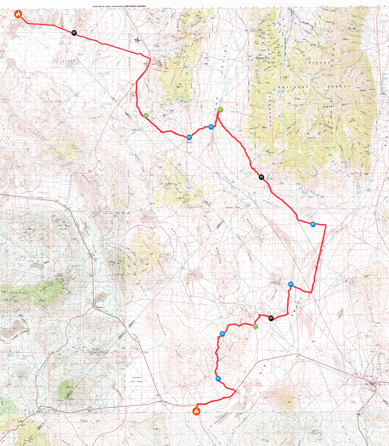
Maps covered in today’s course (1:100,000 USGS historical maps): Walker Lake, Ione Valley, Excelsior Mountains, Tonopah, Benton Range and Goldfield. Maps can be downloaded for free from the USGS here.
Fallon | Tonopah | Coaldale | Goldfield
MORE NOTES FROM THE ROAD:
1-7 Oct – NY to Reno
26-30 Sep – Rally Prep
19-25 Sep – Long Island
12-18 Sep – Yuma and Glamis
5-11 Sep – Sedona
29 Aug – 4 Sep – Long Island
23-28 August – Rod Hall Drive Training
15-22 August – Reno Rebelle Training
8-14 August – TFT8
1-7 August – Serbia overland
July – Serbia, Rally planning
June – Mongolia
16-31 May – Overland Expo, Mongolia
1-15 May – Paris
April – training desert prep
March – Long Island
February – California deserts
January – El Camino del Diablo
December – Long Island
November – New York
15-31 October – Moab
Archive
SPECIAL REPORT
Detailed series on a solo scouting journey into some of the remotest backcountry around Moab. The six day 450-mile off-pavement trip into the Maze district of the Canyonlands National Park offers insight into the challenges of expedition planning… [read]
MORE INFO:
About US Nomads
Training
Practical Matters
In Our Words
Contact Us
SPECIAL REPORT
SCOUTING THE SAHARA IN MAURITANIA: WAYPOINT NOUAKCHOTT
The first in a series of reports from our scouting trip in Mauritania takes and indepth look at the capital city of Nouakchott, and its fishing port… [read]